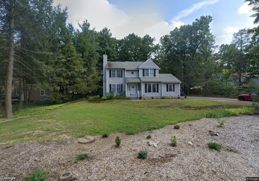
39 Woodside Cir Simsbury, CT 06070
Estimated Value: $402,000 - $492,000
3
Beds
3
Baths
1,581
Sq Ft
$286/Sq Ft
Est. Value
About This Home
This home is located at 39 Woodside Cir, Simsbury, CT 06070 and is currently estimated at $452,770, approximately $286 per square foot. 39 Woodside Cir is a home located in Hartford County with nearby schools including Central School, Henry James Memorial School, and Simsbury High School.
Ownership History
Date
Name
Owned For
Owner Type
Purchase Details
Closed on
Oct 20, 1997
Sold by
Burnett Harold R and Burnett Lillian E
Bought by
Laraia David M and Peterson Edward T
Current Estimated Value
Purchase Details
Closed on
Mar 26, 1997
Sold by
Mansour Dev Inc
Bought by
Martinelli Joshua and Grant Sara
Home Financials for this Owner
Home Financials are based on the most recent Mortgage that was taken out on this home.
Original Mortgage
$140,000
Interest Rate
7.59%
Mortgage Type
Unknown
Purchase Details
Closed on
Oct 21, 1996
Sold by
Freeman Philip
Bought by
Mansour Dev
Home Financials for this Owner
Home Financials are based on the most recent Mortgage that was taken out on this home.
Original Mortgage
$130,000
Interest Rate
9.56%
Mortgage Type
Unknown
Create a Home Valuation Report for This Property
The Home Valuation Report is an in-depth analysis detailing your home's value as well as a comparison with similar homes in the area
Home Values in the Area
Average Home Value in this Area
Purchase History
| Date | Buyer | Sale Price | Title Company |
|---|---|---|---|
| Laraia David M | $91,000 | -- | |
| Martinelli Joshua | $190,000 | -- | |
| Mansour Dev | $55,000 | -- |
Source: Public Records
Mortgage History
| Date | Status | Borrower | Loan Amount |
|---|---|---|---|
| Previous Owner | Mansour Dev | $140,000 | |
| Previous Owner | Mansour Dev | $130,000 | |
| Previous Owner | Mansour Dev | $15,000 | |
| Previous Owner | Mansour Dev | $90,000 |
Source: Public Records
Tax History Compared to Growth
Tax History
| Year | Tax Paid | Tax Assessment Tax Assessment Total Assessment is a certain percentage of the fair market value that is determined by local assessors to be the total taxable value of land and additions on the property. | Land | Improvement |
|---|---|---|---|---|
| 2025 | $8,216 | $240,520 | $74,900 | $165,620 |
| 2024 | $8,012 | $240,520 | $74,900 | $165,620 |
| 2023 | $7,653 | $240,520 | $74,900 | $165,620 |
| 2022 | $7,298 | $188,920 | $79,380 | $109,540 |
| 2021 | $7,298 | $188,920 | $79,380 | $109,540 |
| 2020 | $7,007 | $188,920 | $79,380 | $109,540 |
| 2019 | $7,050 | $188,920 | $79,380 | $109,540 |
| 2018 | $7,102 | $188,920 | $79,380 | $109,540 |
| 2017 | $6,859 | $176,950 | $79,380 | $97,570 |
| 2016 | $6,568 | $176,950 | $79,380 | $97,570 |
| 2015 | $6,568 | $176,950 | $79,380 | $97,570 |
| 2014 | $6,572 | $176,950 | $79,380 | $97,570 |
Source: Public Records
Map
Nearby Homes
- 16 Stratton Forest Way
- 18 Meadowlark Rd
- 3 Stebbins Brook Ln
- 4 Stebbins Brook Ln
- 15 Sand Hill Rd
- 40 Firetown Rd Unit 39
- 1 West St Unit 206
- 301 Bushy Hill Rd
- 308 Hopmeadow St
- 48 Library Ln Unit 48
- 10 Sachems Trail
- 3 Minister Brook Dr
- 8 Quorn Hunt Rd
- 3 Cobtail Way
- 25 Barry Ln
- 8 Crane Place
- 9 Cobtail Way
- 395 Bushy Hill Rd
- 15 Pinnacle Mountain Rd
- 4 Adams Rd