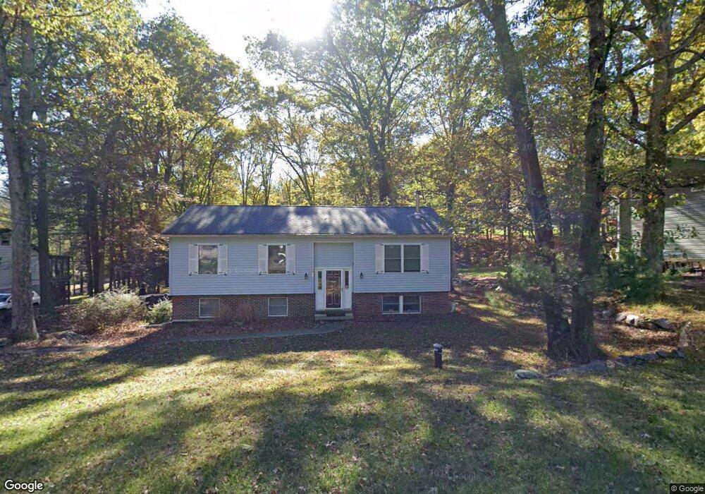
39 Woodside Dr East Stroudsburg, PA 18301
Estimated Value: $252,000 - $331,000
3
Beds
2
Baths
2,040
Sq Ft
$146/Sq Ft
Est. Value
About This Home
This home is located at 39 Woodside Dr, East Stroudsburg, PA 18301 and is currently estimated at $297,958, approximately $146 per square foot. 39 Woodside Dr is a home located in Monroe County with nearby schools including Stroudsburg Junior High School, Stroudsburg High School, and Stroudsburg Seventh-day Adventist School.
Ownership History
Date
Name
Owned For
Owner Type
Purchase Details
Closed on
Jun 30, 2020
Sold by
Walon Ludwik
Bought by
Cortigiano Anthony and Kolenvic Rafeta
Current Estimated Value
Home Financials for this Owner
Home Financials are based on the most recent Mortgage that was taken out on this home.
Original Mortgage
$133,600
Outstanding Balance
$118,687
Interest Rate
3.2%
Mortgage Type
New Conventional
Estimated Equity
$179,271
Purchase Details
Closed on
Dec 5, 2019
Sold by
Fannie Mae
Bought by
Walon Ludwik
Purchase Details
Closed on
Sep 27, 2019
Sold by
Alexander Patricia A
Bought by
Federal National Mortgage Association
Purchase Details
Closed on
Dec 24, 2003
Bought by
Alexander Patricia A
Create a Home Valuation Report for This Property
The Home Valuation Report is an in-depth analysis detailing your home's value as well as a comparison with similar homes in the area
Home Values in the Area
Average Home Value in this Area
Purchase History
| Date | Buyer | Sale Price | Title Company |
|---|---|---|---|
| Cortigiano Anthony | $167,000 | Keystoe Premier Setmnt Svcs | |
| Walon Ludwik | $116,000 | First Choice Abstract Inc | |
| Federal National Mortgage Association | $5,450 | None Available | |
| Alexander Patricia A | $163,500 | -- |
Source: Public Records
Mortgage History
| Date | Status | Borrower | Loan Amount |
|---|---|---|---|
| Open | Cortigiano Anthony | $133,600 |
Source: Public Records
Tax History Compared to Growth
Tax History
| Year | Tax Paid | Tax Assessment Tax Assessment Total Assessment is a certain percentage of the fair market value that is determined by local assessors to be the total taxable value of land and additions on the property. | Land | Improvement |
|---|---|---|---|---|
| 2025 | $1,101 | $133,520 | $27,300 | $106,220 |
| 2024 | $900 | $133,520 | $27,300 | $106,220 |
| 2023 | $4,457 | $133,520 | $27,300 | $106,220 |
| 2022 | $4,551 | $133,520 | $27,300 | $106,220 |
| 2021 | $4,411 | $133,520 | $27,300 | $106,220 |
| 2020 | $4,351 | $133,520 | $27,300 | $106,220 |
| 2019 | $4,256 | $22,570 | $3,000 | $19,570 |
| 2018 | $4,540 | $22,570 | $3,000 | $19,570 |
| 2017 | $4,540 | $22,570 | $3,000 | $19,570 |
| 2016 | $854 | $22,570 | $3,000 | $19,570 |
| 2015 | -- | $22,570 | $3,000 | $19,570 |
| 2014 | -- | $22,570 | $3,000 | $19,570 |
Source: Public Records
Map
Nearby Homes
- 0 Wigwam Park Rd
- 6284 Cardinal Dr
- 0 Marshall Dr
- 102 Arbor Way
- 916 Mt Zion Ave
- 2463 Larkspur Dr
- 2636 Woodruff Ln
- 2142 Wigwam Park Rd
- Lot 72 Larkspur Woodruff
- 3114 Fairfax Terrace
- 4104 Ashwood Ln
- 179 Heathrow Ln
- 476 Hyland Dr
- 445 Hyland Dr
- 1117 Belaire Dr
- 314 White Stone Corner Rd
- 1808 Jennifer Dr
- 1222 Rural Ct
- 329 Hyland Dr
- 7109 Pine Grove
- 4411 Woodside Dr
- 4407 Woodside Dr
- 40 Aka 4407 Woodside Dr
- 4419 Woodside Dr
- 1379 Sky Pine Way
- 4412 Woodside Dr
- 3169 Woodside Dr
- 0 Woodside Dr
- 11 Lots Woodside Dr
- 16 Woodside Dr
- 8-11 Woodside Dr
- 5 Woodside Dr
- 29 Woodside Dr
- 28 Woodside Dr
- 32 Woodside Dr
- 27 Woodside Dr
- 26 Woodside Dr
- 31 Woodside Dr
- 1-2 Woodside Dr
- 33 Woodside Dr