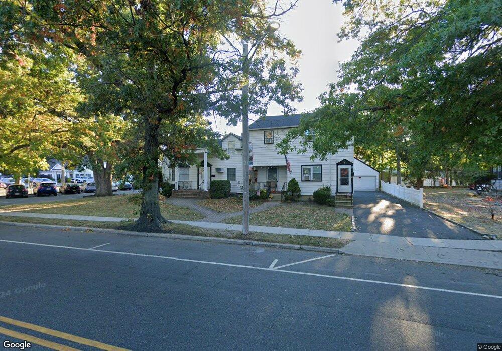
390 Atlantic Ave Unit 2 East Rockaway, NY 11518
Estimated Value: $1,013,165 - $1,183,000
2
Beds
1
Bath
750
Sq Ft
$1,464/Sq Ft
Est. Value
About This Home
This home is located at 390 Atlantic Ave Unit 2, East Rockaway, NY 11518 and is currently estimated at $1,098,083, approximately $1,464 per square foot. 390 Atlantic Ave Unit 2 is a home located in Nassau County with nearby schools including East Rockaway Junior/Senior High School and Our Lady Of Peace School.
Ownership History
Date
Name
Owned For
Owner Type
Purchase Details
Closed on
Dec 13, 2021
Sold by
James Stella and Mary Stella Trustee
Bought by
390 Atlantic Llc
Current Estimated Value
Home Financials for this Owner
Home Financials are based on the most recent Mortgage that was taken out on this home.
Original Mortgage
$552,500
Interest Rate
4.88%
Mortgage Type
New Conventional
Purchase Details
Closed on
Dec 31, 2007
Sold by
Stella Mary
Create a Home Valuation Report for This Property
The Home Valuation Report is an in-depth analysis detailing your home's value as well as a comparison with similar homes in the area
Home Values in the Area
Average Home Value in this Area
Purchase History
| Date | Buyer | Sale Price | Title Company |
|---|---|---|---|
| 390 Atlantic Llc | $850,000 | Chicago Title | |
| 390 Atlantic Llc | $850,000 | Chicago Title | |
| -- | -- | -- | |
| -- | -- | -- |
Source: Public Records
Mortgage History
| Date | Status | Borrower | Loan Amount |
|---|---|---|---|
| Previous Owner | 390 Atlantic Llc | $552,500 |
Source: Public Records
Tax History Compared to Growth
Tax History
| Year | Tax Paid | Tax Assessment Tax Assessment Total Assessment is a certain percentage of the fair market value that is determined by local assessors to be the total taxable value of land and additions on the property. | Land | Improvement |
|---|---|---|---|---|
| 2025 | $15,981 | $648 | $261 | $387 |
| 2024 | $2,376 | $636 | $256 | $380 |
| 2023 | $13,819 | $661 | $266 | $395 |
| 2022 | $13,819 | $661 | $266 | $395 |
| 2021 | $15,931 | $638 | $269 | $369 |
| 2020 | $8,791 | $602 | $264 | $338 |
| 2019 | $1,608 | $645 | $265 | $380 |
| 2018 | $6,518 | $688 | $0 | $0 |
| 2017 | $6,583 | $731 | $267 | $464 |
| 2016 | $8,252 | $774 | $255 | $519 |
| 2015 | $1,830 | $817 | $269 | $548 |
| 2014 | $1,830 | $817 | $269 | $548 |
| 2013 | $1,793 | $860 | $283 | $577 |
Source: Public Records
Map
Nearby Homes
- 390 Atlantic Ave
- 1 George Place
- 315 Atlantic Ave
- 315 Atlantic Ave Unit 1A
- 315 Atlantic Ave Unit 2G
- 320 Atlantic Ave Unit D2
- 320 Atlantic Ave Unit A12
- 320 Atlantic Ave Unit B4
- 49 Waldo Ave
- 1 Alexine Ave
- 290 Atlantic Ave Unit 211
- 290 Atlantic Ave Unit 245
- 490 Atlantic Ave Unit 103
- 490 Atlantic Ave Unit 218
- 490 Atlantic Ave Unit 330
- 19 Plainfield Ave
- 6 Ryder Place
- 41 Carman Ave
- 280 Atlantic Ave Unit 140
- 35 Ryder Ave
- 390 Atlantic Ave Unit A
- 400 Atlantic Ave Unit 2
- 8 Elbert Place
- 4 Elbert Place
- 2 Elbert Place
- 404 Atlantic Ave
- 404 Atlantic Ave Unit 2
- 12 Elbert Place
- 12 Elbert Place Unit 2
- 16 Elbert Place
- 375 Atlantic Ave
- 387 Atlantic Ave
- 20 Elbert Place
- 6 James St N
- 6 James St N
- 6 Columbia Ave
- 8 James St N
- 10 James St N
- 22 Elbert Place
- 422 Atlantic Ave