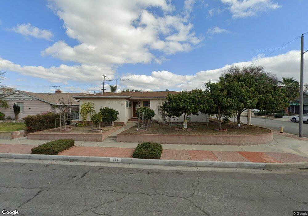
390 Oakland Dr La Habra, CA 90631
Estimated Value: $862,000 - $1,102,000
4
Beds
2
Baths
1,645
Sq Ft
$575/Sq Ft
Est. Value
About This Home
This home is located at 390 Oakland Dr, La Habra, CA 90631 and is currently estimated at $945,272, approximately $574 per square foot. 390 Oakland Dr is a home located in Orange County with nearby schools including Jordan Elementary School, Rancho-Starbuck Intermediate School, and La Habra High School.
Ownership History
Date
Name
Owned For
Owner Type
Purchase Details
Closed on
Aug 20, 2024
Sold by
Phe Julie
Bought by
Julie Phe Family Trust and Phe
Current Estimated Value
Purchase Details
Closed on
Apr 8, 2024
Sold by
Phe Hor Song
Bought by
Phe Julie
Purchase Details
Closed on
Oct 29, 2010
Sold by
Lim Ay Kheng
Bought by
Phe Hor Song
Purchase Details
Closed on
Aug 16, 2010
Sold by
Bank Of America N A
Bought by
Phe Julie and Phe Hor Song
Home Financials for this Owner
Home Financials are based on the most recent Mortgage that was taken out on this home.
Original Mortgage
$100,000
Interest Rate
4.33%
Mortgage Type
New Conventional
Purchase Details
Closed on
May 13, 2010
Sold by
Calas Ermina and Calas Tito
Bought by
Bank Of America Na
Purchase Details
Closed on
Mar 19, 2003
Sold by
Martinez Romeo and Martinez Annabelle
Bought by
Calas Tito and Calas Ermina
Home Financials for this Owner
Home Financials are based on the most recent Mortgage that was taken out on this home.
Original Mortgage
$247,200
Interest Rate
5.82%
Purchase Details
Closed on
Jan 4, 2002
Sold by
Martinez Annabelle and Martinez Annabelle B
Bought by
Martinez Romeo and Martinez Annabelle
Home Financials for this Owner
Home Financials are based on the most recent Mortgage that was taken out on this home.
Original Mortgage
$225,000
Interest Rate
6.73%
Purchase Details
Closed on
Nov 28, 1995
Sold by
Martinez Romeo J
Bought by
Martinez Annabelle B
Home Financials for this Owner
Home Financials are based on the most recent Mortgage that was taken out on this home.
Original Mortgage
$164,350
Interest Rate
7.42%
Purchase Details
Closed on
Nov 9, 1995
Sold by
Hill Ruth Mae
Bought by
Martinez Annabelle B
Home Financials for this Owner
Home Financials are based on the most recent Mortgage that was taken out on this home.
Original Mortgage
$164,350
Interest Rate
7.42%
Purchase Details
Closed on
Dec 16, 1994
Sold by
Hill Ruth Mae
Bought by
Hill Ruth Mae and The Hill Family Trust
Create a Home Valuation Report for This Property
The Home Valuation Report is an in-depth analysis detailing your home's value as well as a comparison with similar homes in the area
Home Values in the Area
Average Home Value in this Area
Purchase History
| Date | Buyer | Sale Price | Title Company |
|---|---|---|---|
| Julie Phe Family Trust | -- | None Listed On Document | |
| Phe Julie | -- | None Listed On Document | |
| Phe Hor Song | -- | First American Title Ins Co | |
| Phe Julie | $342,000 | First American Title Ins Co | |
| Bank Of America Na | $351,000 | Cr Title Services Inc | |
| Calas Tito | $309,000 | Stewart Title | |
| Martinez Romeo | -- | Commonwealth Land Title | |
| Martinez Annabelle B | -- | Orange Coast Title | |
| Martinez Annabelle B | $175,000 | Orange Coast Title | |
| Hill Ruth Mae | -- | -- |
Source: Public Records
Mortgage History
| Date | Status | Borrower | Loan Amount |
|---|---|---|---|
| Previous Owner | Phe Julie | $100,000 | |
| Previous Owner | Calas Tito | $247,200 | |
| Previous Owner | Martinez Romeo | $225,000 | |
| Previous Owner | Martinez Annabelle B | $164,350 | |
| Closed | Calas Tito | $30,900 |
Source: Public Records
Tax History Compared to Growth
Tax History
| Year | Tax Paid | Tax Assessment Tax Assessment Total Assessment is a certain percentage of the fair market value that is determined by local assessors to be the total taxable value of land and additions on the property. | Land | Improvement |
|---|---|---|---|---|
| 2025 | $4,926 | $438,154 | $346,873 | $91,281 |
| 2024 | $4,926 | $429,563 | $340,071 | $89,492 |
| 2023 | $4,807 | $421,141 | $333,403 | $87,738 |
| 2022 | $4,756 | $412,884 | $326,866 | $86,018 |
| 2021 | $4,662 | $404,789 | $320,457 | $84,332 |
| 2020 | $4,651 | $400,639 | $317,171 | $83,468 |
| 2019 | $4,542 | $392,784 | $310,952 | $81,832 |
| 2018 | $4,365 | $385,083 | $304,855 | $80,228 |
| 2017 | $4,287 | $377,533 | $298,878 | $78,655 |
| 2016 | $4,197 | $370,131 | $293,018 | $77,113 |
| 2015 | $4,081 | $364,572 | $288,617 | $75,955 |
| 2014 | $3,956 | $357,431 | $282,963 | $74,468 |
Source: Public Records
Map
Nearby Homes
- 240 Oakland Dr
- 2641 Stanton Ave
- 16621 Crape Myrtle Ln
- 2420 Sidon Ave
- 11636 Tigrina Ave
- 2000 Baja Ave
- 1921 Pine Dr
- 2611 Gregory Ln
- 530 Spruce Way
- 16321 Sugargrove Dr
- 2100 Gregory Ln
- 11518 1st Ave
- 1675 W Lambert Rd Unit 22
- 1731 W Lambert Rd Unit 91
- 1731 W Lambert Rd Unit 61
- 1731 W Lambert Rd Unit 62
- 1750 W Lambert Rd Unit 112
- 1620 W El Portal Dr
- 16540 Whittier Blvd
- 11315 Groveside Ave