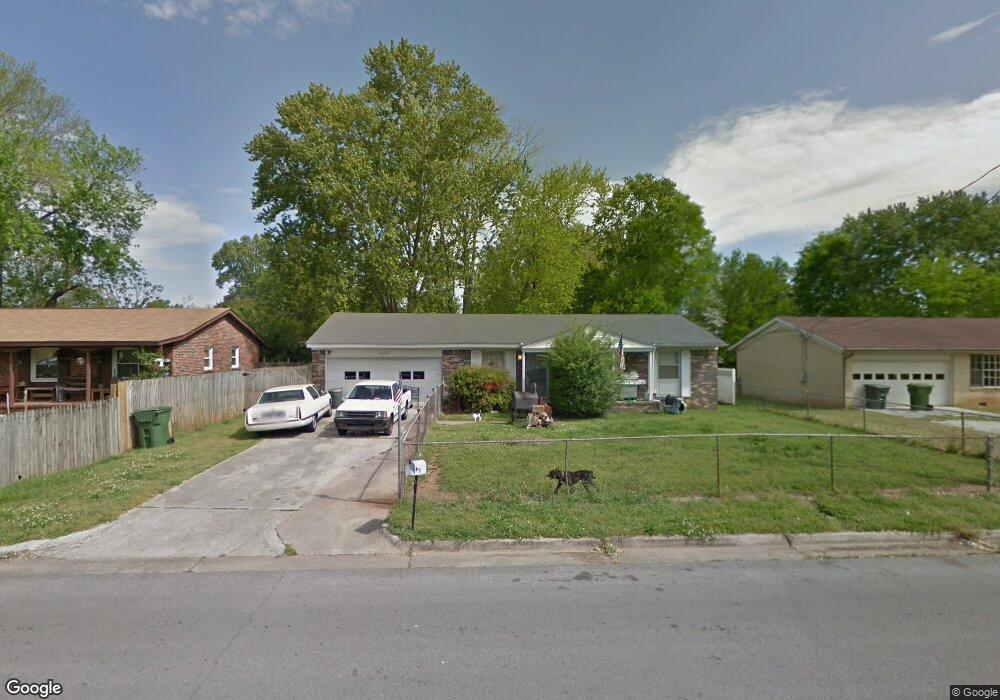
3905 Telstar Cir SW Huntsville, AL 35805
West Huntsville NeighborhoodEstimated Value: $133,000 - $166,029
--
Bed
1
Bath
1,080
Sq Ft
$137/Sq Ft
Est. Value
About This Home
This home is located at 3905 Telstar Cir SW, Huntsville, AL 35805 and is currently estimated at $148,007, approximately $137 per square foot. 3905 Telstar Cir SW is a home with nearby schools including McDonnell Elementary School, Whitesburg Elementary School, and Virgil Grissom High School.
Ownership History
Date
Name
Owned For
Owner Type
Purchase Details
Closed on
Jan 30, 2020
Sold by
Swafford Charles N and Mccormick Edward L
Bought by
Deep Roots Farm Llc
Current Estimated Value
Home Financials for this Owner
Home Financials are based on the most recent Mortgage that was taken out on this home.
Original Mortgage
$85,500
Outstanding Balance
$75,528
Interest Rate
3.7%
Mortgage Type
Seller Take Back
Estimated Equity
$72,479
Purchase Details
Closed on
Feb 9, 2007
Sold by
Ryland Charles R
Bought by
Swafford Charles N and Mccormick Edward E
Create a Home Valuation Report for This Property
The Home Valuation Report is an in-depth analysis detailing your home's value as well as a comparison with similar homes in the area
Home Values in the Area
Average Home Value in this Area
Purchase History
| Date | Buyer | Sale Price | Title Company |
|---|---|---|---|
| Deep Roots Farm Llc | $95,000 | Paulus Title Llc | |
| Swafford Charles N | $46,150 | -- |
Source: Public Records
Mortgage History
| Date | Status | Borrower | Loan Amount |
|---|---|---|---|
| Open | Deep Roots Farm Llc | $85,500 |
Source: Public Records
Tax History Compared to Growth
Tax History
| Year | Tax Paid | Tax Assessment Tax Assessment Total Assessment is a certain percentage of the fair market value that is determined by local assessors to be the total taxable value of land and additions on the property. | Land | Improvement |
|---|---|---|---|---|
| 2025 | $1,451 | $25,020 | $4,100 | $20,920 |
| 2024 | $1,451 | $23,400 | $4,100 | $19,300 |
| 2023 | $1,357 | $22,040 | $2,740 | $19,300 |
| 2022 | $1,134 | $19,560 | $2,740 | $16,820 |
| 2021 | $1,025 | $17,680 | $2,740 | $14,940 |
| 2020 | $822 | $14,180 | $2,040 | $12,140 |
| 2019 | $822 | $14,180 | $2,040 | $12,140 |
| 2018 | $821 | $14,160 | $0 | $0 |
| 2017 | $821 | $14,160 | $0 | $0 |
| 2016 | $821 | $14,160 | $0 | $0 |
| 2015 | $821 | $14,160 | $0 | $0 |
| 2014 | $824 | $14,200 | $0 | $0 |
Source: Public Records
Map
Nearby Homes
- 4403 Gazette Dr SW
- 4013 Patty Ann Dr SW
- 4410 Gazette Dr SW
- 4027 Telstar Cir SW
- 3706 Squaw Valley Dr SW
- 3615 Squaw Valley Dr SW
- 4105 Broyles Ave SW
- 1.43 Conger Rd SW
- 1.43 Acres Conger Rd SW
- 0 Conger Rd SW
- 3520 Conger Rd SW
- 4104 Mcvay St SW Unit A & B
- 3509 Conger Rd SW
- 4011 Eunice St SW
- 3306 Spinners Ct
- 3310 Spinners Ct
- 3312 Spinners Ct
- 3308 Spinners Ct
- 3408 Conger Rd SW
- 4001 Newson Rd SW
- 3903 Telstar Cir SW
- 3907 Telstar Cir SW
- 4019 Apollo Dr SW
- 4321 Balwin Dr SW
- 4017 Apollo Dr SW
- 3909 Telstar Cir SW
- 4021 Apollo Dr SW
- 3904 Telstar Cir SW
- 3902 Telstar Cir SW
- 4015 Apollo Dr SW
- 4023 Apollo Dr SW
- 3906 Telstar Cir SW
- 3911 Telstar Cir SW
- 3908 Telstar Cir SW
- 4013 Apollo Dr SW
- 4303 Gazette Dr SW
- 4018 Apollo Dr SW
- 4020 Apollo Dr SW
- 4102 Talwell Dr SW