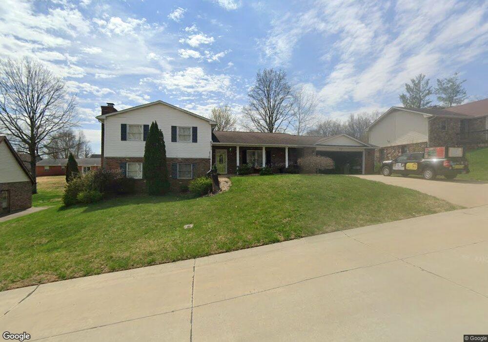
3909 Annwood Dr Cape Girardeau, MO 63701
Estimated Value: $252,000 - $353,000
3
Beds
3
Baths
1,400
Sq Ft
$211/Sq Ft
Est. Value
About This Home
This home is located at 3909 Annwood Dr, Cape Girardeau, MO 63701 and is currently estimated at $295,480, approximately $211 per square foot. 3909 Annwood Dr is a home with nearby schools including Clippard Elementary School, Central Middle School, and Central Junior High School.
Ownership History
Date
Name
Owned For
Owner Type
Purchase Details
Closed on
Oct 25, 2005
Sold by
Bradley Sally Lea
Bought by
Bailey Samuel and Bailey Yvonne
Current Estimated Value
Home Financials for this Owner
Home Financials are based on the most recent Mortgage that was taken out on this home.
Original Mortgage
$149,000
Outstanding Balance
$79,966
Interest Rate
5.9%
Mortgage Type
New Conventional
Estimated Equity
$215,514
Create a Home Valuation Report for This Property
The Home Valuation Report is an in-depth analysis detailing your home's value as well as a comparison with similar homes in the area
Home Values in the Area
Average Home Value in this Area
Purchase History
| Date | Buyer | Sale Price | Title Company |
|---|---|---|---|
| Bailey Samuel | -- | None Available |
Source: Public Records
Mortgage History
| Date | Status | Borrower | Loan Amount |
|---|---|---|---|
| Open | Bailey Samuel | $149,000 |
Source: Public Records
Tax History Compared to Growth
Tax History
| Year | Tax Paid | Tax Assessment Tax Assessment Total Assessment is a certain percentage of the fair market value that is determined by local assessors to be the total taxable value of land and additions on the property. | Land | Improvement |
|---|---|---|---|---|
| 2025 | $16 | $31,690 | $5,090 | $26,600 |
| 2024 | $16 | $30,190 | $4,850 | $25,340 |
| 2023 | $1,569 | $30,190 | $4,850 | $25,340 |
| 2022 | $1,447 | $27,820 | $4,470 | $23,350 |
| 2021 | $1,446 | $27,820 | $4,470 | $23,350 |
| 2020 | $1,451 | $27,820 | $4,470 | $23,350 |
| 2019 | $1,448 | $27,820 | $0 | $0 |
| 2018 | $1,446 | $27,820 | $0 | $0 |
| 2017 | $1,449 | $27,820 | $0 | $0 |
| 2016 | $1,443 | $27,820 | $0 | $0 |
| 2015 | $1,445 | $27,820 | $0 | $0 |
| 2014 | $1,452 | $27,820 | $0 | $0 |
Source: Public Records
Map
Nearby Homes
- 3814 Carolewood Dr
- 1304 Holly Dr
- 1800 Silverthorne Trail
- 1969 Silverthorne Trail
- 1989 Silverthorne Trail
- 3046 Beavercreek Dr
- 807 Caribou Ct
- 3022 Beavercreek Dr
- 2236 Boulder Crest Dr
- 3036 Keystone Dr
- 4516 Doe Run
- 3014 Keystone Dr
- 495 S Lake Dr
- 1435 Chardonnay Ln
- 4530 Doe Run
- 4578 Kingston Ave
- 4527 Doe Run
- 4568 Kingston Ave
- 901 Pheasant Cove Dr
- 4510 Doe Run
- 3913 Annwood Dr
- 3905 Annwood Dr
- 3910 Annwood Dr
- 3910 Carolewood Dr
- 3914 Carolwood
- 3914 Annwood Dr
- 3906 Carolewood Dr
- 3906 Annwood Dr
- 3917 Annwood Dr
- 1305 Ashland Hills Dr
- 3918 Carolewood Dr
- 3902 Carolewood Dr
- 3918 Annwood Dr
- 3902 Annwood Dr
- 3909 Carolewood Dr
- 3913 Carolewood Dr
- 3913 Brentwood Dr
- 3922 Annwood Dr
- 3909 Brentwood Dr
- 3905 Carolewood Dr