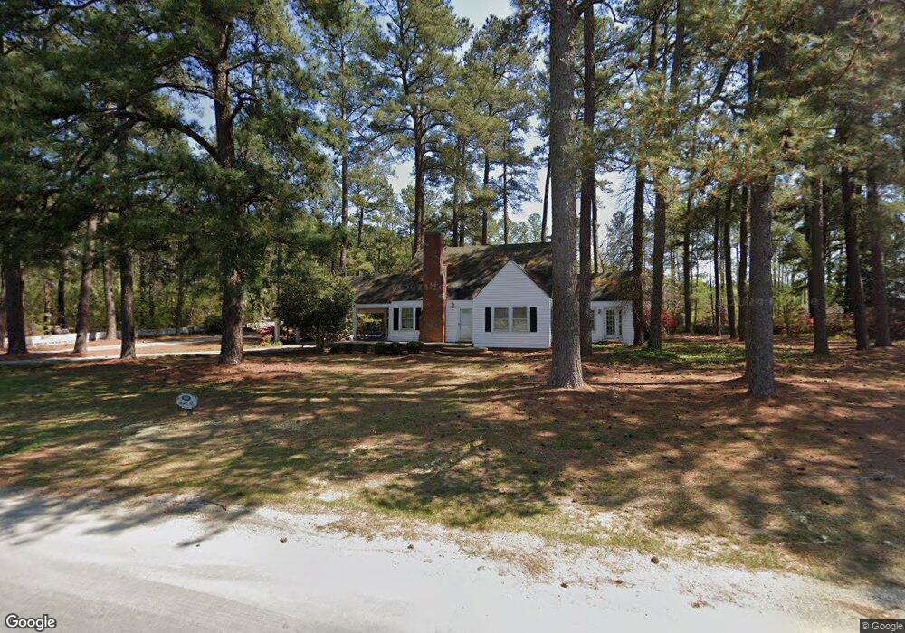
392 Hight Rd Louisburg, NC 27549
Estimated Value: $240,000 - $344,000
3
Beds
2
Baths
1,482
Sq Ft
$191/Sq Ft
Est. Value
About This Home
This home is located at 392 Hight Rd, Louisburg, NC 27549 and is currently estimated at $283,299, approximately $191 per square foot. 392 Hight Rd is a home located in Franklin County with nearby schools including Laurel Mill Elementary School, Terrell Lane Middle School, and Louisburg High School.
Ownership History
Date
Name
Owned For
Owner Type
Purchase Details
Closed on
Mar 6, 2023
Sold by
Hight William L and Hight Laura E
Bought by
Hight William L and Hight William L
Current Estimated Value
Purchase Details
Closed on
Jun 24, 2022
Sold by
Hight William L and Hight Laura E
Bought by
Hight William L and Hight Laura E
Create a Home Valuation Report for This Property
The Home Valuation Report is an in-depth analysis detailing your home's value as well as a comparison with similar homes in the area
Home Values in the Area
Average Home Value in this Area
Purchase History
| Date | Buyer | Sale Price | Title Company |
|---|---|---|---|
| Hight William L | -- | -- | |
| Hight William L | -- | Tomlinson Aubrey S |
Source: Public Records
Tax History Compared to Growth
Tax History
| Year | Tax Paid | Tax Assessment Tax Assessment Total Assessment is a certain percentage of the fair market value that is determined by local assessors to be the total taxable value of land and additions on the property. | Land | Improvement |
|---|---|---|---|---|
| 2025 | $1,366 | $222,370 | $87,350 | $135,020 |
| 2024 | $1,366 | $222,370 | $87,350 | $135,020 |
| 2023 | $1,157 | $123,910 | $28,890 | $95,020 |
| 2022 | $1,147 | $123,910 | $28,890 | $95,020 |
| 2021 | $1,161 | $124,140 | $29,120 | $95,020 |
| 2020 | $1,168 | $124,140 | $29,120 | $95,020 |
| 2019 | $1,158 | $124,140 | $29,120 | $95,020 |
| 2018 | $1,153 | $124,140 | $29,120 | $95,020 |
| 2017 | $972 | $93,920 | $25,810 | $68,110 |
| 2016 | $1,005 | $93,920 | $25,810 | $68,110 |
| 2015 | $1,005 | $93,920 | $25,810 | $68,110 |
| 2014 | $931 | $93,920 | $25,810 | $68,110 |
Source: Public Records
Map
Nearby Homes
- 2329 N Carolina 561
- 09 Tillery Dr
- 11 Tillery Dr
- 08 Tillery Dr
- 592 Perdues Rd
- 06 Tillery Dr
- 348 Raymond Tharrington Rd
- 317 Brewer Rd
- 620 Raymond Tharrington Rd
- 4.29 Acres Leonard Rd
- 9.56 Acres Leonard Rd
- 0 Wood Rd
- 376 T K Allen Rd
- 0 Shortleaf Dr Unit 10119597
- 15 Gina Lee Terrace
- 45 Leisure Ln
- 55 Leisure Ln
- 70 Leisure Ln
- Cypress Springs Dr
- 0 Cypress Creek Dr
- 368 Hight Rd
- 3021 Nc 561 Hwy
- 3114 Nc 561 Hwy
- 3114 Nc 561 Hwy
- 3114 Nc 561 Hwy
- 3114 Nc 561 Hwy
- 2987 Nc 561 Hwy
- 2975 Nc 561 Hwy
- 54 Laurel Mill Rd
- 3149 Nc 561 Hwy
- 3149 Nc 561 Hwy
- 3149 Nc 561 Hwy
- 2884 N Carolina 561
- 2884 Nc 561 Hwy
- 114 Laurel Mill Rd
- 114 Laurel Mill Rd
- 176 Laurel Mill Rd
- 114 Laurel Mill Rd
- 163 Laurel Mill Rd
- 62 Graham Burnette Ln