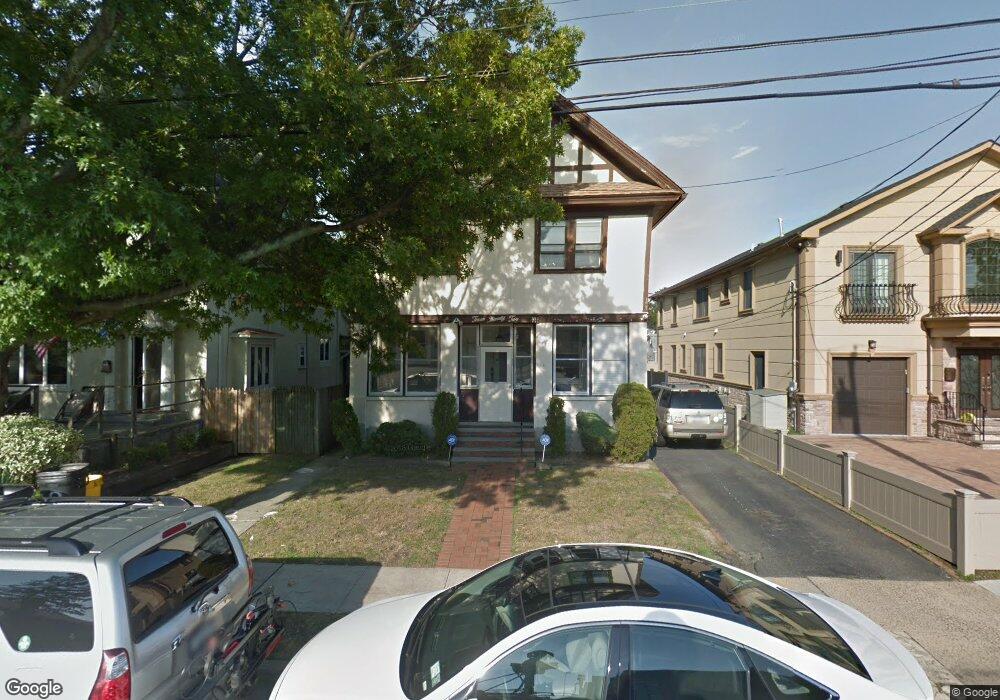
392 Oakland Ave Cedarhurst, NY 11516
Estimated Value: $1,118,000 - $1,253,605
--
Bed
3
Baths
2,668
Sq Ft
$444/Sq Ft
Est. Value
About This Home
This home is located at 392 Oakland Ave, Cedarhurst, NY 11516 and is currently estimated at $1,185,803, approximately $444 per square foot. 392 Oakland Ave is a home located in Nassau County with nearby schools including Lawrence Primary School, Lawrence Elementary School, and Lawrence Middle School.
Ownership History
Date
Name
Owned For
Owner Type
Purchase Details
Closed on
Aug 13, 2009
Sold by
Fein Donny and Fein Elisheva
Bought by
Hersko Geoffrey and Hersko Rachel
Current Estimated Value
Home Financials for this Owner
Home Financials are based on the most recent Mortgage that was taken out on this home.
Original Mortgage
$417,000
Outstanding Balance
$271,331
Interest Rate
5.17%
Mortgage Type
Purchase Money Mortgage
Estimated Equity
$914,472
Purchase Details
Closed on
Dec 9, 2005
Sold by
Barasch Al
Bought by
Fein Elisheva
Create a Home Valuation Report for This Property
The Home Valuation Report is an in-depth analysis detailing your home's value as well as a comparison with similar homes in the area
Home Values in the Area
Average Home Value in this Area
Purchase History
| Date | Buyer | Sale Price | Title Company |
|---|---|---|---|
| Hersko Geoffrey | $575,000 | -- | |
| Fein Elisheva | $570,000 | -- |
Source: Public Records
Mortgage History
| Date | Status | Borrower | Loan Amount |
|---|---|---|---|
| Open | Hersko Geoffrey | $417,000 |
Source: Public Records
Tax History Compared to Growth
Tax History
| Year | Tax Paid | Tax Assessment Tax Assessment Total Assessment is a certain percentage of the fair market value that is determined by local assessors to be the total taxable value of land and additions on the property. | Land | Improvement |
|---|---|---|---|---|
| 2025 | $10,650 | $758 | $268 | $490 |
| 2024 | $3,465 | $760 | $268 | $492 |
| 2023 | $9,762 | $802 | $283 | $519 |
| 2022 | $9,762 | $799 | $282 | $517 |
| 2021 | $9,062 | $799 | $263 | $536 |
| 2020 | $6,852 | $754 | $753 | $1 |
| 2019 | $7,686 | $808 | $803 | $5 |
| 2018 | $7,159 | $862 | $0 | $0 |
| 2017 | $4,810 | $916 | $809 | $107 |
| 2016 | $7,457 | $970 | $775 | $195 |
| 2015 | $2,753 | $1,024 | $657 | $367 |
| 2014 | $2,753 | $1,024 | $657 | $367 |
| 2013 | $2,659 | $1,072 | $688 | $384 |
Source: Public Records
Map
Nearby Homes
- 276 Cedarhurst Ave Unit B2
- 276 Cedarhurst Ave Unit B4
- 272 Cedarhurst Ave Unit A6
- 508 Monroe St
- 383 Clinton Ave
- 530 Hudson Ave Unit A4
- 439 Bayview Ave
- 291 Cedarhurst Ave Unit K9
- 279 Cedarhurst Ave Unit G-6
- 492 Court Ave
- 487 Court Ave
- 461 5th Ave
- 477 Court Ave
- 313 Forest Ave
- 709 Carlyle St
- 463 Summit Ave Unit 2F
- 410 Church Ave
- 7 Park Cir
- 544 Arlington Rd
- 347 Roselle Ave
- 388 Oakland Ave
- 569 Grant Place
- 575 Grant Place
- 568 W Broadway
- 574 W Broadway
- 579 Grant Place
- 580 W Broadway
- 408 Oakland Ave
- 395 Oakland Ave
- 584 W Broadway
- 583 Grant Place
- 570 Grant Place
- 588 W Broadway
- 574 Grant Place
- 405 Oakland Ave
- 412 Oakland Ave
- 578 Grant Place
- 409 Oakland Ave
- 546 W Broadway
- 567 W Broadway