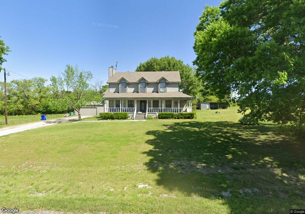
393 Meadowlake Dr Sherman, TX 75092
Estimated Value: $476,574 - $555,000
4
Beds
3
Baths
2,649
Sq Ft
$195/Sq Ft
Est. Value
About This Home
This home is located at 393 Meadowlake Dr, Sherman, TX 75092 and is currently estimated at $515,787, approximately $194 per square foot. 393 Meadowlake Dr is a home located in Grayson County with nearby schools including S&S Consolidated Elementary School, S&S Consolidated Middle School, and S. & S. Cons H.S..
Ownership History
Date
Name
Owned For
Owner Type
Purchase Details
Closed on
Apr 30, 2019
Sold by
Vasquez Justin E and Vasquez Rosa
Bought by
Chapman Andrew Scott and Chapman Cassidie
Current Estimated Value
Home Financials for this Owner
Home Financials are based on the most recent Mortgage that was taken out on this home.
Original Mortgage
$273,948
Outstanding Balance
$241,340
Interest Rate
4.3%
Mortgage Type
FHA
Estimated Equity
$274,447
Purchase Details
Closed on
Aug 5, 2013
Sold by
Jones Marty Middleton
Bought by
Fuhrmann Jerome P and Fuhrmann Phyllis D
Home Financials for this Owner
Home Financials are based on the most recent Mortgage that was taken out on this home.
Original Mortgage
$153,225
Interest Rate
4.49%
Mortgage Type
VA
Create a Home Valuation Report for This Property
The Home Valuation Report is an in-depth analysis detailing your home's value as well as a comparison with similar homes in the area
Home Values in the Area
Average Home Value in this Area
Purchase History
| Date | Buyer | Sale Price | Title Company |
|---|---|---|---|
| Chapman Andrew Scott | -- | Red River Title Co | |
| Fuhrmann Jerome P | -- | Chapin Title Co Inc |
Source: Public Records
Mortgage History
| Date | Status | Borrower | Loan Amount |
|---|---|---|---|
| Open | Chapman Andrew Scott | $273,948 | |
| Previous Owner | Fuhrmann Jerome P | $153,225 |
Source: Public Records
Tax History Compared to Growth
Tax History
| Year | Tax Paid | Tax Assessment Tax Assessment Total Assessment is a certain percentage of the fair market value that is determined by local assessors to be the total taxable value of land and additions on the property. | Land | Improvement |
|---|---|---|---|---|
| 2025 | $3,747 | $369,502 | -- | -- |
| 2024 | $5,015 | $335,911 | $0 | $0 |
| 2023 | $3,246 | $305,374 | $0 | $0 |
| 2022 | $6,259 | $372,200 | $62,272 | $309,928 |
| 2021 | $4,800 | $252,375 | $29,770 | $222,605 |
| 2020 | $4,495 | $229,152 | $16,666 | $212,486 |
| 2019 | $4,624 | $217,449 | $16,666 | $200,783 |
| 2018 | $3,916 | $201,073 | $16,666 | $184,407 |
| 2017 | $3,902 | $198,959 | $13,306 | $185,653 |
| 2016 | $4,136 | $210,916 | $13,306 | $197,610 |
| 2015 | $2,272 | $164,723 | $13,306 | $151,417 |
| 2014 | $2,402 | $149,596 | $13,306 | $136,290 |
Source: Public Records
Map
Nearby Homes
- 2310 Trailside Dr
- 2306 Trailside Dr
- 2302 Trailside Dr
- 2232 Trailside Dr
- 2228 Trailside Dr
- 2224 Trailside Dr
- 2220 Trailside Dr
- 2212 Trailside Dr
- 2213 Trailside Dr
- 2712 Hillview Ln
- The Amherst Plan at Freeman Farm
- The Mason Plan at Freeman Farm
- The Olive Plan at Freeman Farm
- The Elm Plan at Freeman Farm
- The Flower Plan at Hickory Hill
- The Navarro Plan at Freeman Farm
- The Jason Plan at Freeman Farm
- The Elm Plan at Hickory Hill
- The Amherst Plan at Hickory Hill
- The Albany Plan at Hickory Hill
- 237 Meadowlake Dr
- 594 Meadowlake Dr
- 0 Haliburton Ln
- 45 Haliburton Ln
- 33 Salvage Dr
- 73 Haliburton Ln
- 80 Salvage Dr
- 0000 W Lamberth Rd
- 4045 W Lamberth Rd
- 3939 W Lamberth Rd
- 2601 N Friendship Rd
- 4103 W Lamberth Rd
- 3823 W Lamberth Rd
- 173 Rr 2
- 894 Meadowlake Dr
- 3691 W Lamberth Rd
- 1.508 Acres Lamberth Rd
- 13.7580 Acres Lamberth Rd
- 3800 W Lamberth Rd Unit 6202
- 3800 W Lamberth Rd Unit 5103