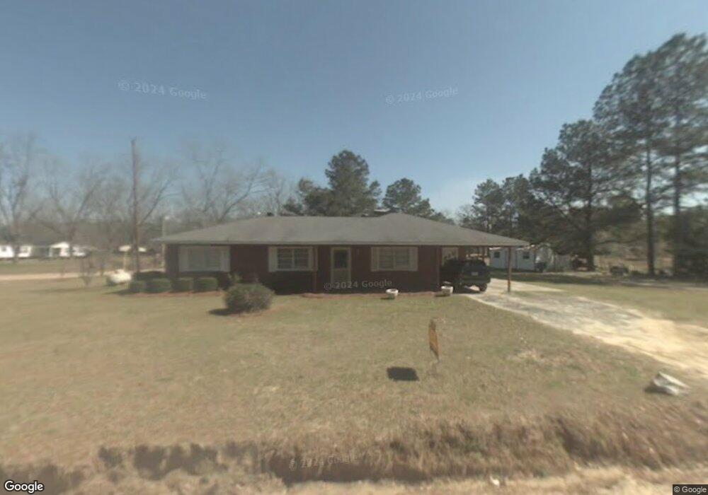
394 Shuman Rd Statesboro, GA 30461
Estimated Value: $162,779 - $234,000
3
Beds
2
Baths
1,552
Sq Ft
$130/Sq Ft
Est. Value
About This Home
This home is located at 394 Shuman Rd, Statesboro, GA 30461 and is currently estimated at $201,195, approximately $129 per square foot. 394 Shuman Rd is a home located in Bulloch County with nearby schools including Statesboro High School, Mattie Lively Elementary School, and William James Middle School.
Ownership History
Date
Name
Owned For
Owner Type
Purchase Details
Closed on
Mar 22, 2021
Sold by
Parker Gilbert
Bought by
Taylor Alexcia A and Burnette Timothus
Current Estimated Value
Home Financials for this Owner
Home Financials are based on the most recent Mortgage that was taken out on this home.
Original Mortgage
$84,390
Outstanding Balance
$75,777
Interest Rate
2.8%
Mortgage Type
New Conventional
Estimated Equity
$125,418
Purchase Details
Closed on
Oct 1, 1980
Bought by
Parker Gilbert
Create a Home Valuation Report for This Property
The Home Valuation Report is an in-depth analysis detailing your home's value as well as a comparison with similar homes in the area
Home Values in the Area
Average Home Value in this Area
Purchase History
| Date | Buyer | Sale Price | Title Company |
|---|---|---|---|
| Taylor Alexcia A | $87,000 | -- | |
| Parker Gilbert | -- | -- |
Source: Public Records
Mortgage History
| Date | Status | Borrower | Loan Amount |
|---|---|---|---|
| Open | Taylor Alexcia A | $84,390 |
Source: Public Records
Tax History Compared to Growth
Tax History
| Year | Tax Paid | Tax Assessment Tax Assessment Total Assessment is a certain percentage of the fair market value that is determined by local assessors to be the total taxable value of land and additions on the property. | Land | Improvement |
|---|---|---|---|---|
| 2024 | $1,152 | $53,720 | $5,240 | $48,480 |
| 2023 | $1,103 | $47,320 | $3,440 | $43,880 |
| 2022 | $751 | $40,605 | $2,876 | $37,729 |
| 2021 | $772 | $34,889 | $2,876 | $32,013 |
| 2020 | $741 | $32,605 | $2,397 | $30,208 |
| 2019 | $749 | $32,792 | $2,397 | $30,395 |
| 2018 | $707 | $30,054 | $1,997 | $28,057 |
| 2017 | $683 | $28,599 | $1,997 | $26,602 |
| 2016 | $683 | $27,864 | $1,997 | $25,868 |
| 2015 | $661 | $26,789 | $1,997 | $24,792 |
| 2014 | $611 | $26,789 | $1,997 | $24,792 |
Source: Public Records
Map
Nearby Homes
- Rl Lee Rd
- R L Lee Rd
- Rl Lee Rd
- Rl Lee Rd
- 0 R L Lee Rd Unit 11 10556586
- 0 R L Lee Rd Unit 8 10529472
- 0 R L Lee Rd Unit 9 10577586
- 67 Red Breast Ln
- 0 Hope Baptist Church Rd Unit 10605612
- 0 Busby Rd Unit 10479601
- 12002 Clito Rd
- 2625 Old Mill Way
- 439 Dover Rd
- APPRX 218 ACRES Old River Rd N
- APPRX 14 ACRES Old River Rd N
- 3978 Wc Hodges Rd
- 21901 U S 301
- 302 Tryon Place
- 0 Effingham Hwy Unit 328090
- 0 Effingham Hwy Unit 10486004
- 607 Rl Lee Rd
- 308 Shuman Rd
- 505 Rl Lee Rd
- 339 Club Rd
- 264 Shuman Rd
- 572 Shuman Rd
- 497 Rl Lee Rd
- 53 Jr Parker Rd
- 228 Shuman Rd
- 115 Brooks Pond House Ln
- 0 Parker Rd Unit 13 75190
- 0 Parker Rd Unit LOT 1 3098709
- 0 Parker Rd Unit LOT 13 3098704
- 0 Parker Rd Unit LOT 1 7201154
- 0 Parker Rd Unit LOT 13 7201152
- 0 Parker Rd Unit LOT 13 7483251
- 0 Parker Rd Unit LOT 1 7483249
- 0 Parker Rd Unit 8 7573354
- 0 Parker Rd Unit 3065390
- 0 Parker Rd Unit 7425727