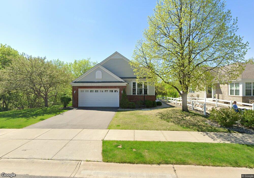
397 Campfire Curve Chaska, MN 55318
Estimated Value: $484,845 - $498,000
3
Beds
3
Baths
1,869
Sq Ft
$262/Sq Ft
Est. Value
About This Home
This home is located at 397 Campfire Curve, Chaska, MN 55318 and is currently estimated at $489,711, approximately $262 per square foot. 397 Campfire Curve is a home located in Carver County with nearby schools including Jonathan Elementary School, Chaska Middle School East, and Chaska High School.
Ownership History
Date
Name
Owned For
Owner Type
Purchase Details
Closed on
May 27, 2005
Sold by
Grote Philip E and Grote Martha C
Bought by
Rhodes Robert W and Rhodes Donna C
Current Estimated Value
Purchase Details
Closed on
Aug 20, 2001
Sold by
Pulte Homes Of Minnesota Corp
Bought by
Grote Philip E and Grote Martha C
Create a Home Valuation Report for This Property
The Home Valuation Report is an in-depth analysis detailing your home's value as well as a comparison with similar homes in the area
Home Values in the Area
Average Home Value in this Area
Purchase History
| Date | Buyer | Sale Price | Title Company |
|---|---|---|---|
| Rhodes Robert W | $339,900 | -- | |
| Grote Philip E | $243,860 | -- |
Source: Public Records
Tax History Compared to Growth
Tax History
| Year | Tax Paid | Tax Assessment Tax Assessment Total Assessment is a certain percentage of the fair market value that is determined by local assessors to be the total taxable value of land and additions on the property. | Land | Improvement |
|---|---|---|---|---|
| 2025 | $4,872 | $420,700 | $78,800 | $341,900 |
| 2024 | $4,802 | $413,100 | $78,800 | $334,300 |
| 2023 | $4,896 | $409,300 | $78,800 | $330,500 |
| 2022 | $4,660 | $435,300 | $78,700 | $356,600 |
| 2021 | $4,134 | $346,000 | $65,600 | $280,400 |
| 2020 | $4,166 | $346,000 | $65,600 | $280,400 |
| 2019 | $4,030 | $321,500 | $62,500 | $259,000 |
| 2018 | $4,032 | $321,500 | $62,500 | $259,000 |
| 2017 | $3,788 | $318,600 | $56,800 | $261,800 |
| 2016 | $3,828 | $275,400 | $0 | $0 |
| 2015 | $3,238 | $253,900 | $0 | $0 |
| 2014 | $3,238 | $221,700 | $0 | $0 |
Source: Public Records
Map
Nearby Homes
- 379 Wagon Wheel Ln
- 314 Campfire Curve
- 2732 Wagon Wheel Curve Unit 11
- 312 Wagon Wheel Ln Unit 16
- 670 Weston Ridge Pkwy
- 110696 Village Rd Unit 219
- 110282 Village Rd
- 110309 Center Green Cir
- 3110 N Chestnut St Unit 414
- 110102 Arboretum Way
- 2890 Autumn Woods Dr
- 441 Pleasant Ln
- 349 Pleasant Ln
- 554 Satori Way
- 6513 Timber Arch Dr
- 936 Bluff Pointe Dr
- 3130 Sugar Maple Dr
- 586 Kassel Ln
- 1078 Overlook Dr
- 661 Satori Way
- 389 Campfire Curve
- 381 Campfire Curve
- 499 Wilderness Dr
- 373 Campfire Curve
- 498 Wilderness Dr
- 493 Wilderness Dr
- 496 Wilderness Dr
- 494 Wilderness Dr
- 401 Campfire Curve
- 365 Campfire Curve
- 492 Wilderness Dr
- 489 Wilderness Dr
- 362 Campfire Curve
- 488 Wilderness Dr
- 405 Campfire Curve
- 358 Campfire Curve
- 361 Campfire Curve
- 486 Wilderness Dr
- 483 Wilderness Dr
- 354 Campfire Curve