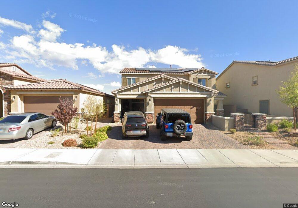
398 Lost Horizon Ave Henderson, NV 89002
Highland Hills NeighborhoodEstimated Value: $702,553 - $767,000
4
Beds
4
Baths
3,479
Sq Ft
$212/Sq Ft
Est. Value
About This Home
This home is located at 398 Lost Horizon Ave, Henderson, NV 89002 and is currently estimated at $736,138, approximately $211 per square foot. 398 Lost Horizon Ave is a home with nearby schools including J. Marlan Walker International School, Jack & Terry Mannion Middle School, and Foothill High School.
Ownership History
Date
Name
Owned For
Owner Type
Purchase Details
Closed on
Aug 5, 2024
Sold by
Geer Carri
Bought by
Thevenot-Geer Family Trust and Thevenot
Current Estimated Value
Purchase Details
Closed on
Jun 13, 2018
Sold by
Thevenot Roy
Bought by
Geer Carri
Home Financials for this Owner
Home Financials are based on the most recent Mortgage that was taken out on this home.
Original Mortgage
$267,240
Interest Rate
4.5%
Mortgage Type
New Conventional
Create a Home Valuation Report for This Property
The Home Valuation Report is an in-depth analysis detailing your home's value as well as a comparison with similar homes in the area
Home Values in the Area
Average Home Value in this Area
Purchase History
| Date | Buyer | Sale Price | Title Company |
|---|---|---|---|
| Thevenot-Geer Family Trust | -- | None Listed On Document | |
| Geer Carri | -- | North American Title Main | |
| Geer Carri | $448,840 | North American Title Main |
Source: Public Records
Mortgage History
| Date | Status | Borrower | Loan Amount |
|---|---|---|---|
| Previous Owner | Geer Carri | $267,240 |
Source: Public Records
Tax History Compared to Growth
Tax History
| Year | Tax Paid | Tax Assessment Tax Assessment Total Assessment is a certain percentage of the fair market value that is determined by local assessors to be the total taxable value of land and additions on the property. | Land | Improvement |
|---|---|---|---|---|
| 2025 | $5,480 | $235,730 | $50,400 | $185,330 |
| 2024 | $5,321 | $235,730 | $50,400 | $185,330 |
| 2023 | $5,321 | $219,810 | $55,300 | $164,510 |
| 2022 | $5,416 | $210,984 | $45,500 | $165,484 |
| 2021 | $5,015 | $169,320 | $42,350 | $126,970 |
| 2020 | $4,865 | $166,098 | $38,500 | $127,598 |
| 2019 | $4,659 | $162,748 | $37,450 | $125,298 |
| 2018 | $651 | $32,200 | $32,200 | $0 |
| 2017 | $649 | $22,400 | $22,400 | $0 |
| 2016 | $611 | $0 | $0 | $0 |
Source: Public Records
Map
Nearby Homes
- 1030 Wavehugger Dr
- 1020 Wavehugger Dr
- 1045 Wavehugger Dr
- 1040 Wavehugger Dr
- 1035 Wavehugger Dr
- 467 Mission Dr
- 434 Lost Horizon Ave
- 641 Patti Ann Woods Dr
- 409 Hightop Ln
- 533 Calypso Dr
- 322 Wintercress Dr
- 1028 Twin Berry Ct
- 1055 Lush Hillside Ct
- 860 Bergamont Dr
- 815 Crabapple Dr
- 1023 Presley Ridge St
- 854 Coral Cottage Dr
- 460 E Paradise Hills Dr
- 848 Coral Cottage Dr
- 600 Quail Covey Rd
- 396 Lost Horizon Ave
- 400 Lost Horizon Ave
- 394 Lost Horizon Ave
- 402 Lost Horizon Ave
- 989 Rustic Rock Ct
- 392 Lost Horizon Ave
- 988 Cedar Cliff Ct
- 991 Rustic Rock Ct
- 990 Rustic Rock Ct
- 990 Cedar Cliff Ct
- 390 Lost Horizon Ave
- 406 Lost Horizon Ave
- 993 Rustic Rock Ct
- 992 Rustic Rock Ct
- 388 Lost Horizon Ave
- 989 Floral Creek Ct
- 408 Lost Horizon Ave
- 995 Rustic Rock Ct
- 994 Rustic Rock Ct
- 987 Cedar Cliff Ct