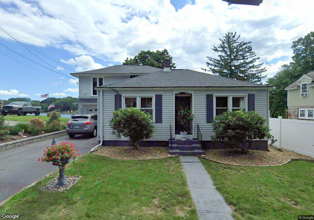
4 Birch Point Trail Oakdale, CT 06370
Estimated Value: $406,513 - $547,000
2
Beds
3
Baths
1,674
Sq Ft
$289/Sq Ft
Est. Value
About This Home
This home is located at 4 Birch Point Trail, Oakdale, CT 06370 and is currently estimated at $483,878, approximately $289 per square foot. 4 Birch Point Trail is a home located in New London County with nearby schools including Leonard J. Tyl Middle School, Montville High School, and St. Thomas More School.
Ownership History
Date
Name
Owned For
Owner Type
Purchase Details
Closed on
Nov 28, 2006
Sold by
Metzger Julian and Metzger Lai
Bought by
Lomonte John and Lomonte Teresa
Current Estimated Value
Purchase Details
Closed on
May 12, 1994
Sold by
Rogers Mary Jeanette and Pepin Raymond
Bought by
Spurgas David M
Home Financials for this Owner
Home Financials are based on the most recent Mortgage that was taken out on this home.
Original Mortgage
$112,500
Interest Rate
7.93%
Mortgage Type
Unknown
Create a Home Valuation Report for This Property
The Home Valuation Report is an in-depth analysis detailing your home's value as well as a comparison with similar homes in the area
Home Values in the Area
Average Home Value in this Area
Purchase History
| Date | Buyer | Sale Price | Title Company |
|---|---|---|---|
| Lomonte John | $420,000 | -- | |
| Lomonte John | $420,000 | -- | |
| Spurgas David M | $125,000 | -- | |
| Spurgas David M | $125,000 | -- |
Source: Public Records
Mortgage History
| Date | Status | Borrower | Loan Amount |
|---|---|---|---|
| Previous Owner | Spurgas David M | $195,000 | |
| Previous Owner | Spurgas David M | $112,500 |
Source: Public Records
Tax History Compared to Growth
Tax History
| Year | Tax Paid | Tax Assessment Tax Assessment Total Assessment is a certain percentage of the fair market value that is determined by local assessors to be the total taxable value of land and additions on the property. | Land | Improvement |
|---|---|---|---|---|
| 2025 | $6,396 | $221,550 | $91,350 | $130,200 |
| 2024 | $6,152 | $221,550 | $91,350 | $130,200 |
| 2023 | $6,133 | $220,850 | $91,350 | $129,500 |
| 2022 | $5,867 | $219,660 | $91,350 | $128,310 |
| 2021 | $6,053 | $190,640 | $89,860 | $100,780 |
| 2020 | $6,173 | $190,640 | $89,860 | $100,780 |
| 2019 | $6,198 | $190,640 | $89,860 | $100,780 |
| 2018 | $6,049 | $190,640 | $89,860 | $100,780 |
| 2017 | $6,043 | $190,640 | $89,860 | $100,780 |
| 2016 | $5,761 | $188,190 | $112,460 | $75,730 |
| 2015 | $5,761 | $188,190 | $112,460 | $75,730 |
| 2014 | $5,527 | $188,190 | $112,460 | $75,730 |
Source: Public Records
Map
Nearby Homes
- 53 Lake Dr
- 8 Eddy Ct
- 33A Laurel Point Dr
- 1578 Old Colchester Rd
- 33D Laurel Point Dr
- 385 Oxoboxo Dam Rd
- 211 Forsyth Rd
- 12 Church Rd
- 15 Forsyth Rd
- 1399 Route 163
- 1300 Old Colchester Rd
- 52 Lake View Ave
- 17 Manor Rd
- 485 Chapel Hill Rd
- 156 Old Colchester Rd
- 87E Cottage Rd
- 94 Massachusetts Rd
- 89 Harris Road Extension
- 306 Old Colchester Rd Unit 197
- 343 Old Colchester Rd Unit R
- 6 Birch Point Trail
- 12 Birch Point Trail
- 50 Lake Dr
- 49 Lake Dr
- 55 Lake Dr
- 7 Birch Point Trail
- 54 Lake Dr
- 11A Birch Point Trail
- 11 Birch Point Trail
- 44 Lake Dr
- 43 Lake Dr
- 59 Lake Dr
- 39 Lake Dr
- 40 Lake Dr
- 14 Beach Ln
- 63 Lake Dr
- 60 Lake Dr
- 0 Lake Dr Unit G511341
- 0 Lake Dr Unit E260355
- 0 Lake Dr Unit E269659