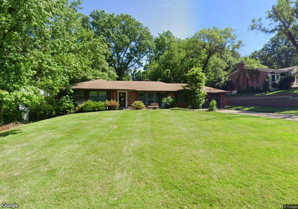
4 Lomond Dr Saint Louis, MO 63135
Estimated Value: $173,000 - $250,000
4
Beds
2
Baths
1,626
Sq Ft
$129/Sq Ft
Est. Value
About This Home
This home is located at 4 Lomond Dr, Saint Louis, MO 63135 and is currently estimated at $209,562, approximately $128 per square foot. 4 Lomond Dr is a home located in St. Louis County with nearby schools including Lee Hamilton Elementary School, Ferguson Middle School, and McCluer High School.
Ownership History
Date
Name
Owned For
Owner Type
Purchase Details
Closed on
Aug 26, 2016
Sold by
Snyder Marjorie May
Bought by
Kalz Kevin
Current Estimated Value
Home Financials for this Owner
Home Financials are based on the most recent Mortgage that was taken out on this home.
Original Mortgage
$78,059
Outstanding Balance
$62,562
Interest Rate
3.62%
Mortgage Type
FHA
Estimated Equity
$147,000
Create a Home Valuation Report for This Property
The Home Valuation Report is an in-depth analysis detailing your home's value as well as a comparison with similar homes in the area
Home Values in the Area
Average Home Value in this Area
Purchase History
| Date | Buyer | Sale Price | Title Company |
|---|---|---|---|
| Kalz Kevin | $79,500 | Title Partners Agency Llc |
Source: Public Records
Mortgage History
| Date | Status | Borrower | Loan Amount |
|---|---|---|---|
| Open | Kalz Kevin | $78,059 |
Source: Public Records
Tax History Compared to Growth
Tax History
| Year | Tax Paid | Tax Assessment Tax Assessment Total Assessment is a certain percentage of the fair market value that is determined by local assessors to be the total taxable value of land and additions on the property. | Land | Improvement |
|---|---|---|---|---|
| 2025 | $2,378 | $43,400 | $3,690 | $39,710 |
| 2024 | $2,378 | $32,970 | $5,320 | $27,650 |
| 2023 | $2,364 | $32,970 | $5,320 | $27,650 |
| 2022 | $2,172 | $26,370 | $7,160 | $19,210 |
| 2021 | $2,102 | $26,370 | $7,160 | $19,210 |
| 2020 | $2,142 | $24,170 | $3,360 | $20,810 |
| 2019 | $2,101 | $24,170 | $3,360 | $20,810 |
| 2018 | $2,139 | $21,950 | $3,100 | $18,850 |
| 2017 | $2,096 | $21,950 | $3,100 | $18,850 |
| 2016 | $1,847 | $19,000 | $3,100 | $15,900 |
| 2015 | $1,860 | $19,000 | $3,100 | $15,900 |
| 2014 | $1,653 | $16,670 | $5,190 | $11,480 |
Source: Public Records
Map
Nearby Homes
- 15 Lake Pembroke Dr
- 1226 Beaver Trail Dr
- 6 Sandringham Ln
- 8 Buckeye Dr
- 655 Hunters Ridge Dr
- 401 Calverton Rd
- 16 White Dr
- 18 White Dr
- 941 N Elizabeth Ave
- 716 Nancy Place
- 222 Wooster Dr
- 13 Cady Dr
- 601 Chanslor Ave
- 116 Grether Ave
- 823 Le Maisson Dr
- 810 Chateau Valley Ct
- 110 Young Dr
- 135 Grether Ave
- 429 N Clay Ave
- 127 Thoroughman Ave
- 3 Lomond Dr
- 5 Lomond Dr
- 2 Lomond Dr
- 1217 Hollins St Unit A
- 1217 Hollins St
- 10 Lomond Dr
- 9 Lomond Dr
- 1209 Hollins St
- 6 Lomond Dr
- 7 Lomond Dr
- 1 Lomond Dr
- 29 Lake Pembroke Dr
- 25 Lake Pembroke Dr
- 23 Lake Pembroke Dr
- 21 Lake Pembroke Dr
- 19 Lake Pembroke Dr
- 17 Lake Pembroke Dr
- 30 Lake Pembroke Dr
- 13 Lake Pembroke Dr
- 28 Lake Pembroke Dr