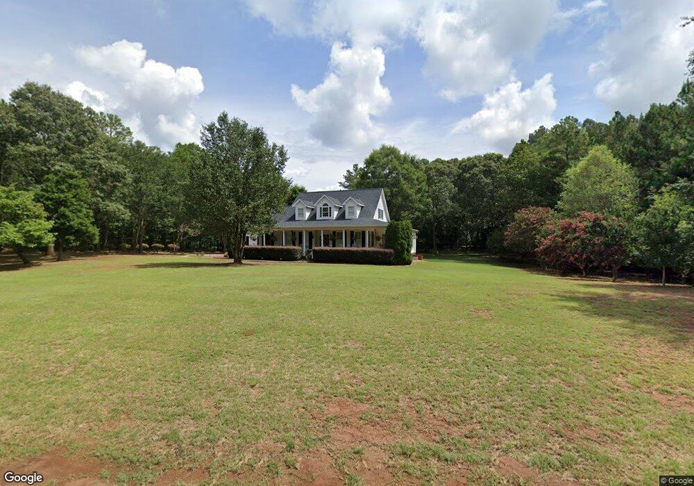
400 Maple Ct Anderson, SC 29621
Estimated Value: $483,000 - $640,000
3
Beds
--
Bath
2,660
Sq Ft
$216/Sq Ft
Est. Value
About This Home
This home is located at 400 Maple Ct, Anderson, SC 29621 and is currently estimated at $575,421, approximately $216 per square foot. 400 Maple Ct is a home with nearby schools including Pendleton High School.
Ownership History
Date
Name
Owned For
Owner Type
Purchase Details
Closed on
Aug 8, 2017
Sold by
Zasadny Peter W and Zasadny Jacqueline
Bought by
Zasadny Peter W and Zasadny Jacqueline
Current Estimated Value
Purchase Details
Closed on
Mar 1, 2006
Sold by
Roper Marion G
Bought by
Zasadny Peter W and Zasadny Jacquelyn
Home Financials for this Owner
Home Financials are based on the most recent Mortgage that was taken out on this home.
Original Mortgage
$297,255
Outstanding Balance
$168,195
Interest Rate
6.19%
Mortgage Type
New Conventional
Estimated Equity
$407,226
Purchase Details
Closed on
Aug 16, 2005
Sold by
Roper Lana B
Bought by
Roper Marion G
Purchase Details
Closed on
Apr 15, 1999
Sold by
Clark Helen M
Bought by
Roper Marion G
Create a Home Valuation Report for This Property
The Home Valuation Report is an in-depth analysis detailing your home's value as well as a comparison with similar homes in the area
Home Values in the Area
Average Home Value in this Area
Purchase History
| Date | Buyer | Sale Price | Title Company |
|---|---|---|---|
| Zasadny Peter W | -- | None Available | |
| Zasadny Peter W | $312,900 | None Available | |
| Roper Marion G | -- | -- | |
| Roper Marion G | $24,000 | -- |
Source: Public Records
Mortgage History
| Date | Status | Borrower | Loan Amount |
|---|---|---|---|
| Open | Zasadny Peter W | $297,255 |
Source: Public Records
Tax History Compared to Growth
Tax History
| Year | Tax Paid | Tax Assessment Tax Assessment Total Assessment is a certain percentage of the fair market value that is determined by local assessors to be the total taxable value of land and additions on the property. | Land | Improvement |
|---|---|---|---|---|
| 2024 | $1,729 | $15,910 | $1,330 | $14,580 |
| 2023 | $1,729 | $15,910 | $1,330 | $14,580 |
| 2022 | $1,547 | $15,910 | $1,330 | $14,580 |
| 2021 | $1,288 | $12,570 | $960 | $11,610 |
| 2020 | $1,288 | $12,570 | $960 | $11,610 |
| 2019 | $1,288 | $12,570 | $960 | $11,610 |
| 2018 | $1,298 | $12,570 | $960 | $11,610 |
| 2017 | -- | $12,570 | $960 | $11,610 |
| 2016 | $1,127 | $12,730 | $820 | $11,910 |
| 2015 | $1,136 | $12,730 | $820 | $11,910 |
| 2014 | $1,177 | $12,730 | $820 | $11,910 |
Source: Public Records
Map
Nearby Homes
- 5206 Slater Rd
- 2030 Donaldson Rd
- TBD Sanders Rd
- 106 Jolly Wingo Rd
- Lot 3 Rogers Rd
- 1348 State Road S-4-97
- 1001 Five Forks Rd
- 102 Rogers Rd
- 5834 Liberty Hwy
- 11 Fieldstone Way
- 1019 Tuscany Dr
- 1020 Tuscany Dr
- 1031 Tuscany Dr
- 1007 Tuscany Dr
- 4204 Weatherstone Way
- 109 Tully Dr
- 307 Addalynn Ln
- 309 Addalynn Ln
- 311 Addalynn Ln
- 403 Maple Ct
- 303 N Walnut Dr
- 401 Maple Ct
- 402 Maple Ct
- 304 N Walnut Dr
- 405 Maple Ct
- 125 N Fork Dr
- 305 N Walnut Dr Unit Lot 59
- 305 N Walnut Dr
- 300 N Walnut Dr
- 127 N Fork Dr
- 123 N Fork Dr
- 201 N Fork Dr
- 307 N Walnut Dr
- 302 N Walnut Dr
- 128 N Fork Dr
- 205 N Fork Dr
- 311 N Walnut Dr
- 200 N Fork Dr
- 109 N Fork Dr