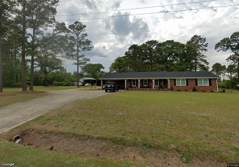
4004 Willie Measley Rd La Grange, NC 28551
Estimated Value: $192,000 - $314,000
3
Beds
3
Baths
2,000
Sq Ft
$125/Sq Ft
Est. Value
About This Home
This home is located at 4004 Willie Measley Rd, La Grange, NC 28551 and is currently estimated at $249,383, approximately $124 per square foot. 4004 Willie Measley Rd is a home located in Lenoir County with nearby schools including La Grange Elementary School, E.B. Frink Middle School, and North Lenoir High School.
Ownership History
Date
Name
Owned For
Owner Type
Purchase Details
Closed on
Aug 8, 2022
Sold by
Earl Wade Christopher and Earl Angela B
Bought by
Lafone Kenneth Ryan and Lafone Hailey Hill
Current Estimated Value
Home Financials for this Owner
Home Financials are based on the most recent Mortgage that was taken out on this home.
Original Mortgage
$185,250
Outstanding Balance
$176,561
Interest Rate
5.3%
Mortgage Type
Balloon
Estimated Equity
$72,822
Create a Home Valuation Report for This Property
The Home Valuation Report is an in-depth analysis detailing your home's value as well as a comparison with similar homes in the area
Home Values in the Area
Average Home Value in this Area
Purchase History
| Date | Buyer | Sale Price | Title Company |
|---|---|---|---|
| Lafone Kenneth Ryan | $195,000 | Swindell Frank G |
Source: Public Records
Mortgage History
| Date | Status | Borrower | Loan Amount |
|---|---|---|---|
| Open | Lafone Kenneth Ryan | $185,250 |
Source: Public Records
Tax History Compared to Growth
Tax History
| Year | Tax Paid | Tax Assessment Tax Assessment Total Assessment is a certain percentage of the fair market value that is determined by local assessors to be the total taxable value of land and additions on the property. | Land | Improvement |
|---|---|---|---|---|
| 2025 | $1,218 | $166,112 | $31,434 | $134,678 |
| 2024 | $1,154 | $124,763 | $17,000 | $107,763 |
| 2023 | $1,194 | $124,763 | $17,000 | $107,763 |
| 2022 | $1,194 | $124,763 | $17,000 | $107,763 |
| 2021 | $1,194 | $124,763 | $17,000 | $107,763 |
| 2020 | $1,194 | $124,763 | $17,000 | $107,763 |
| 2019 | $1,194 | $124,763 | $17,000 | $107,763 |
| 2018 | $1,175 | $124,763 | $17,000 | $107,763 |
| 2017 | $1,176 | $124,763 | $17,000 | $107,763 |
| 2014 | $1,171 | $124,198 | $17,000 | $107,198 |
| 2013 | -- | $124,198 | $17,000 | $107,198 |
| 2011 | -- | $124,198 | $17,000 | $107,198 |
Source: Public Records
Map
Nearby Homes
- 3821 Lindsey Ln
- 5130 Aldridge Store Rd
- 3733 Fields Station Rd
- Lot #2 Albert Sugg Rd
- 3730 Huntcliff Dr
- 3670 Drew Farmer Rd
- 4310 Colie Rd
- 3766 Huntcliff Dr
- 3684 Drew Farmer Rd
- 3696 Drew Farmer Rd
- 3803 Huntcliff Dr
- 3729 Bryan Hardy Rd
- 3711 Drew Farmer Rd
- 101 Forest Dr
- 3216 Dexter Cir
- 5024 Gladys Owens St
- 303 E James St
- 3255 Caroline Nicole Dr
- 113 Institute
- 109 Institute
- 4019 Willie Measley Rd
- 4061 Willie Measley Rd
- 4378 Damascus Rd
- 4375 Damascus Rd
- 4356 Damascus Rd
- 4365 Damascus Rd
- 3434 Ld Hardy Rd
- 3436 Ld Hardy Rd
- 4340 Damascus Rd
- 3420 Ld Hardy Rd
- 3450 Ld Hardy Rd
- 4573 Eason Rd
- 3400 Ld Hardy Rd
- 3370 Ld Hardy Rd
- 4579 Eason Rd
- 4812 Dolly Ln
- 3755 Willie Measley Rd
- 4460 Eason Rd
- 4800 Dolly Ln
- 4709 Eason Rd