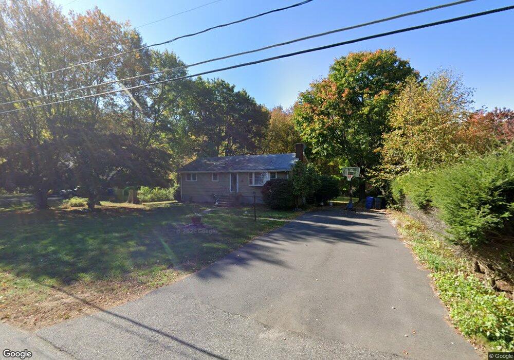
401 Cedar Swamp Rd Coventry, CT 06238
Estimated Value: $294,000 - $360,000
3
Beds
1
Bath
1,008
Sq Ft
$318/Sq Ft
Est. Value
About This Home
This home is located at 401 Cedar Swamp Rd, Coventry, CT 06238 and is currently estimated at $320,273, approximately $317 per square foot. 401 Cedar Swamp Rd is a home located in Tolland County with nearby schools including Coventry Grammar School, George Hersey Robertson School, and Capt. Nathan Hale School.
Ownership History
Date
Name
Owned For
Owner Type
Purchase Details
Closed on
Nov 29, 2001
Sold by
Est Hull Carol and Sheehan Janet
Bought by
Dieterle Jason
Current Estimated Value
Home Financials for this Owner
Home Financials are based on the most recent Mortgage that was taken out on this home.
Original Mortgage
$126,900
Interest Rate
6.66%
Create a Home Valuation Report for This Property
The Home Valuation Report is an in-depth analysis detailing your home's value as well as a comparison with similar homes in the area
Home Values in the Area
Average Home Value in this Area
Purchase History
| Date | Buyer | Sale Price | Title Company |
|---|---|---|---|
| Dieterle Jason | $128,000 | -- | |
| Dieterle Jason | $128,000 | -- |
Source: Public Records
Mortgage History
| Date | Status | Borrower | Loan Amount |
|---|---|---|---|
| Open | Dieterle Jason | $160,000 | |
| Closed | Dieterle Jason | $157,000 | |
| Closed | Dieterle Jason | $126,900 |
Source: Public Records
Tax History Compared to Growth
Tax History
| Year | Tax Paid | Tax Assessment Tax Assessment Total Assessment is a certain percentage of the fair market value that is determined by local assessors to be the total taxable value of land and additions on the property. | Land | Improvement |
|---|---|---|---|---|
| 2025 | $3,939 | $165,800 | $53,600 | $112,200 |
| 2024 | $3,491 | $104,800 | $44,300 | $60,500 |
| 2023 | $3,326 | $104,800 | $44,300 | $60,500 |
| 2022 | $3,265 | $104,800 | $44,300 | $60,500 |
| 2021 | $3,265 | $104,800 | $44,300 | $60,500 |
| 2020 | $3,267 | $104,800 | $44,300 | $60,500 |
| 2019 | $3,371 | $104,700 | $44,300 | $60,400 |
| 2018 | $3,252 | $101,000 | $44,300 | $56,700 |
| 2017 | $3,232 | $101,000 | $44,300 | $56,700 |
| 2016 | $3,151 | $101,000 | $44,300 | $56,700 |
| 2015 | $3,151 | $101,000 | $44,300 | $56,700 |
| 2014 | $3,357 | $117,900 | $54,000 | $63,900 |
Source: Public Records
Map
Nearby Homes
- 65 Bolton Branch Rd
- 5 Laurelwood Ln Unit lot 16
- 7 Laurelwood Ln Unit Lot 15
- 12 Laurelwood Ln Unit lot 8
- 30 Tolland Rd
- 676 Bolton Rd
- 0 Boston Turnpike Unit 24128587
- 101 Dockerel Rd
- 231 Brandy Hill Rd
- 93 Dockerel Rd
- 687 Hop River Rd
- 16 Julia Rd
- 38 John Paul Ln
- 54 Wolf Hill Rd Unit TBB
- 54 Wolf Hill (Lot#49) Rd
- 37 Wolf Hill Rd Unit Lot 40
- 37 Wolf Hill Lot (#40) Rd
- 395 Grant Hill (Mill Race Drive) Lot #21 Rd
- 395 Grant Hill Rd Unit Lot21
- 81 Bouldercrest Ln
- 411 Cedar Swamp Rd
- 391 Cedar Swamp Rd
- 421 Cedar Swamp Rd
- 381 Cedar Swamp Rd
- 85 Bolton Branch Rd
- 95 Bolton Branch Rd
- 431 Cedar Swamp Rd
- 75 Bolton Branch Rd
- 105 Bolton Branch Rd
- 371 Cedar Swamp Rd
- 115 Bolton Branch Rd
- 441 Cedar Swamp Rd
- 55 Bolton Branch Rd
- 380 Cedar Swamp Rd
- 361 Cedar Swamp Rd
- 351 Cedar Swamp Rd
- 94 Bolton Branch Rd
- 125 Bolton Branch Rd
- 451 Cedar Swamp Rd
- 45 Bolton Branch Rd