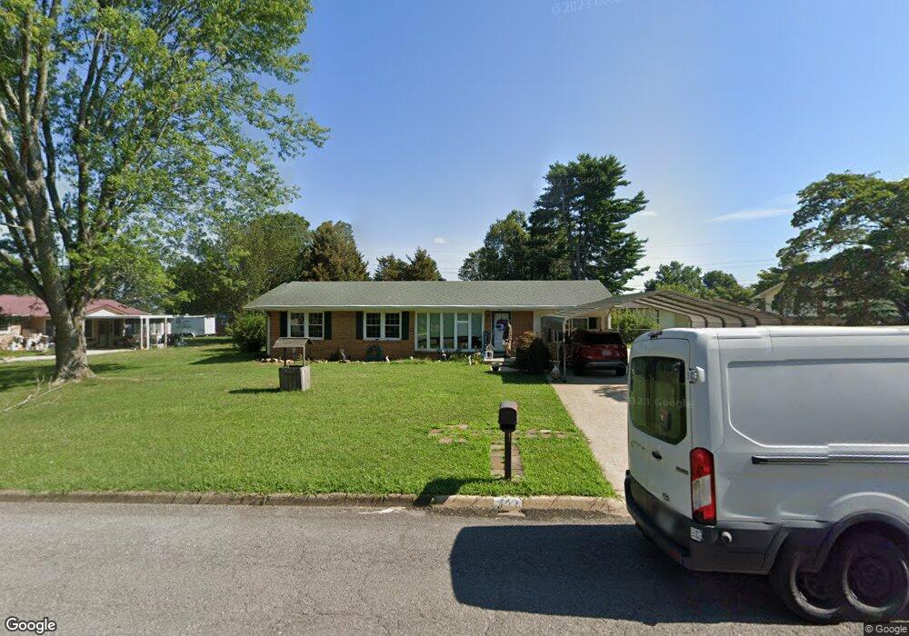
402 Morris St Lawrenceburg, TN 38464
Estimated Value: $184,369 - $240,000
--
Bed
2
Baths
1,430
Sq Ft
$151/Sq Ft
Est. Value
About This Home
This home is located at 402 Morris St, Lawrenceburg, TN 38464 and is currently estimated at $216,342, approximately $151 per square foot. 402 Morris St is a home located in Lawrence County with nearby schools including Ingram Sowell Elementary School, Lawrenceburg Public Elementary School, and David Crockett Elementary School.
Ownership History
Date
Name
Owned For
Owner Type
Purchase Details
Closed on
Nov 3, 2015
Sold by
Smith Dennis
Bought by
Smith Dennis and Smith Patricia Ann
Current Estimated Value
Purchase Details
Closed on
Jan 14, 2014
Bought by
Smith Dennis and Smith Jennifer
Purchase Details
Closed on
Dec 20, 2001
Sold by
Dennis Smith
Bought by
Dennis Smith
Purchase Details
Closed on
Dec 8, 1998
Sold by
Audry Troup
Bought by
Frances Smith
Home Financials for this Owner
Home Financials are based on the most recent Mortgage that was taken out on this home.
Original Mortgage
$50,000
Interest Rate
6.94%
Purchase Details
Closed on
Apr 30, 1963
Bought by
Troup Audry and Troup Oron
Create a Home Valuation Report for This Property
The Home Valuation Report is an in-depth analysis detailing your home's value as well as a comparison with similar homes in the area
Home Values in the Area
Average Home Value in this Area
Purchase History
| Date | Buyer | Sale Price | Title Company |
|---|---|---|---|
| Smith Dennis | -- | -- | |
| Smith Dennis | -- | -- | |
| Dennis Smith | -- | -- | |
| Dennis Smith | -- | -- | |
| Frances Smith | $60,000 | -- | |
| Oron Troup | -- | -- | |
| Troup Audry | -- | -- |
Source: Public Records
Mortgage History
| Date | Status | Borrower | Loan Amount |
|---|---|---|---|
| Previous Owner | Troup Audry | $50,000 |
Source: Public Records
Tax History Compared to Growth
Tax History
| Year | Tax Paid | Tax Assessment Tax Assessment Total Assessment is a certain percentage of the fair market value that is determined by local assessors to be the total taxable value of land and additions on the property. | Land | Improvement |
|---|---|---|---|---|
| 2025 | $1,039 | $33,425 | $0 | $0 |
| 2024 | $1,039 | $33,425 | $4,250 | $29,175 |
| 2023 | $1,039 | $33,425 | $4,250 | $29,175 |
| 2022 | $1,039 | $33,425 | $4,250 | $29,175 |
| 2021 | $810 | $18,425 | $4,250 | $14,175 |
| 2020 | $810 | $18,425 | $4,250 | $14,175 |
| 2019 | $810 | $18,425 | $4,250 | $14,175 |
| 2018 | $810 | $18,425 | $4,250 | $14,175 |
| 2017 | $779 | $17,725 | $4,250 | $13,475 |
| 2016 | $779 | $17,725 | $4,250 | $13,475 |
| 2015 | $738 | $17,725 | $4,250 | $13,475 |
| 2014 | $702 | $16,875 | $3,750 | $13,125 |
Source: Public Records
Map
Nearby Homes
- 413 Kirk St
- 335 Robins St
- 1216 Poplar Dr
- 1050 Baylee Cir
- 717 Toben Terrace
- 4951 Weakley Creek Rd
- 975 Weakley Creek Rd
- 4000 Weakley Creek Rd
- 1303 5th Ave
- 502 9th St
- 801 Douglas Dr
- 602 7th St
- 14 Delana Ave
- 970 9th St
- 1306 Hart Ave
- 501 6th St
- 405 6th St
- 48 Woodland Cir
- 815 1st Ave
- 0 Woodland Cir Unit RTC3033314
- 404 Morris St
- 1600 Massey Ave
- 403 Hoffman St
- 405 Hoffman St
- 1604 Massey Ave
- 403 Morris St
- 406 Morris St
- 405 Morris St
- 1504 Massey Ave
- 407 Hoffman St
- 407 Morris St
- 408 Morris St
- 1519 Massey Ave
- 409 Hoffman St
- 1515 Massey Ave
- 1523 Massey Ave
- 1513 Massey Ave
- 402 Hoffman St
- 1500 Massey Ave
- 1521 Massey Ave