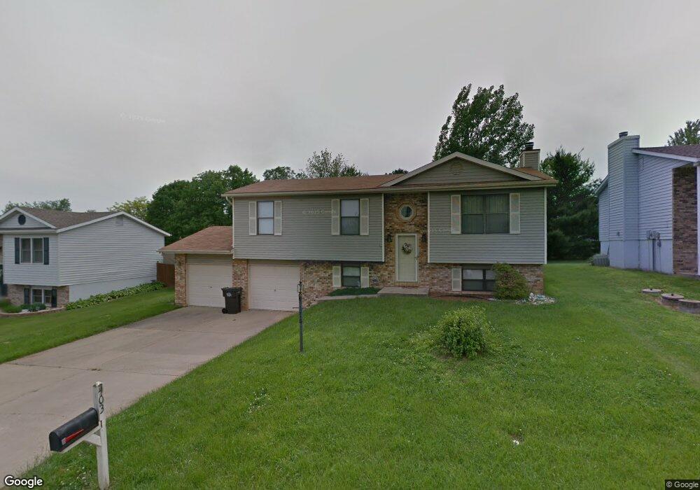
403 Saint Anthony Dr Godfrey, IL 62035
Estimated Value: $193,000 - $215,103
3
Beds
4
Baths
1,012
Sq Ft
$199/Sq Ft
Est. Value
About This Home
This home is located at 403 Saint Anthony Dr, Godfrey, IL 62035 and is currently estimated at $201,776, approximately $199 per square foot. 403 Saint Anthony Dr is a home located in Madison County with nearby schools including Lewis & Clark Elementary School, Alton Middle School, and Alton High School.
Ownership History
Date
Name
Owned For
Owner Type
Purchase Details
Closed on
Jan 19, 2007
Sold by
Batson Pamela S
Bought by
Williams Toi
Current Estimated Value
Home Financials for this Owner
Home Financials are based on the most recent Mortgage that was taken out on this home.
Original Mortgage
$117,288
Outstanding Balance
$70,091
Interest Rate
6.21%
Mortgage Type
FHA
Estimated Equity
$131,685
Purchase Details
Closed on
Oct 6, 2006
Sold by
Batson Lyle W
Bought by
Batson Pamela S
Create a Home Valuation Report for This Property
The Home Valuation Report is an in-depth analysis detailing your home's value as well as a comparison with similar homes in the area
Home Values in the Area
Average Home Value in this Area
Purchase History
| Date | Buyer | Sale Price | Title Company |
|---|---|---|---|
| Williams Toi | $120,000 | Community Title & Escrow Ltd | |
| Batson Pamela S | -- | None Available |
Source: Public Records
Mortgage History
| Date | Status | Borrower | Loan Amount |
|---|---|---|---|
| Open | Williams Toi | $117,288 |
Source: Public Records
Tax History Compared to Growth
Tax History
| Year | Tax Paid | Tax Assessment Tax Assessment Total Assessment is a certain percentage of the fair market value that is determined by local assessors to be the total taxable value of land and additions on the property. | Land | Improvement |
|---|---|---|---|---|
| 2024 | $3,954 | $64,650 | $5,360 | $59,290 |
| 2023 | $3,954 | $59,690 | $4,950 | $54,740 |
| 2022 | $3,745 | $54,590 | $4,530 | $50,060 |
| 2021 | $3,376 | $51,340 | $4,260 | $47,080 |
| 2020 | $3,306 | $50,230 | $4,170 | $46,060 |
| 2019 | $3,375 | $48,920 | $4,060 | $44,860 |
| 2018 | $3,318 | $46,830 | $3,890 | $42,940 |
| 2017 | $3,161 | $46,830 | $3,890 | $42,940 |
| 2016 | $3,071 | $46,830 | $3,890 | $42,940 |
| 2015 | $2,750 | $45,360 | $3,770 | $41,590 |
| 2014 | $2,750 | $45,360 | $3,770 | $41,590 |
| 2013 | $2,750 | $45,360 | $3,770 | $41,590 |
Source: Public Records
Map
Nearby Homes
- 421 Saint John Dr
- 223 Bachman Ln
- 5775 Roach Rd
- 123 Tolle Ln
- 5667 Humbert Rd
- 5661 Humbert Rd
- 0 Humbert Rd Unit MIS25052876
- 4805 Wick Mor Dr
- 00 Pine Ridge Lot#52 Dr
- 504 Elm St
- 212 Pine Ridge Dr
- 4814 Azalea Place Unit 2
- 607 Mulberry St
- 6002 Wenzel Rd
- 4824 Azalea Place Unit 2
- 4803 Azalea Place Unit 1
- 4801 Azalea Place Unit 2
- 0 Happy Ct
- 709 Pardee Rd
- 5510 Lamotte Ln
- 405 Saint Anthony Dr
- 401 Saint Anthony Dr
- 402 Saint Rose Dr
- 407 Saint Anthony Dr
- 404 Saint Rose Dr
- 404 Saint Anthony Dr
- 402 St Rose
- 400 Saint Anthony Dr
- 339 Saint Anthony Dr
- 406 Saint Rose Dr
- 406 Saint Anthony Dr
- 120 Saint Charles Dr
- 120 Stcharles
- 409 Saint Anthony Dr
- 5920 Roach Rd
- 201 Saint Charles Dr
- 5914 Roach Rd
- 340 Saint Anthony Dr
- 5924 Roach Rd
- 403 Saint Rose Dr