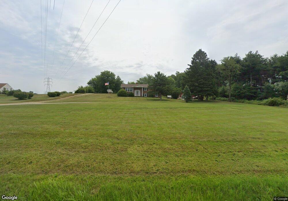
4030 Swallen Ave Louisville, OH 44641
Estimated Value: $274,000 - $326,000
3
Beds
2
Baths
1,664
Sq Ft
$179/Sq Ft
Est. Value
About This Home
This home is located at 4030 Swallen Ave, Louisville, OH 44641 and is currently estimated at $298,656, approximately $179 per square foot. 4030 Swallen Ave is a home located in Stark County with nearby schools including Louisville High School.
Ownership History
Date
Name
Owned For
Owner Type
Purchase Details
Closed on
May 26, 2010
Sold by
Fannie Mae
Bought by
Crawford Robert D and Crawford Melissa S
Current Estimated Value
Home Financials for this Owner
Home Financials are based on the most recent Mortgage that was taken out on this home.
Original Mortgage
$148,006
Outstanding Balance
$98,657
Interest Rate
4.86%
Mortgage Type
FHA
Estimated Equity
$199,999
Purchase Details
Closed on
Oct 24, 2006
Sold by
Kandel Mildred M
Bought by
Zevgolis Frank
Home Financials for this Owner
Home Financials are based on the most recent Mortgage that was taken out on this home.
Original Mortgage
$148,000
Interest Rate
6.45%
Mortgage Type
Purchase Money Mortgage
Create a Home Valuation Report for This Property
The Home Valuation Report is an in-depth analysis detailing your home's value as well as a comparison with similar homes in the area
Home Values in the Area
Average Home Value in this Area
Purchase History
| Date | Buyer | Sale Price | Title Company |
|---|---|---|---|
| Crawford Robert D | $150,000 | Accutitle Agency Inc | |
| Zevgolis Frank | $181,000 | None Available |
Source: Public Records
Mortgage History
| Date | Status | Borrower | Loan Amount |
|---|---|---|---|
| Open | Crawford Robert D | $148,006 | |
| Previous Owner | Zevgolis Frank | $148,000 |
Source: Public Records
Tax History Compared to Growth
Tax History
| Year | Tax Paid | Tax Assessment Tax Assessment Total Assessment is a certain percentage of the fair market value that is determined by local assessors to be the total taxable value of land and additions on the property. | Land | Improvement |
|---|---|---|---|---|
| 2025 | -- | $92,890 | $50,330 | $42,560 |
| 2024 | -- | $92,890 | $50,330 | $42,560 |
| 2023 | $3,603 | $72,420 | $32,690 | $39,730 |
| 2022 | $3,610 | $72,420 | $32,690 | $39,730 |
| 2021 | $3,621 | $72,420 | $32,690 | $39,730 |
| 2020 | $3,091 | $65,140 | $29,470 | $35,670 |
| 2019 | $3,100 | $65,150 | $29,480 | $35,670 |
| 2018 | $3,096 | $65,150 | $29,480 | $35,670 |
| 2017 | $2,968 | $59,610 | $25,130 | $34,480 |
| 2016 | $2,905 | $59,610 | $25,130 | $34,480 |
| 2015 | $2,913 | $59,610 | $25,130 | $34,480 |
| 2014 | $745 | $51,980 | $21,910 | $30,070 |
| 2013 | $1,377 | $51,980 | $21,910 | $30,070 |
Source: Public Records
Map
Nearby Homes
- 2110 Edmar St
- 3390 Meese Rd NE
- 1812 E Broad St
- 2015 E Main St
- 1715 High St
- 641 S Nickelplate St
- 0 Michigan Blvd
- 5495 Meese Rd NE
- 308 Superior St
- 520 S Silver St
- 908 Sand Lot Cir
- 8225 Georgetown St
- 728 E Broad St
- 5765 Maplegrove St
- 1170 Winding Ridge Ave
- 5990 Meese Rd NE
- 510 S Bauman Ct
- 204 E Broad St
- 325 Lincoln Ave
- 910 Crosswyck Cir
- 4088 Swallen Ave
- 4130 Swallen Ave
- 4141 Swallen Ave
- 3932 Swallen Ave
- 4174 Swallen Ave
- 3906 Swallen Ave
- 3895 Swallen Ave
- 4191 Swallen Ave
- 3860 Swallen Ave
- 4242 Swallen Ave
- 4274 Swallen Ave
- 3834 Swallen Ave
- 4258 Oakgrove St
- 4269 Swallen Ave
- 4284 Swallen Ave
- 4315 Swallen Ave
- 4310 Swallen Ave
- 4310 Swallen Ave
- 4320 Swallen Ave
- 4344 Swallen Ave