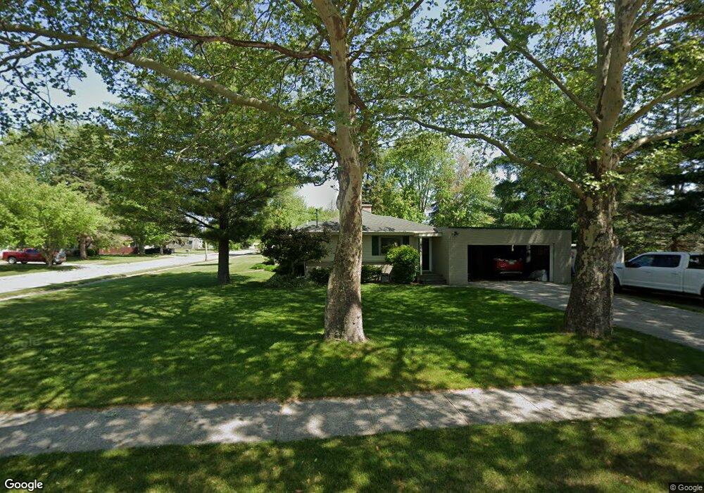
404 Shady Ln Auburn, MI 48611
Estimated Value: $194,533 - $245,000
--
Bed
1
Bath
1,267
Sq Ft
$167/Sq Ft
Est. Value
About This Home
This home is located at 404 Shady Ln, Auburn, MI 48611 and is currently estimated at $211,383, approximately $166 per square foot. 404 Shady Ln is a home located in Bay County with nearby schools including Auburn Elementary School, Western Middle School, and Bay City Western High School.
Ownership History
Date
Name
Owned For
Owner Type
Purchase Details
Closed on
Jul 15, 2024
Sold by
Warner Tamara K and Warner Gary L
Bought by
Warner Gary L and Warner Tamara K
Current Estimated Value
Purchase Details
Closed on
Apr 2, 2003
Sold by
Warner Tamara K
Bought by
Warner Tamara K and Warner Gary
Home Financials for this Owner
Home Financials are based on the most recent Mortgage that was taken out on this home.
Original Mortgage
$93,660
Interest Rate
5.9%
Mortgage Type
Stand Alone Refi Refinance Of Original Loan
Create a Home Valuation Report for This Property
The Home Valuation Report is an in-depth analysis detailing your home's value as well as a comparison with similar homes in the area
Home Values in the Area
Average Home Value in this Area
Purchase History
| Date | Buyer | Sale Price | Title Company |
|---|---|---|---|
| Warner Gary L | -- | None Listed On Document | |
| Warner Tamara K | -- | -- |
Source: Public Records
Mortgage History
| Date | Status | Borrower | Loan Amount |
|---|---|---|---|
| Previous Owner | Warner Tamara K | $93,660 |
Source: Public Records
Tax History Compared to Growth
Tax History
| Year | Tax Paid | Tax Assessment Tax Assessment Total Assessment is a certain percentage of the fair market value that is determined by local assessors to be the total taxable value of land and additions on the property. | Land | Improvement |
|---|---|---|---|---|
| 2025 | $3,121 | $87,900 | $0 | $0 |
| 2024 | $2,445 | $77,500 | $0 | $0 |
| 2023 | $2,328 | $68,200 | $0 | $0 |
| 2022 | $2,810 | $61,600 | $0 | $0 |
| 2021 | $2,644 | $58,100 | $58,100 | $0 |
| 2020 | $2,481 | $56,600 | $56,600 | $0 |
| 2019 | $2,428 | $56,200 | $0 | $0 |
| 2018 | $2,482 | $59,300 | $0 | $0 |
| 2017 | $2,294 | $56,800 | $0 | $0 |
| 2016 | $2,212 | $55,900 | $0 | $55,900 |
| 2015 | -- | $57,000 | $0 | $57,000 |
| 2014 | -- | $55,800 | $0 | $55,800 |
Source: Public Records
Map
Nearby Homes
- 0 Price St
- 319 Price St
- 423 Sunshine Ct
- 937 Appaloosa Pass
- 221 Sycamore Ln
- 0 W North Union Rd Unit 50166876
- 268 W Midland Rd
- 230 W Midland Rd
- 4649 Stephanie Ct
- 1186 W Midland Rd
- 4760 Putt Ln
- 4648 Meadow Ct
- 5501 Garfield Rd
- 1365 W North Union Rd
- 0 Court St
- 4855 Wheat Ridge Ct
- 1598 Fisherville Ct
- 1587 Fisherville Ct
- 1598 Dawn Marie Ct
- 5749 11 Mile Rd