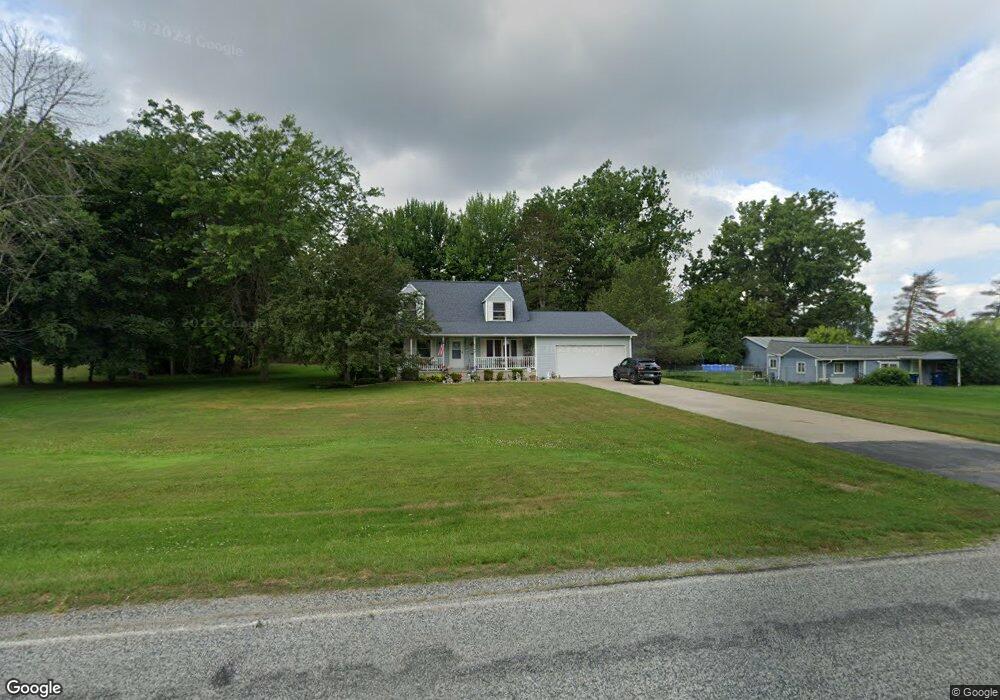
4042 S Portsmouth Rd Bridgeport, MI 48722
Estimated Value: $233,000 - $254,056
4
Beds
2
Baths
1,512
Sq Ft
$162/Sq Ft
Est. Value
About This Home
This home is located at 4042 S Portsmouth Rd, Bridgeport, MI 48722 and is currently estimated at $244,764, approximately $161 per square foot. 4042 S Portsmouth Rd is a home located in Saginaw County with nearby schools including Thomas White School, Martin G. Atkins Elementary School, and Bridgeport High School.
Ownership History
Date
Name
Owned For
Owner Type
Purchase Details
Closed on
May 5, 1999
Sold by
Butzin Dennis and Butzin Mary M
Bought by
Enciso Jose and Enciso Sally
Current Estimated Value
Home Financials for this Owner
Home Financials are based on the most recent Mortgage that was taken out on this home.
Original Mortgage
$133,950
Interest Rate
7.04%
Create a Home Valuation Report for This Property
The Home Valuation Report is an in-depth analysis detailing your home's value as well as a comparison with similar homes in the area
Home Values in the Area
Average Home Value in this Area
Purchase History
| Date | Buyer | Sale Price | Title Company |
|---|---|---|---|
| Enciso Jose | $141,000 | -- | |
| -- | $141,000 | -- |
Source: Public Records
Mortgage History
| Date | Status | Borrower | Loan Amount |
|---|---|---|---|
| Closed | -- | $133,950 |
Source: Public Records
Tax History Compared to Growth
Tax History
| Year | Tax Paid | Tax Assessment Tax Assessment Total Assessment is a certain percentage of the fair market value that is determined by local assessors to be the total taxable value of land and additions on the property. | Land | Improvement |
|---|---|---|---|---|
| 2025 | $2,786 | $112,100 | $0 | $0 |
| 2024 | $745 | $108,700 | $0 | $0 |
| 2023 | $710 | $97,600 | $0 | $0 |
| 2022 | $2,349 | $87,000 | $0 | $0 |
| 2021 | $2,169 | $76,000 | $0 | $0 |
| 2020 | $2,102 | $71,000 | $0 | $0 |
| 2019 | $2,003 | $66,400 | $5,900 | $60,500 |
| 2018 | $619 | $67,500 | $0 | $0 |
| 2017 | $1,816 | $67,500 | $0 | $0 |
| 2016 | $1,965 | $62,100 | $0 | $0 |
| 2014 | -- | $53,800 | $0 | $48,700 |
| 2013 | -- | $53,300 | $0 | $0 |
Source: Public Records
Map
Nearby Homes
- 5205 Baker Rd
- 5885 McGrandy Rd
- 0 VL S Airport Rd
- V/L S Airport Rd
- 4719 Baker Rd
- 6605 Bridgeport Hwy
- 4694 King Rd
- 6412 Tin Lizzy Ln
- 6267 Junction Rd
- Parcel E W Rolling Hills Dr
- Parcel B W Rolling Hills Dr
- Parcel D W Rolling Hills Dr
- Parcel F W Rolling Hills Dr
- Parcel C W Rolling Hills Dr
- 3927 State St
- 3838 Sherman St
- 3977 Snowberry Rd
- 4333 Riverview Dr
- 4051 Old King Rd
- 4224 Pineport Rd
- 4030 S Portsmouth Rd
- 5962 Baker Rd
- 4025 S Portsmouth Rd
- 4067 S Portsmouth Rd
- 4110 S Portsmouth Rd
- 5940 Baker Rd
- 4095 S Portsmouth Rd
- 4041 S Portsmouth Rd
- 6038 Baker Rd
- 4115 S Portsmouth Rd
- 5910 Baker Rd
- 4120 S Portsmouth Rd
- 6050 Baker Rd
- 4090 Emerald Dr
- 4140 S Portsmouth Rd
- 4140 S Portsmouth Rd
- 4066 Emerald Dr
- 5890 Baker Rd
- 3967 S Portsmouth Rd
- 4123 S Portsmouth Rd