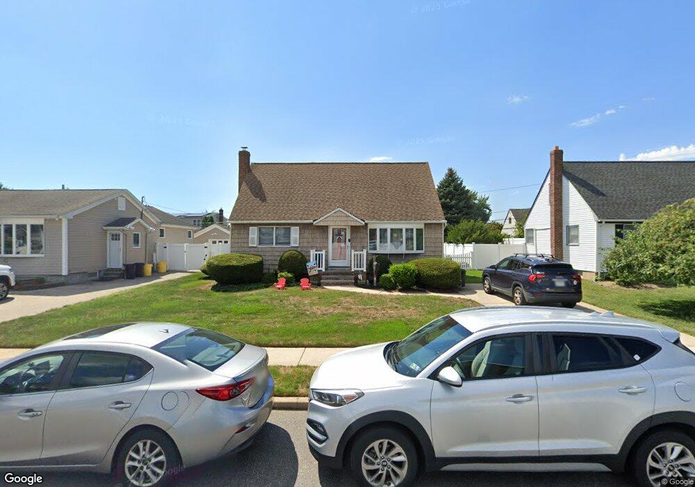
4048 Maywood Dr Seaford, NY 11783
Estimated Value: $658,000 - $710,236
4
Beds
1
Bath
1,176
Sq Ft
$582/Sq Ft
Est. Value
About This Home
This home is located at 4048 Maywood Dr, Seaford, NY 11783 and is currently estimated at $684,118, approximately $581 per square foot. 4048 Maywood Dr is a home located in Nassau County with nearby schools including John H. West Elementary School, Plainedge Middle School, and Plainedge Senior High School.
Ownership History
Date
Name
Owned For
Owner Type
Purchase Details
Closed on
Aug 15, 2017
Sold by
Peterson Cathy Ann and Testa John
Bought by
Carvalho Philip F and Oliver Elizabeth M
Current Estimated Value
Home Financials for this Owner
Home Financials are based on the most recent Mortgage that was taken out on this home.
Original Mortgage
$364,500
Outstanding Balance
$304,147
Interest Rate
3.96%
Mortgage Type
New Conventional
Estimated Equity
$379,971
Purchase Details
Closed on
Feb 16, 2007
Sold by
Testa Liborio John
Create a Home Valuation Report for This Property
The Home Valuation Report is an in-depth analysis detailing your home's value as well as a comparison with similar homes in the area
Home Values in the Area
Average Home Value in this Area
Purchase History
| Date | Buyer | Sale Price | Title Company |
|---|---|---|---|
| Carvalho Philip F | $405,000 | None Available | |
| -- | -- | -- |
Source: Public Records
Mortgage History
| Date | Status | Borrower | Loan Amount |
|---|---|---|---|
| Open | Carvalho Philip F | $364,500 |
Source: Public Records
Tax History Compared to Growth
Tax History
| Year | Tax Paid | Tax Assessment Tax Assessment Total Assessment is a certain percentage of the fair market value that is determined by local assessors to be the total taxable value of land and additions on the property. | Land | Improvement |
|---|---|---|---|---|
| 2025 | $13,133 | $425 | $236 | $189 |
| 2024 | $3,798 | $441 | $245 | $196 |
| 2023 | $13,231 | $441 | $245 | $196 |
| 2022 | $13,231 | $441 | $245 | $196 |
| 2021 | $13,598 | $423 | $235 | $188 |
| 2020 | $14,275 | $644 | $477 | $167 |
| 2019 | $9,117 | $739 | $547 | $192 |
| 2018 | $9,117 | $739 | $0 | $0 |
| 2017 | $5,741 | $739 | $547 | $192 |
| 2016 | $8,938 | $739 | $547 | $192 |
| 2015 | $2,757 | $739 | $547 | $192 |
| 2014 | $2,757 | $739 | $547 | $192 |
| 2013 | $2,501 | $739 | $547 | $192 |
Source: Public Records
Map
Nearby Homes
- 3977 Wellwood Rd
- 4195 Florence Rd
- 3980 Kingsberry Rd
- 4042 Old Post Rd
- 4278 Clarissa Rd
- 3805 Colonial Ct
- 294 Swansdowne Dr
- 580 Heathcliff Dr
- 3901 Moore St
- 8 Reading Ln
- 3842 Whitman St
- 3 Brewster Gate
- 243 Elm Dr S
- 15 Budd Ct
- 4129 Duff Place
- 647 Seamans Neck Rd
- 6 Regal Ln
- 17 Rural Ln
- 68 Thorne Ave
- 79 Elizabeth Dr
- 4042 Maywood Dr
- 4054 Maywood Dr
- 3991 Wellwood Rd
- 3983 Wellwood Rd
- 4036 Maywood Dr
- 4060 Maywood Dr
- 3997 Wellwood Rd
- 3962 Sandra Ln
- 4053 Maywood Dr
- 4030 Maywood Dr
- 3971 Wellwood Rd
- 473 Piping Rock Rd
- 4072 Maywood Dr
- 3963 Sandra Ln
- 4019 Wellwood Rd
- 4065 Maywood Dr
- 4024 Maywood Dr
- 3990 Wellwood Rd
- 3965 Wellwood Rd
- 4174 Florence Rd