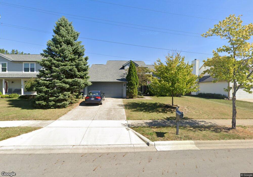
408 Burns Dr N Westerville, OH 43082
Genoa NeighborhoodEstimated Value: $411,976 - $444,000
3
Beds
3
Baths
1,896
Sq Ft
$229/Sq Ft
Est. Value
About This Home
This home is located at 408 Burns Dr N, Westerville, OH 43082 and is currently estimated at $433,744, approximately $228 per square foot. 408 Burns Dr N is a home located in Delaware County with nearby schools including Robert Frost Elementary School, Heritage Middle School, and Westerville-North High School.
Ownership History
Date
Name
Owned For
Owner Type
Purchase Details
Closed on
Jun 7, 2004
Sold by
Gift Joseph A
Bought by
Cripe Timothy J and Cripe Dara M
Current Estimated Value
Home Financials for this Owner
Home Financials are based on the most recent Mortgage that was taken out on this home.
Original Mortgage
$155,173
Interest Rate
6.06%
Mortgage Type
Purchase Money Mortgage
Create a Home Valuation Report for This Property
The Home Valuation Report is an in-depth analysis detailing your home's value as well as a comparison with similar homes in the area
Home Values in the Area
Average Home Value in this Area
Purchase History
| Date | Buyer | Sale Price | Title Company |
|---|---|---|---|
| Cripe Timothy J | $194,000 | -- |
Source: Public Records
Mortgage History
| Date | Status | Borrower | Loan Amount |
|---|---|---|---|
| Closed | Cripe Timothy J | $155,173 |
Source: Public Records
Tax History Compared to Growth
Tax History
| Year | Tax Paid | Tax Assessment Tax Assessment Total Assessment is a certain percentage of the fair market value that is determined by local assessors to be the total taxable value of land and additions on the property. | Land | Improvement |
|---|---|---|---|---|
| 2024 | $5,591 | $109,730 | $23,520 | $86,210 |
| 2023 | $5,526 | $109,730 | $23,520 | $86,210 |
| 2022 | $5,409 | $83,090 | $16,100 | $66,990 |
| 2021 | $5,455 | $83,090 | $16,100 | $66,990 |
| 2020 | $5,662 | $83,090 | $16,100 | $66,990 |
| 2019 | $4,907 | $68,460 | $14,000 | $54,460 |
| 2018 | $4,827 | $68,460 | $14,000 | $54,460 |
| 2017 | $4,711 | $65,250 | $10,190 | $55,060 |
| 2016 | $5,013 | $65,250 | $10,190 | $55,060 |
| 2015 | $4,632 | $65,250 | $10,190 | $55,060 |
| 2014 | $4,678 | $65,250 | $10,190 | $55,060 |
| 2013 | $4,457 | $62,130 | $10,190 | $51,940 |
Source: Public Records
Map
Nearby Homes
- 718 Sugar Ct
- 547 County Line Rd
- 656 Olde Mill Dr
- 672 Stonefield Dr
- 754 Kingsmead Rd Unit 18754
- 150 Matthew Ave
- 267 Windemere Place
- 175 Nottingham Ct
- 223 Dogwood Ln
- 912 Lakeway Ct E
- 974 Lakeland Dr
- 589 E College Ave
- 348 Buck Run Trail
- 368 E College Ave
- 364 E College Ave
- 137 Abbeycross Ln
- 129 Abbeycross Ln Unit 129
- 114 Canterbrick Dr
- 768 Collingwood Dr
- 66 Abbeycross Ln
- 402 Burns Dr N
- 416 Burns Dr N
- 394 Burns Dr N
- 561 Grist Run Rd
- 567 Grist Run Rd
- 428 Burns Dr N
- 585 Mulberry Way N
- 388 Burns Dr N
- 401 Burns Dr N
- 555 Grist Run Rd
- 582 Mulberry Way N
- 573 Grist Run Rd
- 391 Burns Dr N
- 434 Burns Dr N
- 380 Burns Dr N
- 549 Grist Run Rd
- 579 Grist Run Rd
- 575 Mulberry Way N
- 429 Burns Dr N
- 572 Mulberry Way N