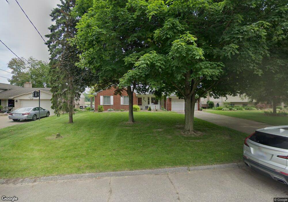
409 Beverly Island Dr Waterford, MI 48328
Waterford Township NeighborhoodEstimated Value: $448,000 - $612,000
3
Beds
2
Baths
1,687
Sq Ft
$312/Sq Ft
Est. Value
About This Home
This home is located at 409 Beverly Island Dr, Waterford, MI 48328 and is currently estimated at $526,258, approximately $311 per square foot. 409 Beverly Island Dr is a home located in Oakland County with nearby schools including Donelson Hills Elementary School, Mason Middle School, and Waterford Mott High School.
Ownership History
Date
Name
Owned For
Owner Type
Purchase Details
Closed on
Aug 30, 2000
Sold by
Cuzzort Elizabeth M
Bought by
Elizabeth M Cuzzort Tr
Current Estimated Value
Purchase Details
Closed on
Oct 17, 1997
Sold by
Cuzzort Elizabeth M
Bought by
Cuzzort Elizabeth M
Home Financials for this Owner
Home Financials are based on the most recent Mortgage that was taken out on this home.
Original Mortgage
$50,000
Interest Rate
7.65%
Create a Home Valuation Report for This Property
The Home Valuation Report is an in-depth analysis detailing your home's value as well as a comparison with similar homes in the area
Home Values in the Area
Average Home Value in this Area
Purchase History
| Date | Buyer | Sale Price | Title Company |
|---|---|---|---|
| Elizabeth M Cuzzort Tr | -- | -- | |
| Cuzzort Elizabeth M | -- | -- |
Source: Public Records
Mortgage History
| Date | Status | Borrower | Loan Amount |
|---|---|---|---|
| Previous Owner | Cuzzort Elizabeth M | $50,000 |
Source: Public Records
Tax History Compared to Growth
Tax History
| Year | Tax Paid | Tax Assessment Tax Assessment Total Assessment is a certain percentage of the fair market value that is determined by local assessors to be the total taxable value of land and additions on the property. | Land | Improvement |
|---|---|---|---|---|
| 2024 | $3,906 | $224,970 | $0 | $0 |
| 2023 | $3,718 | $212,570 | $0 | $0 |
| 2022 | $6,075 | $192,290 | $0 | $0 |
| 2021 | $5,767 | $190,470 | $0 | $0 |
| 2020 | $3,403 | $193,240 | $0 | $0 |
| 2019 | $5,640 | $190,330 | $0 | $0 |
| 2018 | $5,582 | $197,200 | $0 | $0 |
| 2017 | $5,123 | $197,200 | $0 | $0 |
| 2016 | $5,114 | $198,980 | $0 | $0 |
| 2015 | -- | $193,720 | $0 | $0 |
| 2014 | -- | $156,450 | $0 | $0 |
| 2011 | -- | $137,010 | $0 | $0 |
Source: Public Records
Map
Nearby Homes
- 321 Beverly Estates Dr Unit 5
- 345 Beverly Island Dr
- 3014 Edgewater Dr
- 3066 W Huron St
- 433 Hogarth St
- 425 Hogarth St
- 424 Hogarth St
- The Dover Plan at Hogarth
- The Dawson Plan at Hogarth
- The Concord Plan at Hogarth
- The Everest Plan at Hogarth
- 540 Lake Village Ave
- 603 Woodingham Ave
- 581 S Winding Dr
- 2918 Woodbine Dr
- 3313 Harbours Blvd
- 715 Woodingham Ave
- 445 Lakeside Dr
- 3860 Lawley Ave
- 3168 Herbell Dr
- 401 Beverly Island Dr
- 417 Beverly Island Dr
- 425 Beverly Island Dr
- 393 Beverly Island Dr
- 402 Beverly Island Dr
- 410 Beverly Island Dr
- 433 Beverly Island Dr
- 418 Beverly Island Dr
- 385 Beverly Island Dr
- 426 Beverly Island Dr
- 372 Beverly Island Dr
- 441 Beverly Island Dr
- 434 Beverly Island Dr
- 377 Beverly Island Dr
- 442 Beverly Island Dr
- 449 Beverly Island Dr
- 360 Beverly Island Dr
- 369 Beverly Island Dr
- 348 Beverly Island Dr
- 450 Beverly Island Dr