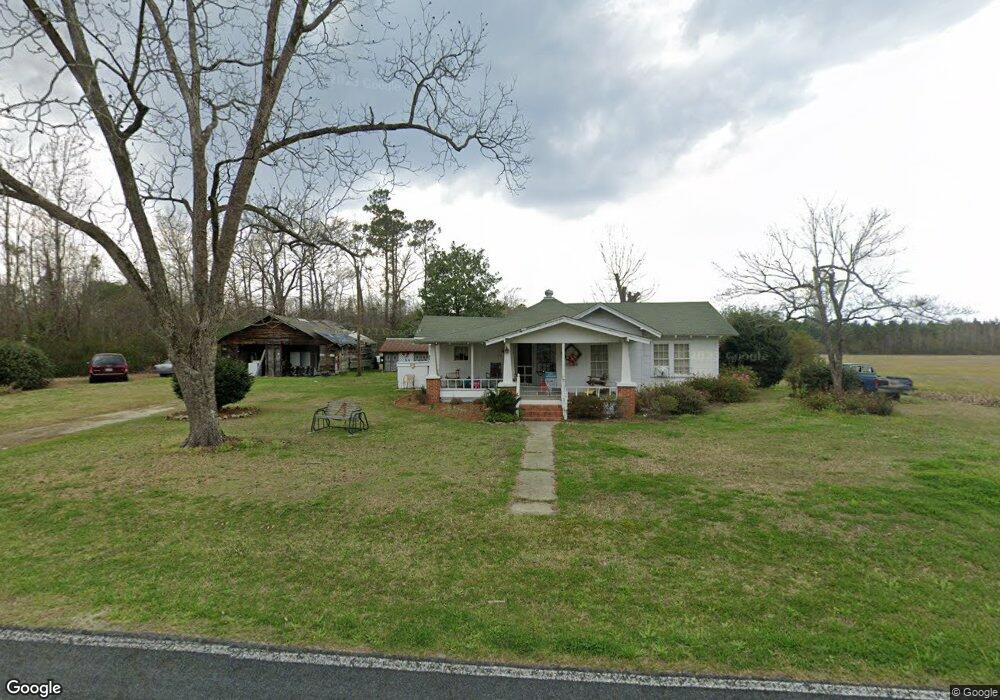
409 Porter Rd Tabor City, NC 28463
Estimated Value: $73,354 - $147,000
--
Bed
--
Bath
840
Sq Ft
$121/Sq Ft
Est. Value
About This Home
This home is located at 409 Porter Rd, Tabor City, NC 28463 and is currently estimated at $101,339, approximately $120 per square foot. 409 Porter Rd is a home located in Columbus County with nearby schools including South Columbus High School.
Ownership History
Date
Name
Owned For
Owner Type
Purchase Details
Closed on
Feb 14, 2007
Sold by
Roberts G Sherrell G and Roberts Marvelene A
Bought by
Cartrette Harold Dean and Cartrette Pamela K
Current Estimated Value
Home Financials for this Owner
Home Financials are based on the most recent Mortgage that was taken out on this home.
Original Mortgage
$30,800
Outstanding Balance
$18,448
Interest Rate
6.16%
Mortgage Type
Future Advance Clause Open End Mortgage
Estimated Equity
$82,891
Create a Home Valuation Report for This Property
The Home Valuation Report is an in-depth analysis detailing your home's value as well as a comparison with similar homes in the area
Home Values in the Area
Average Home Value in this Area
Purchase History
| Date | Buyer | Sale Price | Title Company |
|---|---|---|---|
| Cartrette Harold Dean | $30,000 | -- |
Source: Public Records
Mortgage History
| Date | Status | Borrower | Loan Amount |
|---|---|---|---|
| Open | Cartrette Harold Dean | $30,800 |
Source: Public Records
Tax History Compared to Growth
Tax History
| Year | Tax Paid | Tax Assessment Tax Assessment Total Assessment is a certain percentage of the fair market value that is determined by local assessors to be the total taxable value of land and additions on the property. | Land | Improvement |
|---|---|---|---|---|
| 2024 | $470 | $29,200 | $8,900 | $20,300 |
| 2023 | $470 | $29,200 | $8,900 | $20,300 |
| 2022 | $470 | $29,200 | $8,900 | $20,300 |
| 2021 | $470 | $29,200 | $8,900 | $20,300 |
| 2020 | $455 | $27,600 | $8,700 | $18,900 |
| 2019 | $458 | $27,600 | $8,700 | $18,900 |
| 2018 | $455 | $27,600 | $8,700 | $18,900 |
| 2017 | $458 | $27,600 | $8,700 | $18,900 |
| 2016 | $463 | $27,600 | $8,700 | $18,900 |
| 2015 | $473 | $27,600 | $8,700 | $18,900 |
| 2014 | $473 | $27,600 | $8,700 | $18,900 |
Source: Public Records
Map
Nearby Homes
- 455 Dothan Rd
- TBD Green Sea Rd
- 65 Clemmons Dr
- 0 Wright Rd Unit 100374580
- 137 Gores Dr
- 22984 Peacock Rd
- 3689 Wright
- TBD Wright Rd
- 4102 Swamp Fox Hwy E
- 2106 Armview Rd
- 2187 Armview Rd
- 1822 Log Cabin Rd
- 2100 G&b Ln
- 2092 G&b Ln
- 2093 G&b Ln
- 78 Ashworth Dr Unit Kerry A- Lot 58
- 78 Ashworth Dr Unit Lot 58- Kerry A
- 1150 Cbi Rd
- 1375 Kenny Jordan Rd
- 198 Kinlaw Dr
- 348 Porter Rd
- 514 Porter Rd
- 738 Porter Rd
- Lot # 10 Clemmons Dr
- 436 Herbert Norris Rd
- 470 Herbert Norris Rd
- 370 Herbert Norris Rd
- 133 Porter Rd
- 0 Porter Rd Unit 100258951
- TBD Porter Rd
- 251 Sandy Pit Rd
- 56 Porter Rd
- 239 Herbert Norris Rd
- 203 Herbert Norris Rd
- 161 Courtney Square
- 6955 Swamp Fox Hwy E
- 7013 Swamp Fox Hwy E
- 7013 Swamp Fox Hwy E
- 6691 Swamp Fox Hwy E
- 29 Friendly Ln