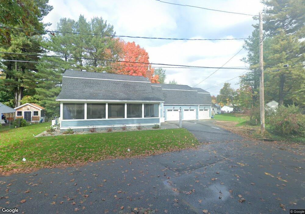
41 Woodside Ave Leominster, MA 01453
Estimated Value: $522,000 - $873,000
4
Beds
2
Baths
3,204
Sq Ft
$213/Sq Ft
Est. Value
About This Home
This home is located at 41 Woodside Ave, Leominster, MA 01453 and is currently estimated at $681,897, approximately $212 per square foot. 41 Woodside Ave is a home located in Worcester County with nearby schools including Leominster High School, St. Leo School, and St. Anna Catholic School.
Ownership History
Date
Name
Owned For
Owner Type
Purchase Details
Closed on
Sep 15, 1986
Bought by
Antonucci Michael W and Antonucci Linda D
Current Estimated Value
Create a Home Valuation Report for This Property
The Home Valuation Report is an in-depth analysis detailing your home's value as well as a comparison with similar homes in the area
Home Values in the Area
Average Home Value in this Area
Purchase History
| Date | Buyer | Sale Price | Title Company |
|---|---|---|---|
| Antonucci Michael W | $149,900 | -- |
Source: Public Records
Mortgage History
| Date | Status | Borrower | Loan Amount |
|---|---|---|---|
| Closed | Antonucci Michael W | $137,000 | |
| Closed | Antonucci Michael W | $150,000 | |
| Closed | Antonucci Michael W | $56,000 | |
| Closed | Antonucci Michael W | $63,000 |
Source: Public Records
Tax History Compared to Growth
Tax History
| Year | Tax Paid | Tax Assessment Tax Assessment Total Assessment is a certain percentage of the fair market value that is determined by local assessors to be the total taxable value of land and additions on the property. | Land | Improvement |
|---|---|---|---|---|
| 2025 | $7,941 | $566,000 | $130,100 | $435,900 |
| 2024 | $7,830 | $539,600 | $123,900 | $415,700 |
| 2023 | $7,408 | $476,700 | $107,700 | $369,000 |
| 2022 | $6,427 | $388,100 | $93,700 | $294,400 |
| 2021 | $6,362 | $350,900 | $72,900 | $278,000 |
| 2020 | $6,102 | $339,400 | $72,900 | $266,500 |
| 2019 | $5,912 | $318,900 | $69,400 | $249,500 |
| 2018 | $5,855 | $302,900 | $67,500 | $235,400 |
| 2017 | $5,664 | $287,100 | $63,000 | $224,100 |
| 2016 | $5,512 | $281,500 | $63,000 | $218,500 |
| 2015 | $5,033 | $258,900 | $63,000 | $195,900 |
| 2014 | $4,758 | $251,900 | $67,900 | $184,000 |
Source: Public Records
Map
Nearby Homes
- 37 Woodside Ave
- 90 Pleasant Terrace
- 47 Woodside Ave
- 98 Pleasant Terrace
- 82 Pleasant Terrace
- 34 Woodside Ave
- 33 Woodside Ave
- 55 Woodside Ave
- 74 Pleasant Terrace
- 45 Old Brook Rd
- 22 Woodside Ave
- 59 Woodside Ave
- 19 Woodside Ave
- 87 Pleasant Terrace
- 97 Pleasant Terrace
- 79 Pleasant Terrace
- 79 Pleasant Terrace Unit 3
- 79 Pleasant Terrace Unit 6
- 79 Pleasant Terrace Unit 4
- 79 Pleasant Terrace Unit 2