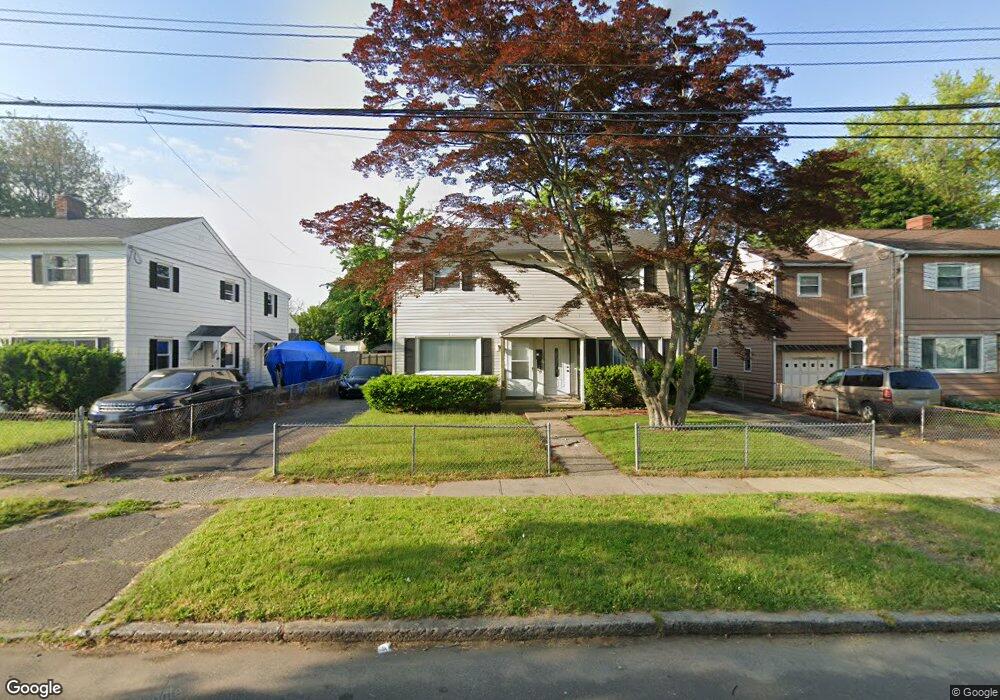
41 Wooster Ave Stratford, CT 06615
Stratford Center Historic District NeighborhoodEstimated Value: $251,000 - $274,091
3
Beds
1
Bath
1,078
Sq Ft
$243/Sq Ft
Est. Value
About This Home
This home is located at 41 Wooster Ave, Stratford, CT 06615 and is currently estimated at $262,023, approximately $243 per square foot. 41 Wooster Ave is a home located in Fairfield County with nearby schools including Stratford Academy - Johnson House, David Wooster Middle School, and Stratford High School.
Ownership History
Date
Name
Owned For
Owner Type
Purchase Details
Closed on
Feb 18, 2010
Sold by
Bepko Thomas
Bought by
Jackson Roxanne
Current Estimated Value
Home Financials for this Owner
Home Financials are based on the most recent Mortgage that was taken out on this home.
Original Mortgage
$66,888
Outstanding Balance
$45,384
Interest Rate
5.62%
Mortgage Type
FHA
Estimated Equity
$216,639
Create a Home Valuation Report for This Property
The Home Valuation Report is an in-depth analysis detailing your home's value as well as a comparison with similar homes in the area
Home Values in the Area
Average Home Value in this Area
Purchase History
| Date | Buyer | Sale Price | Title Company |
|---|---|---|---|
| Jackson Roxanne | $63,000 | -- |
Source: Public Records
Mortgage History
| Date | Status | Borrower | Loan Amount |
|---|---|---|---|
| Open | Jackson Roxanne | $66,888 | |
| Previous Owner | Jackson Roxanne | $90,540 |
Source: Public Records
Tax History Compared to Growth
Tax History
| Year | Tax Paid | Tax Assessment Tax Assessment Total Assessment is a certain percentage of the fair market value that is determined by local assessors to be the total taxable value of land and additions on the property. | Land | Improvement |
|---|---|---|---|---|
| 2025 | $3,729 | $92,770 | $34,320 | $58,450 |
| 2024 | $3,729 | $92,770 | $34,320 | $58,450 |
| 2023 | $3,729 | $92,770 | $34,320 | $58,450 |
| 2022 | $3,661 | $92,770 | $34,320 | $58,450 |
| 2021 | $3,662 | $92,770 | $34,320 | $58,450 |
| 2020 | $3,677 | $92,770 | $34,320 | $58,450 |
| 2019 | $2,643 | $66,300 | $21,640 | $44,660 |
| 2018 | $2,645 | $66,300 | $21,640 | $44,660 |
| 2017 | $2,650 | $66,300 | $21,640 | $44,660 |
| 2016 | $2,585 | $66,300 | $21,640 | $44,660 |
| 2015 | $2,452 | $66,300 | $21,640 | $44,660 |
| 2014 | $2,521 | $70,760 | $22,600 | $48,160 |
Source: Public Records
Map
Nearby Homes
- 79 Wooster Ave
- 70 Guzzi Dr
- 394 Harding Ave
- 909 Main St
- 325 Mckinley Ave
- 291 Birdseye St
- 161 Ryan Ave
- 1260 Elm St
- 107 Dewey St
- 216 Mckinley Ave
- 240 Placid Ave
- 171 Boswell St
- 148 Columbus Ave
- 126 Garibaldi Ave
- 125 Garibaldi Ave
- 1170 South Ave
- 79 Boswell St
- 1460 Elm St Unit 322
- 1460 Elm St Unit 225
- 88 Boswell St
- 49 Wooster Ave
- 39 Wooster Ave
- 39 Wooster Ave Unit 1
- 31 Wooster Ave
- 29 Wooster Ave
- 59 Wooster Ave
- 61 Wooster Ave
- 21 Wooster Ave
- 666 Columbus Ave
- 674 Columbus Ave
- 19 Wooster Ave
- 676 Columbus Ave
- 646 Columbus Ave
- 32 Wooster Ave
- 684 Columbus Ave
- 30 Wooster Ave
- 654 Columbus Ave Unit 656
- 644 Columbus Ave
- 11 Wooster Ave
- 71 Wooster Ave