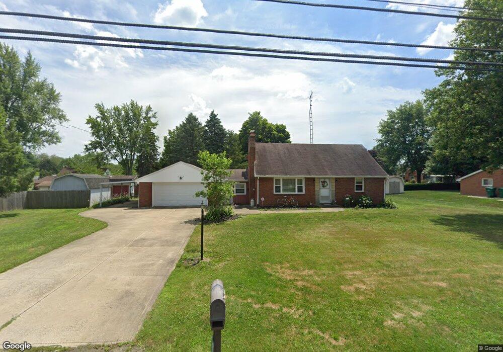
410 Reno Dr Louisville, OH 44641
Estimated Value: $210,000 - $248,000
3
Beds
2
Baths
1,404
Sq Ft
$164/Sq Ft
Est. Value
About This Home
This home is located at 410 Reno Dr, Louisville, OH 44641 and is currently estimated at $229,794, approximately $163 per square foot. 410 Reno Dr is a home located in Stark County with nearby schools including Louisville High School and St. Thomas Aquinas High School & Middle School.
Ownership History
Date
Name
Owned For
Owner Type
Purchase Details
Closed on
Jan 7, 2010
Sold by
Nicodemo John L
Bought by
Noll Gregory P
Current Estimated Value
Home Financials for this Owner
Home Financials are based on the most recent Mortgage that was taken out on this home.
Original Mortgage
$84,000
Outstanding Balance
$54,842
Interest Rate
4.84%
Mortgage Type
New Conventional
Estimated Equity
$174,952
Purchase Details
Closed on
Jan 26, 2006
Sold by
Rhoads Vincent B and Rhoads Elizabeth J
Bought by
Rhoads Vincent B and Rhoads Elizabeth J
Create a Home Valuation Report for This Property
The Home Valuation Report is an in-depth analysis detailing your home's value as well as a comparison with similar homes in the area
Home Values in the Area
Average Home Value in this Area
Purchase History
| Date | Buyer | Sale Price | Title Company |
|---|---|---|---|
| Noll Gregory P | $105,000 | Attorney | |
| Rhoads Vincent B | -- | None Available |
Source: Public Records
Mortgage History
| Date | Status | Borrower | Loan Amount |
|---|---|---|---|
| Open | Noll Gregory P | $84,000 |
Source: Public Records
Tax History Compared to Growth
Tax History
| Year | Tax Paid | Tax Assessment Tax Assessment Total Assessment is a certain percentage of the fair market value that is determined by local assessors to be the total taxable value of land and additions on the property. | Land | Improvement |
|---|---|---|---|---|
| 2025 | -- | $67,340 | $21,420 | $45,920 |
| 2024 | -- | $67,340 | $21,420 | $45,920 |
| 2023 | $2,285 | $53,170 | $17,710 | $35,460 |
| 2022 | $1,372 | $53,170 | $17,710 | $35,460 |
| 2021 | $1,509 | $53,170 | $17,710 | $35,460 |
| 2020 | $1,877 | $47,180 | $15,960 | $31,220 |
| 2019 | $1,885 | $48,090 | $16,870 | $31,220 |
| 2018 | $1,914 | $48,090 | $16,870 | $31,220 |
| 2017 | $1,754 | $42,530 | $14,140 | $28,390 |
| 2016 | $1,790 | $42,530 | $14,140 | $28,390 |
| 2015 | $1,795 | $42,530 | $14,140 | $28,390 |
| 2014 | $1,712 | $37,700 | $12,530 | $25,170 |
| 2013 | $860 | $37,700 | $12,530 | $25,170 |
Source: Public Records
Map
Nearby Homes
- 524 Glenbar St
- 614 Reno Dr
- 0 Glenbar St
- 5474 Ravenna Ave
- 428 Honeycrisp Dr NE
- 3047 Mcintosh Dr NE
- 432 Honeycrisp Dr NE
- 2962 Mcintosh Dr NE
- 2963 Mcintosh Dr NE
- 430 Honeycrisp Dr NE
- 2957 Mcintosh Dr NE
- 0 Brookridge Ave
- 316 E Reno Dr
- 300 Kennedy St
- 3580 Brookridge Ave Lot 15
- 910 Crosswyck Cir
- 1175 Sturbridge Dr
- 1149 Sturbridge Dr
- 1170 Winding Ridge Ave
- 325 Lincoln Ave
- 420 Reno Dr
- 322 Reno Dr
- 217 Fairview St
- 227 Fairview St
- 203 Fairview St
- 430 Reno Dr
- 239 Fairview St
- 308 Reno Dr
- 1378 Zwick Ave
- 508 Reno Dr
- 1406 Glenbrook Ave
- 216 Fairview St
- 307 Fairview St
- 1418 Glenbrook Ave
- 206 Fairview St
- 300 Reno Dr
- 155 Fairview St
- 305 Reno Dr
- 335 Chapel Ridge St
- 1426 Glenbrook Ave