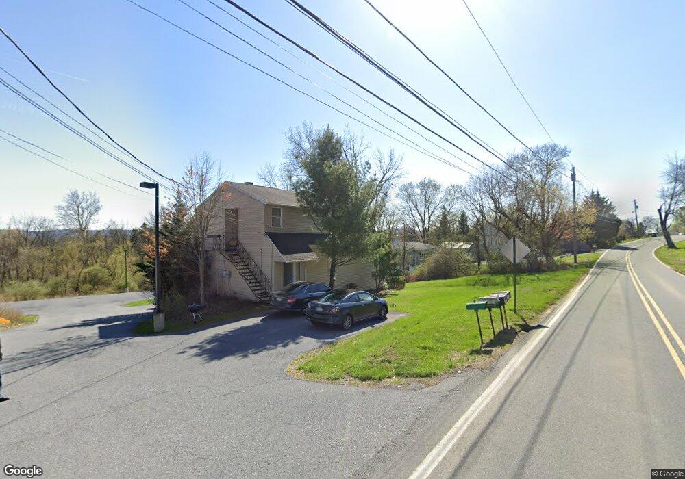
410 Rugby Rd Birdsboro, PA 19508
Estimated Value: $486,000 - $704,863
14
Beds
7
Baths
5,569
Sq Ft
$103/Sq Ft
Est. Value
About This Home
This home is located at 410 Rugby Rd, Birdsboro, PA 19508 and is currently estimated at $574,288, approximately $103 per square foot. 410 Rugby Rd is a home located in Berks County with nearby schools including Owatin Creek Elementary School, Exeter Township Junior High School, and Exeter Township Senior High School.
Ownership History
Date
Name
Owned For
Owner Type
Purchase Details
Closed on
Sep 22, 2011
Sold by
Sterner David H and Sterner Irene M
Bought by
Valdivieso Josefina T and Valdivieso Josefina A
Current Estimated Value
Home Financials for this Owner
Home Financials are based on the most recent Mortgage that was taken out on this home.
Original Mortgage
$195,600
Outstanding Balance
$134,393
Interest Rate
4.33%
Mortgage Type
Purchase Money Mortgage
Estimated Equity
$439,895
Purchase Details
Closed on
Sep 20, 2011
Sold by
Sterner David H and Sterner Irene M
Bought by
Residences At The Cannery Llc
Home Financials for this Owner
Home Financials are based on the most recent Mortgage that was taken out on this home.
Original Mortgage
$195,600
Outstanding Balance
$134,393
Interest Rate
4.33%
Mortgage Type
Purchase Money Mortgage
Estimated Equity
$439,895
Create a Home Valuation Report for This Property
The Home Valuation Report is an in-depth analysis detailing your home's value as well as a comparison with similar homes in the area
Home Values in the Area
Average Home Value in this Area
Purchase History
| Date | Buyer | Sale Price | Title Company |
|---|---|---|---|
| Valdivieso Josefina T | $950 | None Available | |
| Residences At The Cannery Llc | $106,000 | Conestoga Title Insurance |
Source: Public Records
Mortgage History
| Date | Status | Borrower | Loan Amount |
|---|---|---|---|
| Open | Residences At The Cannery Llc | $195,600 |
Source: Public Records
Tax History Compared to Growth
Tax History
| Year | Tax Paid | Tax Assessment Tax Assessment Total Assessment is a certain percentage of the fair market value that is determined by local assessors to be the total taxable value of land and additions on the property. | Land | Improvement |
|---|---|---|---|---|
| 2025 | $3,189 | $222,300 | $94,100 | $128,200 |
| 2024 | -- | $222,300 | $94,100 | $128,200 |
| 2023 | $10,212 | $222,300 | $94,100 | $128,200 |
| 2022 | $9,304 | $222,300 | $94,100 | $128,200 |
| 2021 | $9,944 | $222,300 | $94,100 | $128,200 |
| 2020 | $9,834 | $222,300 | $94,100 | $128,200 |
| 2019 | $9,725 | $222,300 | $94,100 | $128,200 |
| 2018 | $2,445 | $222,300 | $94,100 | $128,200 |
| 2017 | $9,557 | $222,300 | $94,100 | $128,200 |
| 2016 | $2,314 | $222,300 | $94,100 | $128,200 |
| 2015 | $2,314 | $222,300 | $94,100 | $128,200 |
| 2014 | $2,231 | $222,300 | $94,100 | $128,200 |
Source: Public Records
Map
Nearby Homes
- 140 Heister Rd
- 129 Virginia Ave
- 207 Lincoln Dr
- 6221 Perkiomen Ave
- 705 Schoffers Rd
- 105 Bordic Rd
- 30 Keystone Rd
- 201 Bordic Rd
- 313 Bordic Rd
- 59 Keystone Rd
- 301 Hampshire Ave
- 25 Shelbourne Rd
- 312 Hampshire Ave
- 400 Pennsylvania Ave
- 1411 Claire Dr
- 1322 Budd St
- 21 Warwick Ct
- 21 Sawgrass Dr
- 26 Bent Brook Cir
- 700 Fabers Rd