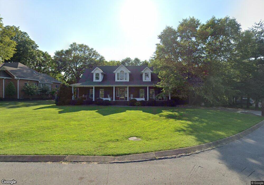
410 Stonewall Ct Lebanon, TN 37087
Estimated Value: $665,614 - $814,000
--
Bed
3
Baths
4,972
Sq Ft
$151/Sq Ft
Est. Value
About This Home
This home is located at 410 Stonewall Ct, Lebanon, TN 37087 and is currently estimated at $749,904, approximately $150 per square foot. 410 Stonewall Ct is a home located in Wilson County with nearby schools including Castle Heights Elementary School, Winfree Bryant Middle School, and Lebanon High School.
Ownership History
Date
Name
Owned For
Owner Type
Purchase Details
Closed on
May 2, 2002
Bought by
Petty David and Petty Ann W
Current Estimated Value
Purchase Details
Closed on
Dec 15, 1994
Bought by
Gurgiolo Daniel A and Gurgiolo Marilyn
Purchase Details
Closed on
Jun 29, 1993
Bought by
Bradshaw James C and Bradshaw Co-Trustees
Purchase Details
Closed on
Nov 1, 1989
Bought by
Shenandoah Associates (Lp)
Purchase Details
Closed on
Apr 4, 1904
Bought by
Horn Springs Development
Create a Home Valuation Report for This Property
The Home Valuation Report is an in-depth analysis detailing your home's value as well as a comparison with similar homes in the area
Home Values in the Area
Average Home Value in this Area
Purchase History
| Date | Buyer | Sale Price | Title Company |
|---|---|---|---|
| Petty David | $34,000 | -- | |
| Gurgiolo Daniel A | $52,400 | -- | |
| Bradshaw James C | $1,900,000 | -- | |
| Shenandoah Associates (Lp) | -- | -- | |
| Horn Springs Development | -- | -- |
Source: Public Records
Tax History Compared to Growth
Tax History
| Year | Tax Paid | Tax Assessment Tax Assessment Total Assessment is a certain percentage of the fair market value that is determined by local assessors to be the total taxable value of land and additions on the property. | Land | Improvement |
|---|---|---|---|---|
| 2024 | $2,688 | $121,850 | $16,250 | $105,600 |
| 2022 | $3,523 | $121,850 | $16,250 | $105,600 |
| 2021 | $3,524 | $121,850 | $16,250 | $105,600 |
| 2020 | $3,644 | $121,850 | $16,250 | $105,600 |
| 2019 | $831 | $96,950 | $12,025 | $84,925 |
| 2018 | $3,402 | $96,950 | $12,025 | $84,925 |
| 2017 | $3,402 | $96,950 | $12,025 | $84,925 |
| 2016 | $3,402 | $96,950 | $12,025 | $84,925 |
| 2015 | $3,517 | $96,950 | $12,025 | $84,925 |
| 2014 | $3,119 | $85,973 | $0 | $0 |
Source: Public Records
Map
Nearby Homes
- 2019 Arlington Rd
- 1930 Arlington Rd
- 108 Southfork Dr
- 1925 Vicksburg Ln
- 1920 Hampton Dr
- 1915 Appomattox Dr
- 0 Palmer Rd
- 0 Horn Springs Rd Unit RTC2822257
- 0 Horn Springs Rd Unit RTC2822266
- 0 Horn Springs Rd Unit RTC2780684
- 3 Horn Springs Rd
- 523 Medwyk Dr
- 1907 Roanoke Dr
- 1063 River Oaks Blvd
- The McGinnis Plan at Stratford Station
- The Langford Plan at Stratford Station
- The Palmer Plan at Stratford Station
- The Braselton II Plan at Stratford Station
- The Harrington Plan at Stratford Station
- The Peachtree Plan at Stratford Station
- 412 Stonewall Ct
- 408 Stonewall Ct
- 2120 Barnes Dr
- 411 Stonewall Ct
- 409 Stonewall Ct
- 407 Stonewall Ct
- 2028 Arlington Rd
- 2026 Arlington Rd
- 2024 Arlington Rd
- 2022 Arlington Rd
- 408 Barnes Dr
- 412 Barnes Dr
- 406 Barnes Dr
- 404 Barnes Dr
- 2017 Arlington Rd
- 2020 Arlington Rd
- 402 Barnes Dr
- 2018 Arlington Rd
- 414 Amarillo Dr
- 416 Amarillo Dr