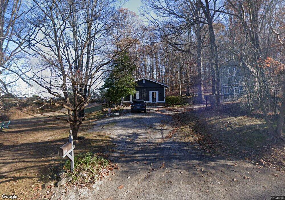
4110 Link Rd Knoxville, TN 37918
Corinth NeighborhoodEstimated Value: $313,000 - $362,000
3
Beds
2
Baths
1,632
Sq Ft
$205/Sq Ft
Est. Value
About This Home
This home is located at 4110 Link Rd, Knoxville, TN 37918 and is currently estimated at $334,442, approximately $204 per square foot. 4110 Link Rd is a home located in Knox County with nearby schools including Ritta Elementary School, Holston Middle School, and Gibbs High School.
Ownership History
Date
Name
Owned For
Owner Type
Purchase Details
Closed on
May 11, 1999
Sold by
Va
Bought by
Freeman David J and Freeman Carol A
Current Estimated Value
Home Financials for this Owner
Home Financials are based on the most recent Mortgage that was taken out on this home.
Original Mortgage
$65,000
Outstanding Balance
$20,543
Interest Rate
10%
Mortgage Type
Purchase Money Mortgage
Estimated Equity
$313,899
Purchase Details
Closed on
Jul 30, 1998
Sold by
Smith Marcus R and Smith Angela K
Bought by
Va
Purchase Details
Closed on
Nov 26, 1996
Sold by
Johnson Louis D
Bought by
Smith Angela K
Purchase Details
Closed on
Jul 6, 1995
Bought by
Johnson Louis D
Create a Home Valuation Report for This Property
The Home Valuation Report is an in-depth analysis detailing your home's value as well as a comparison with similar homes in the area
Home Values in the Area
Average Home Value in this Area
Purchase History
| Date | Buyer | Sale Price | Title Company |
|---|---|---|---|
| Freeman David J | $65,000 | -- | |
| Va | $63,662 | -- | |
| Smith Angela K | $71,000 | -- | |
| Johnson Louis D | -- | -- |
Source: Public Records
Mortgage History
| Date | Status | Borrower | Loan Amount |
|---|---|---|---|
| Open | Freeman David J | $65,000 |
Source: Public Records
Tax History Compared to Growth
Tax History
| Year | Tax Paid | Tax Assessment Tax Assessment Total Assessment is a certain percentage of the fair market value that is determined by local assessors to be the total taxable value of land and additions on the property. | Land | Improvement |
|---|---|---|---|---|
| 2025 | $655 | $42,175 | $0 | $0 |
| 2024 | $655 | $42,175 | $0 | $0 |
| 2023 | $655 | $42,175 | $0 | $0 |
| 2022 | $655 | $42,175 | $0 | $0 |
| 2021 | $681 | $32,125 | $0 | $0 |
| 2020 | $681 | $32,125 | $0 | $0 |
| 2019 | $681 | $32,125 | $0 | $0 |
| 2018 | $681 | $32,125 | $0 | $0 |
| 2017 | $681 | $32,125 | $0 | $0 |
| 2016 | $660 | $0 | $0 | $0 |
| 2015 | $660 | $0 | $0 | $0 |
| 2014 | $660 | $0 | $0 | $0 |
Source: Public Records
Map
Nearby Homes
- 6734 Worthington Ln
- 3803 Crimson Clover
- 4713 Shell Ln
- 3772 Crimson Clover Ln
- 3766 Crimson Clover Ln
- 3761 Crimson Clover Ln
- 3760 Crimson Clover Ln
- 3755 Crimson Clover Ln
- Sycamore Plan at Harvest Meadow - Freedom Collection
- Dogwood Plan at Harvest Meadow - Freedom Collection
- Redbud Plan at Harvest Meadow - Freedom Collection
- 3754 Crimson Clover Ln
- 4723 Bella Capri Ln
- 4725 Bella Capri Ln
- 3736 Crimson Clover Ln
- 3773 Crimson Clover Ln
- 4880 Shell Ln
- 7001 Washington Pike
- 4721 Wise Springs Rd
- 4654 Angakot Rd
- 4133 Link Rd
- 4119 Link Rd
- 4100 Link Rd
- 4137 Link Rd
- 4117 Link Rd
- 6765 Ingleside Ln
- 4121 Link Rd
- 6759 Ingleside Ln
- 4139 Link Rd
- 6766 Ingleside Ln
- 6753 Ingleside Ln
- 4127 Link Rd
- 6760 Ingleside Ln
- 6769 Ingleside Ln
- 6747 Ingleside Ln
- 4300 Link Rd
- 6754 Ingleside Ln
- 6741 Ingleside Ln
- 6748 Ingleside Ln
- 6718 Worthington Ln
