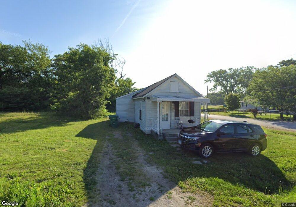
4113 Tudor Ave East Saint Louis, IL 62207
Estimated Value: $29,000 - $112,000
--
Bed
--
Bath
552
Sq Ft
$104/Sq Ft
Est. Value
About This Home
This home is located at 4113 Tudor Ave, East Saint Louis, IL 62207 and is currently estimated at $57,479, approximately $104 per square foot. 4113 Tudor Ave is a home located in St. Clair County with nearby schools including Annette Officer Elementary, East St Louis-Lincoln Middle School, and East St Louis Senior High School.
Ownership History
Date
Name
Owned For
Owner Type
Purchase Details
Closed on
Sep 17, 2018
Sold by
St Clair County
Bought by
Cook Mary
Current Estimated Value
Purchase Details
Closed on
Jul 25, 2018
Sold by
Holbrook Thomas
Bought by
Keith Murphy and Keith Murphy
Purchase Details
Closed on
Dec 5, 2014
Sold by
Saint Clair County
Bought by
Murphy Keith
Purchase Details
Closed on
Dec 19, 2012
Sold by
Harris Anna H and Hutto Sean T
Bought by
Saint Clair County
Purchase Details
Closed on
Feb 12, 2012
Sold by
Harris Nicholson Anna
Bought by
Murphy Keith
Purchase Details
Closed on
Feb 14, 2001
Sold by
Mccowan Lisa Ann and Mccowan Michael
Bought by
Harris Terry
Create a Home Valuation Report for This Property
The Home Valuation Report is an in-depth analysis detailing your home's value as well as a comparison with similar homes in the area
Home Values in the Area
Average Home Value in this Area
Purchase History
| Date | Buyer | Sale Price | Title Company |
|---|---|---|---|
| Cook Mary | -- | Attorney | |
| Keith Murphy | -- | Attorney | |
| Murphy Keith | -- | None Available | |
| Saint Clair County | -- | None Available | |
| Murphy Keith | $10,000 | None Available | |
| Harris Terry | $2,500 | -- |
Source: Public Records
Tax History Compared to Growth
Tax History
| Year | Tax Paid | Tax Assessment Tax Assessment Total Assessment is a certain percentage of the fair market value that is determined by local assessors to be the total taxable value of land and additions on the property. | Land | Improvement |
|---|---|---|---|---|
| 2024 | $40 | $6,252 | $246 | $6,006 |
| 2023 | $31 | $5,650 | $222 | $5,428 |
| 2022 | $866 | $4,952 | $195 | $4,757 |
| 2021 | $491 | $2,668 | $185 | $2,483 |
| 2020 | $481 | $104 | $52 | $52 |
| 2019 | $486 | $104 | $52 | $52 |
| 2018 | $412 | $106 | $53 | $53 |
| 2017 | $412 | $2,588 | $192 | $2,396 |
| 2016 | $337 | $1,650 | $238 | $1,412 |
| 2014 | $298 | $1,632 | $235 | $1,397 |
| 2013 | $342 | $100 | $50 | $50 |
Source: Public Records
Map
Nearby Homes
- 1927 Bond Ave
- 6330 Church Rd
- 3325 Bond Ave
- 604 West Ave
- 3300 Mccasland Ave
- 5413 Nelson Ave
- 2953 Virginia Place
- 2626 Missouri Ave
- 351 N 26th St
- 3125 Louisiana Blvd
- 1415 S J St
- 1997 Oak Tree Ln
- 1924 Bond Ave
- 2201 Gaty Ave
- 1902 Baker Ave
- 2274 Carol St
- 2372 Lorraine Dr
- 472 N 25th St
- 550 N 30th St
- 2014 Florence St
- 708 S 42nd St
- 4036 Piggott Ave
- 805 S 42nd St
- 4110 Tudor Ave
- 4016 Piggott Ave
- 4014 Piggott Ave
- 4014 Piggott Ave
- 4010 Piggott Ave
- 4208 Tudor Ave
- 4107 Piggott Ave
- 4105 Piggott Ave
- 901 S 42nd St
- 4210 Tudor Ave
- 4119 Piggott Ave
- 4119 Piggott Ave
- 4212 Piggott Ave
- 4204 Tudor Ave
- 4011 Piggott Ave
- 4008 Piggott Ave
- 4017 Tudor Ave