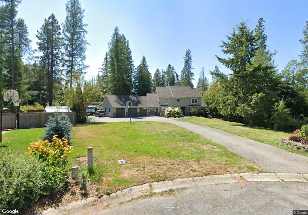
412 Remington Ct Sandpoint, ID 83864
Estimated Value: $801,000 - $1,054,000
4
Beds
4
Baths
3,217
Sq Ft
$277/Sq Ft
Est. Value
About This Home
This home is located at 412 Remington Ct, Sandpoint, ID 83864 and is currently estimated at $892,645, approximately $277 per square foot. 412 Remington Ct is a home located in Bonner County with nearby schools including Washington Elementary School, Sandpoint Middle School, and Sandpoint High School.
Ownership History
Date
Name
Owned For
Owner Type
Purchase Details
Closed on
Sep 23, 2020
Sold by
Burrows Matthew H and Burrows Lisa A
Bought by
Burrows Matthew and Burrows Lisa
Current Estimated Value
Home Financials for this Owner
Home Financials are based on the most recent Mortgage that was taken out on this home.
Original Mortgage
$280,000
Outstanding Balance
$248,481
Interest Rate
2.9%
Mortgage Type
New Conventional
Estimated Equity
$644,164
Purchase Details
Closed on
Nov 17, 2010
Sold by
Peitz Gary A
Bought by
Burrows Matthew H and Burrows Lisa A
Home Financials for this Owner
Home Financials are based on the most recent Mortgage that was taken out on this home.
Original Mortgage
$240,000
Interest Rate
4.23%
Mortgage Type
New Conventional
Create a Home Valuation Report for This Property
The Home Valuation Report is an in-depth analysis detailing your home's value as well as a comparison with similar homes in the area
Home Values in the Area
Average Home Value in this Area
Purchase History
| Date | Buyer | Sale Price | Title Company |
|---|---|---|---|
| Burrows Matthew | -- | North Idaho Title Company | |
| Burrows Matthew H | -- | -- | |
| Peitz Gary A | -- | -- |
Source: Public Records
Mortgage History
| Date | Status | Borrower | Loan Amount |
|---|---|---|---|
| Open | Burrows Matthew | $280,000 | |
| Closed | Burrows Matthew H | $240,000 |
Source: Public Records
Tax History Compared to Growth
Tax History
| Year | Tax Paid | Tax Assessment Tax Assessment Total Assessment is a certain percentage of the fair market value that is determined by local assessors to be the total taxable value of land and additions on the property. | Land | Improvement |
|---|---|---|---|---|
| 2025 | $4,077 | $697,824 | $272,946 | $424,878 |
| 2024 | $4,672 | $755,706 | $272,946 | $482,760 |
| 2023 | $3,711 | $815,765 | $272,946 | $542,819 |
| 2022 | $4,167 | $691,878 | $197,938 | $493,940 |
| 2021 | $3,720 | $462,783 | $110,336 | $352,447 |
| 2020 | $3,716 | $444,774 | $110,336 | $334,438 |
| 2019 | $4,012 | $453,419 | $110,336 | $343,083 |
| 2018 | $3,867 | $425,872 | $110,336 | $315,536 |
| 2017 | $3,867 | $398,764 | $0 | $0 |
| 2016 | $3,601 | $360,098 | $0 | $0 |
| 2015 | $3,690 | $360,098 | $0 | $0 |
| 2014 | $3,716 | $360,278 | $0 | $0 |
Source: Public Records
Map
Nearby Homes
- 414 Creekside Ln
- 207 S Lincoln Ave
- 17 Canoe Cove
- 1509 Cedar St
- 1020 Park Ave
- 1309 Westwood Ln
- NNA Nicholas Way
- 1607 Gondola Ct
- 1523 Nicholas Way
- 1320 Mathison Dr
- 71 Widgeon Hollow
- 424 S Olive Ave
- 424 S Olive Ave Unit 303
- 424 S Olive Ave Unit 103
- 424 S Olive Ave Unit 203
- 1405 Autumn Ln
- 1205 W Lake St
- 210 Olive Ave
- 210 S Olive Ave
- 411 S Olive Ave Unit 1
- 404 Remington Ct
- 2205 Browning Way
- 411 Remington Ct
- 301 Creekside Ln
- 2123 Browning Way
- 324 Remington Ct
- 409 Creekside Ln
- 421 Creekside Ln
- 405 Remington Ct
- 427 Creekside Ln
- 2211 Browning Way
- 2117 Browning Way
- 410 Creekside Ln
- 318 Remington Ct
- NKA Browning
- 0 Nka Browning Way Unit 22-8248
- 323 Remington Ct
- 416 S Lincoln Ave
- 2124 Browning Way
- 410 S Lincoln Ave