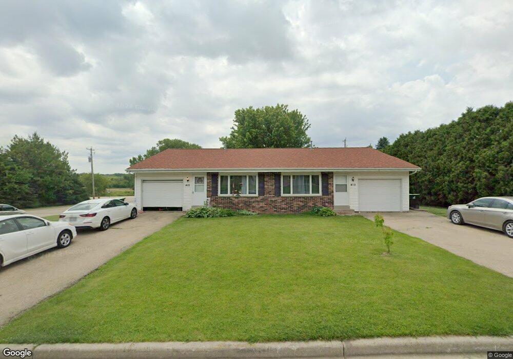
413 Colby Cir Iron Ridge, WI 53035
Estimated Value: $307,227 - $354,000
--
Bed
--
Bath
--
Sq Ft
0.38
Acres
About This Home
This home is located at 413 Colby Cir, Iron Ridge, WI 53035 and is currently estimated at $327,307. 413 Colby Cir is a home located in Dodge County with nearby schools including Hartford High School and St. Matthew Lutheran School.
Ownership History
Date
Name
Owned For
Owner Type
Purchase Details
Closed on
Oct 22, 2023
Sold by
Werther Douglas H and Werther Theresa L
Bought by
Douglas H Werther And Lynn T Werther 2011 Rev and Werther
Current Estimated Value
Purchase Details
Closed on
Aug 8, 2014
Sold by
Higgins John F and Higgins Marlis A
Bought by
Werther Douglas H and Werther Theresa L
Home Financials for this Owner
Home Financials are based on the most recent Mortgage that was taken out on this home.
Original Mortgage
$111,750
Interest Rate
4.15%
Mortgage Type
New Conventional
Create a Home Valuation Report for This Property
The Home Valuation Report is an in-depth analysis detailing your home's value as well as a comparison with similar homes in the area
Home Values in the Area
Average Home Value in this Area
Purchase History
| Date | Buyer | Sale Price | Title Company |
|---|---|---|---|
| Douglas H Werther And Lynn T Werther 2011 Rev | -- | None Listed On Document | |
| Werther Douglas H | $149,000 | None Available |
Source: Public Records
Mortgage History
| Date | Status | Borrower | Loan Amount |
|---|---|---|---|
| Previous Owner | Werther Douglas H | $111,750 |
Source: Public Records
Tax History Compared to Growth
Tax History
| Year | Tax Paid | Tax Assessment Tax Assessment Total Assessment is a certain percentage of the fair market value that is determined by local assessors to be the total taxable value of land and additions on the property. | Land | Improvement |
|---|---|---|---|---|
| 2024 | $3,098 | $155,200 | $35,000 | $120,200 |
| 2023 | $3,078 | $155,200 | $35,000 | $120,200 |
| 2022 | $3,047 | $155,200 | $35,000 | $120,200 |
| 2021 | $2,947 | $155,200 | $35,000 | $120,200 |
| 2020 | $3,128 | $155,200 | $35,000 | $120,200 |
| 2019 | $2,969 | $155,200 | $35,000 | $120,200 |
| 2018 | $2,993 | $155,200 | $35,000 | $120,200 |
| 2017 | $2,781 | $155,200 | $35,000 | $120,200 |
| 2016 | $2,745 | $155,200 | $35,000 | $120,200 |
| 2015 | $2,708 | $155,200 | $35,000 | $120,200 |
| 2014 | $3,705 | $195,700 | $35,000 | $160,700 |
Source: Public Records
Map
Nearby Homes
- 234 Watertower Cir
- 202 East Ave
- 0 Burkwald Ave
- N5413 County Rd S
- Lt0 E Neda Rd
- N4973 Lake Dr
- N6436 County Road Tw
- N4569 Hazelwood Rd
- N4690 Lake Dr
- Lt1 Lilly Rd
- Lt0 Lilly Rd
- Lt2 Lilly Rd
- N4510 & N4504 Anthony Island
- N4510 Anthony Island -
- .68 Acre Parcel Anthony Island
- Lt38 Sinissippi Point Rd
- 244 S Ridge St
- 727 E Lakeview Rd Unit 8
- 252 S Hustis St
- W4436 E Lakeview Rd
- 409 Colby Cir
- 414 Colby Cir
- 501 Herman St
- 405 Colby Cir
- 407 Ann Marie Dr
- 101 Fenceline Ave
- 407 Ann Marie Ave
- 401 Colby Cir
- 403 Ann Marie Dr
- 411 Ann Marie Dr
- 102 Fenceline Ave
- 505 Herman St
- 103 Fenceline Ave Unit A
- 132 Lincoln Ave
- 415 Ann Marie Dr
- 128 Lincoln Ave
- 402 Ann Marie Dr
- 104 Fenceline Ave
- 105 Fenceline Ave
- 412 Ann Marie Ave