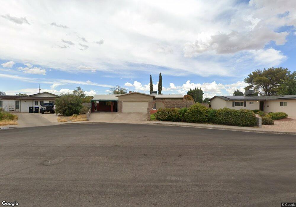
413 Emerald Cir Henderson, NV 89002
Highland Hills NeighborhoodEstimated Value: $418,000 - $489,000
4
Beds
3
Baths
2,625
Sq Ft
$169/Sq Ft
Est. Value
About This Home
This home is located at 413 Emerald Cir, Henderson, NV 89002 and is currently estimated at $443,237, approximately $168 per square foot. 413 Emerald Cir is a home located in Clark County with nearby schools including Fay Galloway Elementary School, Jack & Terry Mannion Middle School, and Foothill High School.
Ownership History
Date
Name
Owned For
Owner Type
Purchase Details
Closed on
Jan 28, 2016
Sold by
Stark Patricia A
Bought by
Stark Ronald
Current Estimated Value
Home Financials for this Owner
Home Financials are based on the most recent Mortgage that was taken out on this home.
Original Mortgage
$120,000
Interest Rate
3.81%
Mortgage Type
New Conventional
Purchase Details
Closed on
May 25, 2005
Sold by
Stark Ronald
Bought by
Stark Ronald
Home Financials for this Owner
Home Financials are based on the most recent Mortgage that was taken out on this home.
Original Mortgage
$151,788
Interest Rate
5.74%
Mortgage Type
New Conventional
Purchase Details
Closed on
Aug 27, 1997
Sold by
Stark Elmer and Stark Lillian
Bought by
Stark Ronald
Home Financials for this Owner
Home Financials are based on the most recent Mortgage that was taken out on this home.
Original Mortgage
$107,030
Interest Rate
7.43%
Create a Home Valuation Report for This Property
The Home Valuation Report is an in-depth analysis detailing your home's value as well as a comparison with similar homes in the area
Home Values in the Area
Average Home Value in this Area
Purchase History
| Date | Buyer | Sale Price | Title Company |
|---|---|---|---|
| Stark Ronald | -- | First American Title Insuran | |
| Stark Ronald | -- | Nevada Title Company | |
| Stark Ronald | -- | Ati Title |
Source: Public Records
Mortgage History
| Date | Status | Borrower | Loan Amount |
|---|---|---|---|
| Closed | Stark Ronald | $120,000 | |
| Closed | Stark Ronald | $151,788 | |
| Closed | Stark Ronald | $107,030 |
Source: Public Records
Tax History Compared to Growth
Tax History
| Year | Tax Paid | Tax Assessment Tax Assessment Total Assessment is a certain percentage of the fair market value that is determined by local assessors to be the total taxable value of land and additions on the property. | Land | Improvement |
|---|---|---|---|---|
| 2025 | $1,143 | $62,974 | $28,700 | $34,274 |
| 2024 | $1,111 | $62,974 | $28,700 | $34,274 |
| 2023 | $1,111 | $64,915 | $33,950 | $30,965 |
| 2022 | $1,078 | $54,943 | $27,300 | $27,643 |
| 2021 | $1,047 | $51,276 | $25,550 | $25,726 |
| 2020 | $1,014 | $49,848 | $24,850 | $24,998 |
| 2019 | $984 | $46,575 | $21,000 | $25,575 |
| 2018 | $955 | $44,139 | $18,900 | $25,239 |
| 2017 | $1,283 | $44,250 | $17,850 | $26,400 |
| 2016 | $906 | $38,457 | $10,500 | $27,957 |
| 2015 | $903 | $38,828 | $10,500 | $28,328 |
| 2014 | $875 | $30,552 | $8,750 | $21,802 |
Source: Public Records
Map
Nearby Homes
- 408 Scenic Dr
- 234 Walsh Peak Ave
- 615 Hidden Valley Dr
- 334 Laurel Peak Dr
- 331 Laurel Peak Dr
- 328 Owens Peak Dr
- 302 Walsh Peak Ave
- Rhett Plan at Highpointe at Black Mt Ranch
- Franklin with Next Gen Suite Plan at Highpointe at Black Mt Ranch
- Reid Plan at Highpointe at Black Mt Ranch
- Ramsey Plan at Highpointe at Black Mt Ranch
- Fletcher Plan at Highpointe at Black Mt Ranch
- Finley Plan at Highpointe at Black Mt Ranch
- 316 Mount Williamson St
- 242 White Crest Peak Ave
- 226 White Crest Peak Ave
- 313 Mount Langley St
- 385 Cove Ct Unit 2
- Nora Plan at Landmark at Black Mt Ranch
- Diana Plan at Landmark at Black Mt Ranch
- 411 Emerald Cir
- 414 E Horizon Dr
- 412 E Horizon Dr
- 416 E Horizon Dr
- 417 Emerald Cir
- 412 Emerald Cir
- 410 E Horizon Dr
- 410 E Horizon Dr Unit None
- 416 Emerald Cir
- 418 E Horizon Dr
- 605 Cameo Cir
- 418 Emerald Cir
- 414 Emerald Cir
- 603 Cameo Cir
- 601 Cameo Cir
- 607 Cameo Cir
- 425 Scenic Dr
- 427 Scenic Dr
- 423 Scenic Dr
- 605 Sierra Ln