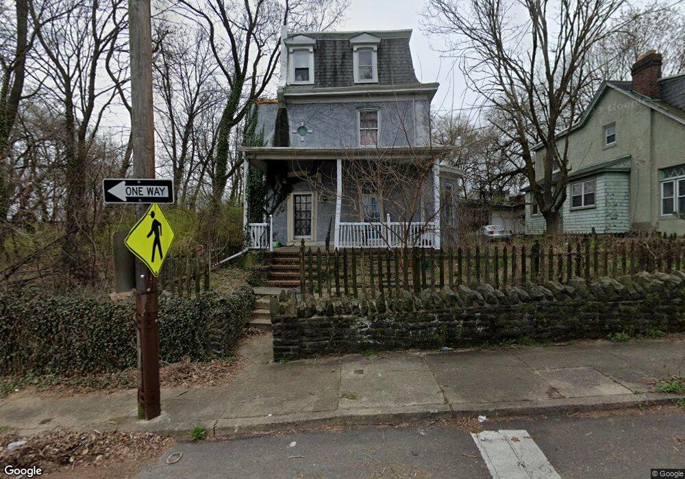
414 E Bringhurst St Philadelphia, PA 19144
East Germantown NeighborhoodEstimated Value: $97,000 - $272,000
--
Bed
--
Bath
3,300
Sq Ft
$64/Sq Ft
Est. Value
About This Home
This home is located at 414 E Bringhurst St, Philadelphia, PA 19144 and is currently estimated at $212,611, approximately $64 per square foot. 414 E Bringhurst St is a home located in Philadelphia County with nearby schools including Roosevelt Theodore Middle School, Martin Luther King High School, and John Wister Elementary School.
Ownership History
Date
Name
Owned For
Owner Type
Purchase Details
Closed on
Aug 25, 2008
Sold by
Whittington Quida A and Dow Mary E
Bought by
Whittington Quida A
Current Estimated Value
Purchase Details
Closed on
Jun 12, 1998
Sold by
Dombrowski Joseph
Bought by
Whittington Ouida A and Dow Mary E
Purchase Details
Closed on
Jul 25, 1997
Sold by
Johntz Marjorie E
Bought by
Dombrowski Joseph
Create a Home Valuation Report for This Property
The Home Valuation Report is an in-depth analysis detailing your home's value as well as a comparison with similar homes in the area
Home Values in the Area
Average Home Value in this Area
Purchase History
| Date | Buyer | Sale Price | Title Company |
|---|---|---|---|
| Whittington Quida A | -- | None Available | |
| Whittington Ouida A | $35,000 | -- | |
| Dombrowski Joseph | $33,000 | -- |
Source: Public Records
Tax History Compared to Growth
Tax History
| Year | Tax Paid | Tax Assessment Tax Assessment Total Assessment is a certain percentage of the fair market value that is determined by local assessors to be the total taxable value of land and additions on the property. | Land | Improvement |
|---|---|---|---|---|
| 2025 | $2,569 | $248,300 | $49,660 | $198,640 |
| 2024 | $2,569 | $248,300 | $49,660 | $198,640 |
| 2023 | $2,569 | $183,500 | $36,700 | $146,800 |
| 2022 | $945 | $138,500 | $36,700 | $101,800 |
| 2021 | $1,575 | $0 | $0 | $0 |
| 2020 | $1,575 | $0 | $0 | $0 |
| 2019 | $1,645 | $0 | $0 | $0 |
| 2018 | $1,767 | $0 | $0 | $0 |
| 2017 | $1,767 | $0 | $0 | $0 |
| 2016 | $1,347 | $0 | $0 | $0 |
| 2015 | $1,289 | $0 | $0 | $0 |
| 2014 | -- | $126,200 | $8,926 | $117,274 |
| 2012 | -- | $13,120 | $3,326 | $9,794 |
Source: Public Records
Map
Nearby Homes
- 306 E Queen Ln
- 83 E Ashmead St
- 5301 R Belfield Ave
- 5301 Belfield Ave
- 238 E Queen Ln
- 253 R E Penn St
- 510 E Queen Ln
- 437 49 E Collom St
- 529 E Queen Ln
- 4995 Sheldon St
- 540 E Ashmead St
- 5154 Wakefield St
- 5220 Wakefield St
- 4950 Wakefield St
- 78 E Penn St
- 94 E Ashmead St
- 101 E Wister St
- 4940 Rubicam St
- 92 E Wister St
- 5022 Wakefield St
- 410 E Bringhurst St
- 404 E Bringhurst St
- 419 E Ashmead St
- 400 E Bringhurst St
- 5211 Rubicam St
- 417 E Ashmead St
- 413 E Ashmead St
- 415 E Ashmead St
- 5209 Rubicam St
- 409 E Ashmead St
- 411 E Ashmead St
- 405 E Ashmead St
- 407 E Ashmead St
- 403 E Ashmead St
- 401 E Ashmead St
- 306 E Bringhurst St
- 5212 Rubicam St
- 5210 Rubicam St
- 416 E Ashmead St
- 414 E Ashmead St