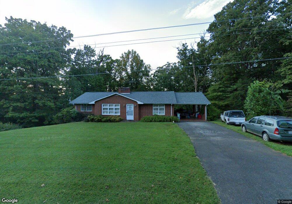
4147 Westfield Rd Mount Airy, NC 27030
Estimated Value: $152,000 - $210,000
3
Beds
1
Bath
1,180
Sq Ft
$153/Sq Ft
Est. Value
About This Home
This home is located at 4147 Westfield Rd, Mount Airy, NC 27030 and is currently estimated at $180,071, approximately $152 per square foot. 4147 Westfield Rd is a home with nearby schools including Westfield Elementary School, Pilot Mountain Middle School, and East Surry High School.
Ownership History
Date
Name
Owned For
Owner Type
Purchase Details
Closed on
Nov 21, 2014
Sold by
Turner Linda C and Arrington Wanda K
Bought by
Turner Linda C and Arrington Wanda K
Current Estimated Value
Purchase Details
Closed on
Jun 23, 2006
Sold by
Arrington Eddie Dean and Arrington Penny Cooke
Bought by
Turner Linda C
Home Financials for this Owner
Home Financials are based on the most recent Mortgage that was taken out on this home.
Original Mortgage
$58,000
Outstanding Balance
$34,366
Interest Rate
6.71%
Mortgage Type
New Conventional
Estimated Equity
$145,705
Purchase Details
Closed on
Nov 1, 1955
Purchase Details
Closed on
Jan 1, 1951
Create a Home Valuation Report for This Property
The Home Valuation Report is an in-depth analysis detailing your home's value as well as a comparison with similar homes in the area
Home Values in the Area
Average Home Value in this Area
Purchase History
| Date | Buyer | Sale Price | Title Company |
|---|---|---|---|
| Turner Linda C | -- | None Available | |
| Turner Linda C | $45,000 | None Available | |
| Arrington Eddie Dean | -- | None Available | |
| -- | -- | -- | |
| -- | -- | -- |
Source: Public Records
Mortgage History
| Date | Status | Borrower | Loan Amount |
|---|---|---|---|
| Open | Turner Linda C | $58,000 |
Source: Public Records
Tax History Compared to Growth
Tax History
| Year | Tax Paid | Tax Assessment Tax Assessment Total Assessment is a certain percentage of the fair market value that is determined by local assessors to be the total taxable value of land and additions on the property. | Land | Improvement |
|---|---|---|---|---|
| 2025 | $819 | $132,150 | $19,500 | $112,650 |
| 2024 | $693 | $103,840 | $18,000 | $85,840 |
| 2023 | $681 | $103,840 | $18,000 | $85,840 |
| 2022 | $681 | $103,840 | $18,000 | $85,840 |
| 2021 | $693 | $103,840 | $18,000 | $85,840 |
| 2020 | $683 | $98,560 | $18,000 | $80,560 |
| 2019 | $680 | $98,560 | $0 | $0 |
| 2018 | $678 | $98,560 | $0 | $0 |
| 2017 | $646 | $93,760 | $0 | $0 |
| 2016 | $646 | $93,760 | $0 | $0 |
| 2013 | -- | $94,100 | $0 | $0 |
Source: Public Records
Map
Nearby Homes
- 583 Snody Rd
- 00 Blue Hollow Rd Unit 5
- 0 Blue Hollow Rd Unit 33 1176021
- 0 Blue Hollow Rd Unit 23105199
- 000 Blue Hollow Rd Unit 27
- 733 Slate Mountain Rd
- 140 Daniels Dell Ln
- 731 Indian Grove Church Rd
- 107 Cory Trail
- 0 Norman Rd
- Lot 4,5,6 Sideview Ln
- 7.8ac Norman Rd
- 0 NE Pine St
- 200 Englewood Trail
- Lot 5 Howell Rd
- 00 Paynetown Rd
- 1970 Mcbride Rd
- 335 Badgett Ave
- 124 Rocky Ln
- 759 Cameron Ln
- 4140 Westfield Rd
- 4169 Westfield Rd
- 4106 Westfield Rd
- 4201 Westfield Rd
- 4202 Westfield Rd
- 4083 Westfield Rd
- 4070 Westfield Rd
- 143 Bobsled Ln
- 4242 Westfield Rd
- 4071 Westfield Rd
- 4018 Westfield Rd
- 4256 Westfield Rd
- 336 Lazy Brook Ln
- 401 Lazy Brook Ln
- 314 Lazy Brook Ln
- 4291 Westfield Rd
- 168 Cain Rd
- 238 Cain Rd
- 4333 Westfield Rd
- 264 Cain Rd