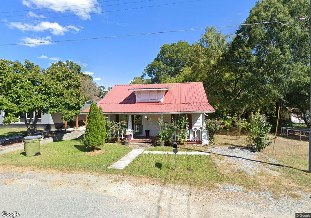
415 High St Thomasville, NC 27360
Estimated Value: $61,000 - $169,000
2
Beds
1
Bath
1,152
Sq Ft
$99/Sq Ft
Est. Value
About This Home
This home is located at 415 High St, Thomasville, NC 27360 and is currently estimated at $114,286, approximately $99 per square foot. 415 High St is a home located in Davidson County with nearby schools including Thomasville Primary School, Liberty Drive Elementary School, and Thomasville Middle School.
Ownership History
Date
Name
Owned For
Owner Type
Purchase Details
Closed on
Jul 19, 2011
Sold by
G8 Capital Fund Xii Llc
Bought by
Eh Pooled 710 Lp
Current Estimated Value
Purchase Details
Closed on
Jul 14, 2011
Sold by
Eh Pooled 710 Lp
Bought by
Torres Sonia Esparza
Purchase Details
Closed on
Apr 30, 2010
Sold by
Federal National Mortgage Association
Bought by
G8 Capital Fund Xii Llc
Purchase Details
Closed on
Mar 11, 2010
Sold by
Deweese Steaphon M and Deweese Melissa Renee
Bought by
Federal National Mortgage Association
Purchase Details
Closed on
Mar 11, 2004
Sold by
Deweese Bonnie Hicks
Bought by
Deweese Steve
Purchase Details
Closed on
Aug 1, 1998
Purchase Details
Closed on
Aug 1, 1980
Create a Home Valuation Report for This Property
The Home Valuation Report is an in-depth analysis detailing your home's value as well as a comparison with similar homes in the area
Home Values in the Area
Average Home Value in this Area
Purchase History
| Date | Buyer | Sale Price | Title Company |
|---|---|---|---|
| Eh Pooled 710 Lp | $10,500 | None Available | |
| Torres Sonia Esparza | $12,405 | None Available | |
| G8 Capital Fund Xii Llc | $9,228 | None Available | |
| Federal National Mortgage Association | $47,162 | None Available | |
| Deweese Steve | -- | -- | |
| -- | $26,000 | -- | |
| -- | $10,500 | -- |
Source: Public Records
Tax History Compared to Growth
Tax History
| Year | Tax Paid | Tax Assessment Tax Assessment Total Assessment is a certain percentage of the fair market value that is determined by local assessors to be the total taxable value of land and additions on the property. | Land | Improvement |
|---|---|---|---|---|
| 2025 | $497 | $37,270 | $0 | $0 |
| 2024 | $497 | $37,270 | $0 | $0 |
| 2023 | $497 | $37,270 | $0 | $0 |
| 2022 | $497 | $37,270 | $0 | $0 |
| 2021 | $499 | $37,270 | $0 | $0 |
| 2020 | $436 | $33,160 | $0 | $0 |
| 2019 | $444 | $33,160 | $0 | $0 |
| 2018 | $444 | $33,160 | $0 | $0 |
| 2017 | $438 | $33,160 | $0 | $0 |
| 2016 | $424 | $33,160 | $0 | $0 |
| 2015 | $424 | $33,160 | $0 | $0 |
| 2014 | $412 | $32,170 | $0 | $0 |
Source: Public Records
Map
Nearby Homes
- 300 Cox Ave
- 502 Culbreth Ave
- 312 Culbreth Ave
- 129 Jewell St
- 622 Cox Ave
- 108 Maple Ave
- 106 College St
- 107 College St
- 615 Midland Ave
- 312 Phillips St
- 30 Culbreth Ave
- 707 Willowmoore Ave
- 17 E Main St
- 101 Montlieu Ave
- 105 School St
- 6 Mock St
- 301 Brown St
- 904 Ball Park Rd
- 17 Fisher Ferry St
- 106 Carolina Ave