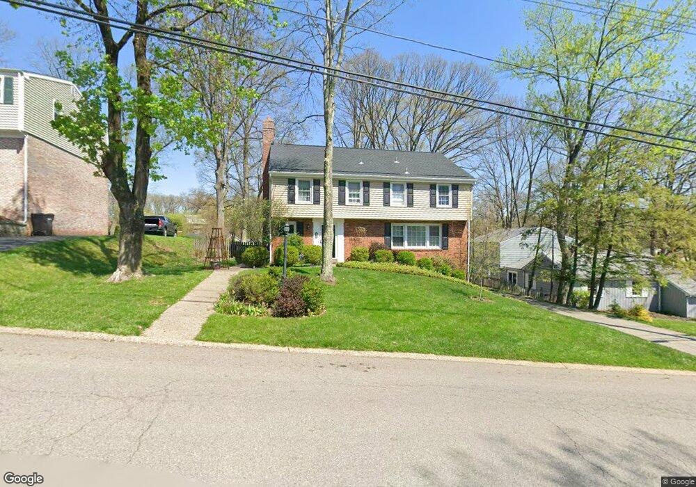
415 Sunderland Dr Pittsburgh, PA 15237
Ross Township NeighborhoodEstimated Value: $419,000 - $450,000
4
Beds
3
Baths
2,340
Sq Ft
$186/Sq Ft
Est. Value
About This Home
This home is located at 415 Sunderland Dr, Pittsburgh, PA 15237 and is currently estimated at $435,590, approximately $186 per square foot. 415 Sunderland Dr is a home located in Allegheny County with nearby schools including McIntyre Elementary School, North Hills Middle School, and North Hills Senior High School.
Ownership History
Date
Name
Owned For
Owner Type
Purchase Details
Closed on
May 31, 2005
Sold by
Shannon Robert L
Bought by
Stango Jared M
Current Estimated Value
Home Financials for this Owner
Home Financials are based on the most recent Mortgage that was taken out on this home.
Original Mortgage
$152,000
Outstanding Balance
$80,270
Interest Rate
5.94%
Mortgage Type
New Conventional
Estimated Equity
$355,320
Create a Home Valuation Report for This Property
The Home Valuation Report is an in-depth analysis detailing your home's value as well as a comparison with similar homes in the area
Home Values in the Area
Average Home Value in this Area
Purchase History
| Date | Buyer | Sale Price | Title Company |
|---|---|---|---|
| Stango Jared M | $190,000 | -- |
Source: Public Records
Mortgage History
| Date | Status | Borrower | Loan Amount |
|---|---|---|---|
| Open | Stango Jared M | $152,000 |
Source: Public Records
Tax History Compared to Growth
Tax History
| Year | Tax Paid | Tax Assessment Tax Assessment Total Assessment is a certain percentage of the fair market value that is determined by local assessors to be the total taxable value of land and additions on the property. | Land | Improvement |
|---|---|---|---|---|
| 2025 | $5,551 | $204,600 | $45,400 | $159,200 |
| 2024 | $5,551 | $204,600 | $45,400 | $159,200 |
| 2023 | $5,551 | $204,600 | $45,400 | $159,200 |
| 2022 | $5,416 | $204,600 | $45,400 | $159,200 |
| 2021 | $968 | $204,600 | $45,400 | $159,200 |
| 2020 | $5,336 | $204,600 | $45,400 | $159,200 |
| 2019 | $5,254 | $204,600 | $45,400 | $159,200 |
| 2018 | $968 | $204,600 | $45,400 | $159,200 |
| 2017 | $5,162 | $204,600 | $45,400 | $159,200 |
| 2016 | $968 | $204,600 | $45,400 | $159,200 |
| 2015 | $968 | $204,600 | $45,400 | $159,200 |
| 2014 | $5,052 | $204,600 | $45,400 | $159,200 |
Source: Public Records
Map
Nearby Homes
- 403 Sunderland Dr
- 5900 Babcock Blvd Unit 56
- 5900 Babcock Blvd Unit 35
- 5900 Babcock Blvd Unit 42
- 5900 Babcock Blvd Unit 70
- 7 Chapel Dr
- 46 Chapel Dr
- 130 Grant Ave
- 405 Highland Pines Ct Unit D405
- 218 Lincoln Ave
- 491 Cherry Ct
- 515 Neola Dr
- 512 Dogwood Ct Unit 512
- 2206 Lenox Oval Unit 2206
- 1201 Lenox Oval
- 212 Pine Ct
- 201 Pine Ct
- 306 Bernice St
- 518 Lincoln Ave
- 2407 Charlemagne Cir
- 413 Sunderland Dr
- 138 Drood Ln
- 136 Drood Ln
- 412 Sunderland Dr
- 407 Sunderland Dr
- 416 Sunderland Dr
- 419 Sunderland Dr
- 102 Gadshill Place
- 414 Sunderland Dr
- 103 Camden Ct
- 101 Camden Ct
- 585 Sunderland Dr
- 408 Sunderland Dr
- 139 Drood Ln
- 104 Gadshill Place
- 137 Drood Ln
- 586 Sunderland Dr
- 7715 Wick Dr
- 135 Drood Ln
- 1 Karen Dr