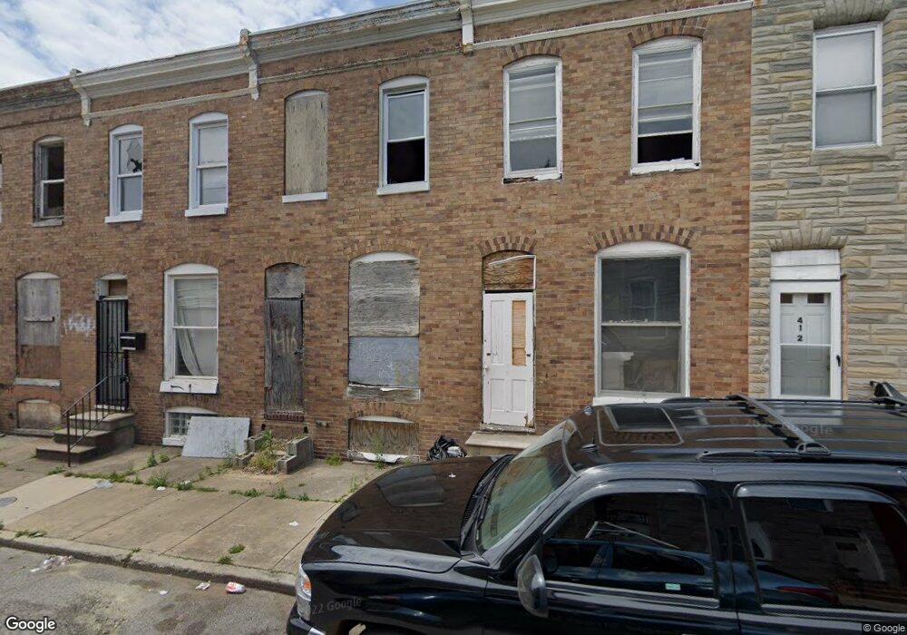
416 Furrow St Baltimore, MD 21223
Carrollton Ridge NeighborhoodEstimated Value: $48,000 - $167,576
2
Beds
1
Bath
910
Sq Ft
$118/Sq Ft
Est. Value
About This Home
This home is located at 416 Furrow St, Baltimore, MD 21223 and is currently estimated at $107,788, approximately $118 per square foot. 416 Furrow St is a home located in Baltimore City with nearby schools including Booker T. Washington Middle School, Edmondson Westside High School, and Digital Harbor High School.
Ownership History
Date
Name
Owned For
Owner Type
Purchase Details
Closed on
Dec 5, 2008
Sold by
Taylor Korey
Bought by
Wilson Keith N
Current Estimated Value
Purchase Details
Closed on
Mar 2, 1999
Sold by
Intercoastal Investment
Bought by
Taylor Korey
Purchase Details
Closed on
Nov 6, 1996
Sold by
Wheatley Gary
Bought by
Residential Development Llc
Purchase Details
Closed on
Jul 20, 1995
Sold by
Hannahs Roland S
Bought by
Wheatley Gary
Create a Home Valuation Report for This Property
The Home Valuation Report is an in-depth analysis detailing your home's value as well as a comparison with similar homes in the area
Home Values in the Area
Average Home Value in this Area
Purchase History
| Date | Buyer | Sale Price | Title Company |
|---|---|---|---|
| Wilson Keith N | $12,407 | -- | |
| Taylor Korey | $39,000 | -- | |
| Intercoastal Investment | $9,500 | -- | |
| Residential Development Llc | $13,740 | -- | |
| Wheatley Gary | $11,000 | -- |
Source: Public Records
Tax History Compared to Growth
Tax History
| Year | Tax Paid | Tax Assessment Tax Assessment Total Assessment is a certain percentage of the fair market value that is determined by local assessors to be the total taxable value of land and additions on the property. | Land | Improvement |
|---|---|---|---|---|
| 2025 | $277 | $13,400 | -- | -- |
| 2024 | $277 | $11,800 | $0 | $0 |
| 2023 | $241 | $10,200 | $2,000 | $8,200 |
| 2022 | $208 | $8,800 | $0 | $0 |
| 2021 | $175 | $7,400 | $0 | $0 |
| 2020 | $142 | $6,000 | $2,000 | $4,000 |
| 2019 | $117 | $5,000 | $0 | $0 |
| 2018 | $94 | $4,000 | $0 | $0 |
| 2017 | $71 | $3,000 | $0 | $0 |
| 2016 | $71 | $3,000 | $0 | $0 |
| 2015 | $71 | $3,000 | $0 | $0 |
| 2014 | $71 | $3,000 | $0 | $0 |
Source: Public Records
Map
Nearby Homes
- 419 Furrow St
- 423 Furrow St
- 411 Furrow St
- 420 S Smallwood St
- 426 S Smallwood St
- 406 S Smallwood St
- 2202 Ashton St
- 2241 Ramsay St
- 452 Furrow St
- 454 Furrow St
- 347 S Smallwood St
- 342 S Smallwood St
- 328 Furrow St
- 430 S Bentalou St
- 510 S Smallwood St
- 408 S Bentalou St
- 478 S Bentalou St
- 480 S Bentalou St
- 406 S Pulaski St
- 2228 Christian St
- 418 Furrow St
- 420 Furrow St
- 414 Furrow St
- 412 Furrow St
- 424 Furrow St
- 426 Furrow St
- 428 Furrow St
- 430 Furrow St
- 407 S Bentalou St
- 405 S Bentalou St
- 409 S Bentalou St
- 403 S Bentalou St
- 411 S Bentalou St
- 401 S Bentalou St
- 2225 Ramsay St
- 2223 Ramsay St
- 432 Furrow St
- 2227 Ramsay St
- 2221 Ramsay St
- 413 S Bentalou St