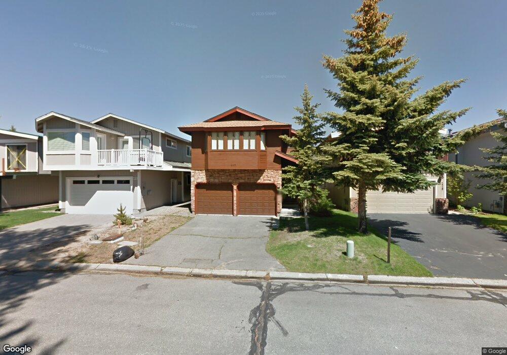
417 Christie Dr South Lake Tahoe, CA 96150
Estimated Value: $1,087,000 - $1,622,000
4
Beds
3
Baths
2,294
Sq Ft
$624/Sq Ft
Est. Value
About This Home
This home is located at 417 Christie Dr, South Lake Tahoe, CA 96150 and is currently estimated at $1,430,657, approximately $623 per square foot. 417 Christie Dr is a home located in El Dorado County with nearby schools including Tahoe Valley Elementary School, South Tahoe Middle School, and South Tahoe High School.
Ownership History
Date
Name
Owned For
Owner Type
Purchase Details
Closed on
Aug 29, 2008
Sold by
Brassfield Jerry G
Bought by
Cheatham Gregory L and Manrao Neelu
Current Estimated Value
Purchase Details
Closed on
Aug 19, 1998
Sold by
Brassfield Susan
Bought by
Brassfield Jerry G
Home Financials for this Owner
Home Financials are based on the most recent Mortgage that was taken out on this home.
Original Mortgage
$227,000
Interest Rate
6.88%
Purchase Details
Closed on
Aug 14, 1998
Sold by
Brassfield Jerry G Tr and Brassfield Rev Tr Of 1/86
Bought by
Brassfield Jerry G
Home Financials for this Owner
Home Financials are based on the most recent Mortgage that was taken out on this home.
Original Mortgage
$227,000
Interest Rate
6.88%
Create a Home Valuation Report for This Property
The Home Valuation Report is an in-depth analysis detailing your home's value as well as a comparison with similar homes in the area
Home Values in the Area
Average Home Value in this Area
Purchase History
| Date | Buyer | Sale Price | Title Company |
|---|---|---|---|
| Cheatham Gregory L | $780,000 | Old Republic Title Company | |
| Brassfield Jerry G | -- | Old Republic Title Company | |
| Brassfield Jerry G | -- | Old Republic Title Company |
Source: Public Records
Mortgage History
| Date | Status | Borrower | Loan Amount |
|---|---|---|---|
| Previous Owner | Brassfield Jerry G | $227,000 |
Source: Public Records
Tax History Compared to Growth
Tax History
| Year | Tax Paid | Tax Assessment Tax Assessment Total Assessment is a certain percentage of the fair market value that is determined by local assessors to be the total taxable value of land and additions on the property. | Land | Improvement |
|---|---|---|---|---|
| 2025 | $10,444 | $1,004,433 | $643,871 | $360,562 |
| 2024 | $10,444 | $984,740 | $631,247 | $353,493 |
| 2023 | $10,334 | $965,432 | $618,870 | $346,562 |
| 2022 | $10,232 | $946,503 | $606,736 | $339,767 |
| 2021 | $10,073 | $932,355 | $594,840 | $337,515 |
| 2020 | $10,023 | $927,431 | $588,741 | $338,690 |
| 2019 | $9,976 | $909,424 | $577,198 | $332,226 |
| 2018 | $9,754 | $891,770 | $565,881 | $325,889 |
| 2017 | $9,602 | $874,462 | $554,786 | $319,676 |
| 2016 | $9,407 | $857,493 | $543,908 | $313,585 |
| 2015 | $8,504 | $771,000 | $488,500 | $282,500 |
| 2014 | $7,715 | $714,500 | $452,000 | $262,500 |
Source: Public Records
Map
Nearby Homes
- 569 Lucerne Way
- 2185 Morro Dr
- 2081 Venice Dr Unit 285
- 2081 Venice Dr Unit 280
- 2030 Aloha Dr
- 552 Christie Dr Unit 307
- 2031 Venice Dr Unit 322
- 276 Beach Dr
- 555 Tahoe Keys Blvd Unit 13
- 1938 Marconi Way
- 497 Tahoe Keys Blvd Unit 20
- 489 Tahoe Keys Blvd Unit 68
- 489 Tahoe Keys Blvd Unit 47
- 489 Tahoe Keys Blvd Unit 55
- 489 Tahoe Keys Blvd Unit 56
- 1932 Kokanee Way
- 439 Ala Wai Blvd Unit 106
- 439 Ala Wai Blvd Unit 111
- 439 Ala Wai Blvd Unit 140
- 477 Ala Wai Blvd Unit 91
- 413 Christie Dr
- 419 Christie Dr
- 411 Christie Dr
- 421 Christie Dr
- 409 Christie Dr
- 423 Christie Dr
- 407 Christie Dr
- 418 Christie Dr
- 422 Christie Dr
- 405 Christie Dr
- 428 Christie Dr
- 412 Christie Dr
- 429 Christie Dr
- 410 Christie Dr
- 403 Christie Dr
- 406 Christie Dr
- 431 Christie Dr
- 408 Christie Dr
- 432 Christie Dr
- 401 Christie Dr