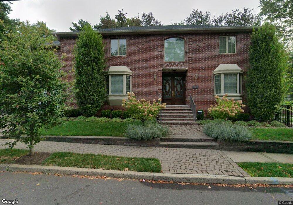
418 Jones Rd Englewood, NJ 07631
Estimated Value: $1,316,814 - $1,599,000
--
Bed
--
Bath
3,534
Sq Ft
$405/Sq Ft
Est. Value
About This Home
This home is located at 418 Jones Rd, Englewood, NJ 07631 and is currently estimated at $1,431,454, approximately $405 per square foot. 418 Jones Rd is a home located in Bergen County with nearby schools including Dr J Grieco Elementary School, Dr Mccloud Elementary School, and J.E. Dismus Middle School.
Ownership History
Date
Name
Owned For
Owner Type
Purchase Details
Closed on
Feb 16, 2010
Sold by
Levy Renee
Bought by
Obadiah Ronnie and Obadiah Nicole
Current Estimated Value
Home Financials for this Owner
Home Financials are based on the most recent Mortgage that was taken out on this home.
Original Mortgage
$300,000
Outstanding Balance
$199,342
Interest Rate
5.11%
Mortgage Type
Purchase Money Mortgage
Estimated Equity
$1,232,112
Create a Home Valuation Report for This Property
The Home Valuation Report is an in-depth analysis detailing your home's value as well as a comparison with similar homes in the area
Home Values in the Area
Average Home Value in this Area
Purchase History
| Date | Buyer | Sale Price | Title Company |
|---|---|---|---|
| Obadiah Ronnie | $896,500 | -- |
Source: Public Records
Mortgage History
| Date | Status | Borrower | Loan Amount |
|---|---|---|---|
| Open | Obadiah Ronnie | $300,000 |
Source: Public Records
Tax History Compared to Growth
Tax History
| Year | Tax Paid | Tax Assessment Tax Assessment Total Assessment is a certain percentage of the fair market value that is determined by local assessors to be the total taxable value of land and additions on the property. | Land | Improvement |
|---|---|---|---|---|
| 2025 | $23,217 | $755,500 | $229,700 | $525,800 |
| 2024 | $22,514 | $755,500 | $229,700 | $525,800 |
| 2023 | $22,280 | $755,500 | $229,700 | $525,800 |
| 2022 | $22,280 | $755,500 | $229,700 | $525,800 |
| 2021 | $21,834 | $755,500 | $229,700 | $525,800 |
| 2020 | $21,267 | $755,500 | $229,700 | $525,800 |
| 2019 | $21,071 | $755,500 | $229,700 | $525,800 |
| 2018 | $20,565 | $755,500 | $229,700 | $525,800 |
| 2017 | $19,953 | $755,500 | $229,700 | $525,800 |
| 2016 | $20,287 | $793,400 | $255,200 | $538,200 |
| 2015 | $20,113 | $793,400 | $255,200 | $538,200 |
| 2014 | $19,946 | $793,400 | $255,200 | $538,200 |
Source: Public Records
Map
Nearby Homes
- 300 Van Nostrand Ave
- 290 Van Nostrand Ave
- 229 Allison Ct
- 18 Mallard Ct
- 14 Mallard Ct Unit 105
- 285 Arch Rd
- 24 Gentry Dr
- 9 Pheasant Run Unit 137
- 306 Hutchinson Rd
- 135 Rockwood Place
- 56 Fox Run Dr
- 129 Phelps Ave
- 505 Adele Ct
- 12 Summit St
- 110 Phelps Ave
- 2 Old Quarry Rd
- 636 Jones Rd
- 87 Irving Ave
- 267 E Linden Ave
- 66 Elm St
- 412 Jones Rd
- 301 Van Nostrand Ave
- 304 Van Nostrand Ave
- 295 Van Nostrand Ave
- 317 Van Nostrand Ave
- 302 Van Nostrand Ave
- 287 Van Nostrand Ave
- 298 Van Nostrand Ave
- 404 Jones Rd
- 405 Jones Rd
- 292 Van Nostrand Ave
- 285 Van Nostrand Ave
- 401 Jones Rd
- 283 Van Nostrand Ave
- 301 Walton St
- 284 Van Nostrand Ave
- 416 Gloucester St
- 291 Walton St
- 440 Jones Rd
- 400 Jones Rd