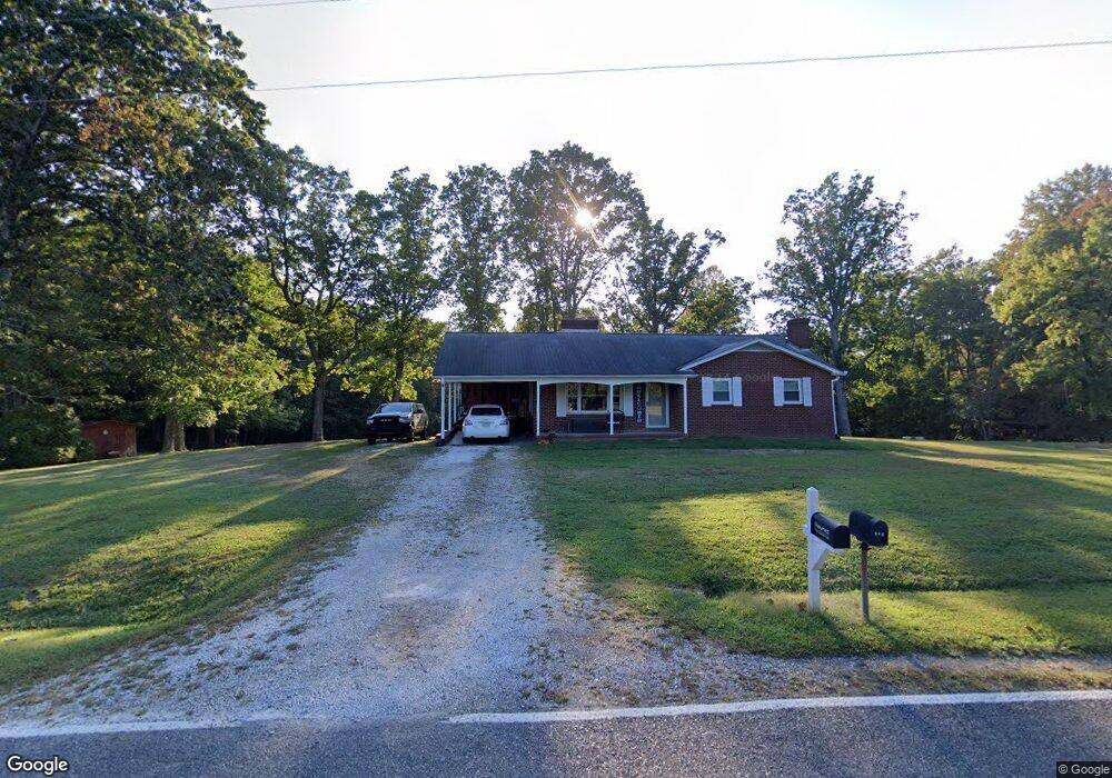
418 Norman Rd Mount Airy, NC 27030
Estimated Value: $169,546 - $275,000
3
Beds
1
Bath
1,255
Sq Ft
$174/Sq Ft
Est. Value
About This Home
This home is located at 418 Norman Rd, Mount Airy, NC 27030 and is currently estimated at $218,887, approximately $174 per square foot. 418 Norman Rd is a home with nearby schools including Westfield Elementary School, Pilot Mountain Middle School, and East Surry High School.
Ownership History
Date
Name
Owned For
Owner Type
Purchase Details
Closed on
Oct 31, 2016
Sold by
Stevens Kenneth Earl and Stevens Ruby
Bought by
Haynes Zain Jonathan and Haynes Abbey Martin
Current Estimated Value
Home Financials for this Owner
Home Financials are based on the most recent Mortgage that was taken out on this home.
Original Mortgage
$73,737
Outstanding Balance
$59,039
Interest Rate
3.42%
Mortgage Type
New Conventional
Estimated Equity
$159,848
Create a Home Valuation Report for This Property
The Home Valuation Report is an in-depth analysis detailing your home's value as well as a comparison with similar homes in the area
Home Values in the Area
Average Home Value in this Area
Purchase History
| Date | Buyer | Sale Price | Title Company |
|---|---|---|---|
| Haynes Zain Jonathan | $73,000 | Attorney |
Source: Public Records
Mortgage History
| Date | Status | Borrower | Loan Amount |
|---|---|---|---|
| Open | Haynes Zain Jonathan | $73,737 |
Source: Public Records
Tax History Compared to Growth
Tax History
| Year | Tax Paid | Tax Assessment Tax Assessment Total Assessment is a certain percentage of the fair market value that is determined by local assessors to be the total taxable value of land and additions on the property. | Land | Improvement |
|---|---|---|---|---|
| 2025 | $647 | $100,710 | $15,500 | $85,210 |
| 2024 | $571 | $80,220 | $14,300 | $65,920 |
| 2023 | $563 | $80,220 | $14,300 | $65,920 |
| 2022 | $563 | $80,220 | $14,300 | $65,920 |
| 2021 | $571 | $80,220 | $14,300 | $65,920 |
| 2020 | $554 | $75,590 | $14,300 | $61,290 |
| 2019 | $551 | $75,590 | $14,300 | $61,290 |
| 2018 | $531 | $75,590 | $0 | $0 |
| 2017 | $522 | $75,590 | $0 | $0 |
Source: Public Records
Map
Nearby Homes
- 0 Norman Rd
- 733 Slate Mountain Rd
- 107 Cory Trail
- 7.8ac Norman Rd
- 140 Daniels Dell Ln
- 00 Blue Hollow Rd Unit 5
- 583 Snody Rd
- 759 Cameron Ln
- 0 Blue Hollow Rd Unit 33 1176021
- 0 Blue Hollow Rd Unit 23105199
- 000 Blue Hollow Rd Unit 27
- Lot 4,5,6 Sideview Ln
- 1305 Brim Rd
- 00 Albion Church Rd
- 1970 Mcbride Rd
- 731 Indian Grove Church Rd
- 109 Dorothy Ln
- 0 NE Pine St
- 1507 Rogers Rd
- xx 44.93 Acres Stardust Trail
- 442 Norman Rd
- 442 Norman Rd
- 451 Norman Rd
- 378 Norman Rd
- 381 Norman Rd
- 149 Bryson Ln
- 367 Norman Rd
- 480 Norman Rd
- 315 Norman Rd
- 106 Latin Trail
- 292 Norman Rd
- 275 Norman Rd
- 239 Norman Rd
- 625 Norman Rd
- 201 Norman Rd
- 918 Slate Mountain Rd
- 868 Slate Mountain Rd
- 854 Slate Mountain Rd
- TBD Slate Mountain Rd
- 00 Norman Rd