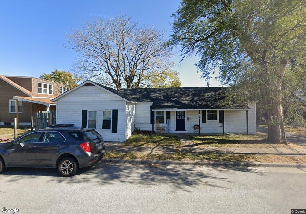
419 N 1st St Wood River, IL 62095
Estimated Value: $95,720 - $138,000
3
Beds
1
Bath
1,176
Sq Ft
$96/Sq Ft
Est. Value
About This Home
This home is located at 419 N 1st St, Wood River, IL 62095 and is currently estimated at $112,680, approximately $95 per square foot. 419 N 1st St is a home located in Madison County with nearby schools including Lewis-Clark Elementary School and East Alton-Wood River High School.
Ownership History
Date
Name
Owned For
Owner Type
Purchase Details
Closed on
Oct 19, 2021
Sold by
Judicial Sales Corp
Bought by
Property Connections Llc
Current Estimated Value
Purchase Details
Closed on
Jul 11, 2005
Sold by
Utt Wayne T
Bought by
Hardester Michael and Hardester Joy A
Home Financials for this Owner
Home Financials are based on the most recent Mortgage that was taken out on this home.
Original Mortgage
$64,500
Interest Rate
7.95%
Mortgage Type
Fannie Mae Freddie Mac
Purchase Details
Closed on
Jun 8, 2005
Sold by
West Holly A
Bought by
Utt Wayne T
Home Financials for this Owner
Home Financials are based on the most recent Mortgage that was taken out on this home.
Original Mortgage
$64,500
Interest Rate
7.95%
Mortgage Type
Fannie Mae Freddie Mac
Create a Home Valuation Report for This Property
The Home Valuation Report is an in-depth analysis detailing your home's value as well as a comparison with similar homes in the area
Home Values in the Area
Average Home Value in this Area
Purchase History
| Date | Buyer | Sale Price | Title Company |
|---|---|---|---|
| Property Connections Llc | $5,500 | None Available | |
| Hardester Michael | $64,500 | First American Title Ins Co | |
| Utt Wayne T | -- | -- |
Source: Public Records
Mortgage History
| Date | Status | Borrower | Loan Amount |
|---|---|---|---|
| Previous Owner | Hardester Michael | $64,500 |
Source: Public Records
Tax History Compared to Growth
Tax History
| Year | Tax Paid | Tax Assessment Tax Assessment Total Assessment is a certain percentage of the fair market value that is determined by local assessors to be the total taxable value of land and additions on the property. | Land | Improvement |
|---|---|---|---|---|
| 2024 | $2,525 | $29,430 | $2,960 | $26,470 |
| 2023 | $2,525 | $27,440 | $2,760 | $24,680 |
| 2022 | $2,395 | $25,330 | $2,550 | $22,780 |
| 2021 | $1,636 | $23,610 | $2,380 | $21,230 |
| 2020 | $1,579 | $22,740 | $2,290 | $20,450 |
| 2019 | $1,506 | $22,060 | $2,220 | $19,840 |
| 2018 | $1,504 | $21,520 | $2,110 | $19,410 |
| 2017 | $1,401 | $21,010 | $2,060 | $18,950 |
| 2016 | $1,372 | $21,010 | $2,060 | $18,950 |
| 2015 | $1,363 | $20,790 | $2,040 | $18,750 |
| 2014 | $1,363 | $20,790 | $2,040 | $18,750 |
| 2013 | $1,363 | $21,090 | $2,070 | $19,020 |
Source: Public Records
Map
Nearby Homes
- 469 N 1st St
- 72 E Acton Ave
- 41 W Penning Ave
- 242 E Lorena Ave
- 71 Carstens Ave
- 537 Tipton Ave
- 411 E Ferguson Ave
- 523 E Acton Ave
- 458 N 6th St
- 503 E Ferguson Ave
- 545 E Acton Ave
- 726 Rice St
- 777 Condit St
- 623 E Lorena Ave
- 830 N Wood River Ave
- 810 Halloran Ave
- 805 State St
- 833 State St
- 523 Wilson Ave
- 527 Metzger Ave
- 104 Eula Ave
- 102 Eula Ave
- 120 Eula Ave
- 120 Eula Ave
- 101 E Jennings Ave
- 103 E Jennings Ave
- 105 E Jennings Ave
- 79 E Jennings Ave
- 426 N 1st St
- 130 Eula Ave
- 430 N 1st St
- 441 N 1st St
- 125 E Jennings Ave
- 75 E Jennings Ave
- 436 N 1st St
- 138 Eula Ave
- 449 N 1st St
- 73 E Jennings Ave
- 131 E Jennings Ave
- 440 N 1st St