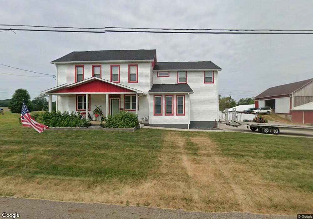
4191 Swallen Ave Louisville, OH 44641
Estimated Value: $212,000 - $323,755
3
Beds
3
Baths
2,132
Sq Ft
$126/Sq Ft
Est. Value
About This Home
This home is located at 4191 Swallen Ave, Louisville, OH 44641 and is currently estimated at $268,939, approximately $126 per square foot. 4191 Swallen Ave is a home located in Stark County with nearby schools including Louisville High School.
Ownership History
Date
Name
Owned For
Owner Type
Purchase Details
Closed on
Sep 29, 2015
Sold by
Garnes Martin
Bought by
Demos Michael L and Demos Megan A
Current Estimated Value
Home Financials for this Owner
Home Financials are based on the most recent Mortgage that was taken out on this home.
Original Mortgage
$92,000
Outstanding Balance
$36,031
Interest Rate
3.08%
Mortgage Type
New Conventional
Estimated Equity
$232,908
Purchase Details
Closed on
Dec 29, 2000
Sold by
Lautzenheiser Steven L
Bought by
Garnes Martin
Home Financials for this Owner
Home Financials are based on the most recent Mortgage that was taken out on this home.
Original Mortgage
$115,900
Interest Rate
7.77%
Purchase Details
Closed on
Jan 30, 1997
Sold by
Lautzenheiser Rita M
Bought by
Lautzenheiser Steven L
Home Financials for this Owner
Home Financials are based on the most recent Mortgage that was taken out on this home.
Original Mortgage
$46,000
Interest Rate
7.81%
Mortgage Type
New Conventional
Create a Home Valuation Report for This Property
The Home Valuation Report is an in-depth analysis detailing your home's value as well as a comparison with similar homes in the area
Home Values in the Area
Average Home Value in this Area
Purchase History
| Date | Buyer | Sale Price | Title Company |
|---|---|---|---|
| Demos Michael L | $115,000 | Attorney | |
| Garnes Martin | $122,000 | -- | |
| Lautzenheiser Steven L | $46,000 | -- |
Source: Public Records
Mortgage History
| Date | Status | Borrower | Loan Amount |
|---|---|---|---|
| Open | Demos Michael L | $92,000 | |
| Previous Owner | Garnes Martin | $115,900 | |
| Previous Owner | Lautzenheiser Steven L | $46,000 |
Source: Public Records
Tax History Compared to Growth
Tax History
| Year | Tax Paid | Tax Assessment Tax Assessment Total Assessment is a certain percentage of the fair market value that is determined by local assessors to be the total taxable value of land and additions on the property. | Land | Improvement |
|---|---|---|---|---|
| 2025 | -- | $108,750 | $44,170 | $64,580 |
| 2024 | -- | $108,750 | $44,170 | $64,580 |
| 2023 | $4,053 | $82,740 | $29,050 | $53,690 |
| 2022 | $4,061 | $82,740 | $29,050 | $53,690 |
| 2021 | $4,073 | $82,740 | $29,050 | $53,690 |
| 2020 | $2,257 | $48,130 | $26,150 | $21,980 |
| 2019 | $2,267 | $48,150 | $26,160 | $21,990 |
| 2018 | $2,261 | $48,150 | $26,160 | $21,990 |
| 2017 | $2,121 | $43,110 | $22,440 | $20,670 |
| 2016 | $2,075 | $43,110 | $22,440 | $20,670 |
| 2015 | $2,171 | $44,400 | $23,730 | $20,670 |
| 2014 | $45 | $38,690 | $20,690 | $18,000 |
| 2013 | $1,026 | $38,690 | $20,690 | $18,000 |
Source: Public Records
Map
Nearby Homes
- 2110 Edmar St
- 2015 E Main St
- 1812 E Broad St
- 3390 Meese Rd NE
- 1715 High St
- 5495 Meese Rd NE
- 0 Michigan Blvd
- 641 S Nickelplate St
- 308 Superior St
- 520 S Silver St
- 5765 Maplegrove St
- 728 E Broad St
- 908 Sand Lot Cir
- 1170 Winding Ridge Ave
- 8225 Georgetown St
- 910 Crosswyck Cir
- 325 Lincoln Ave
- 6052 N Nickelplate St
- 510 S Bauman Ct
- 204 E Broad St
- 4242 Swallen Ave
- 4269 Swallen Ave
- 4174 Swallen Ave
- 4315 Swallen Ave
- 4141 Swallen Ave
- 4274 Swallen Ave
- 4284 Swallen Ave
- 4130 Swallen Ave
- 4310 Swallen Ave
- 4310 Swallen Ave
- 4320 Swallen Ave
- 4344 Swallen Ave
- 4088 Swallen Ave
- 4364 Swallen Ave
- 4375 Swallen Ave
- 4375 Swallen Ave
- 4030 Swallen Ave
- 4400 Swallen Ave
- 4420 Swallen Ave
- 4258 Oakgrove St