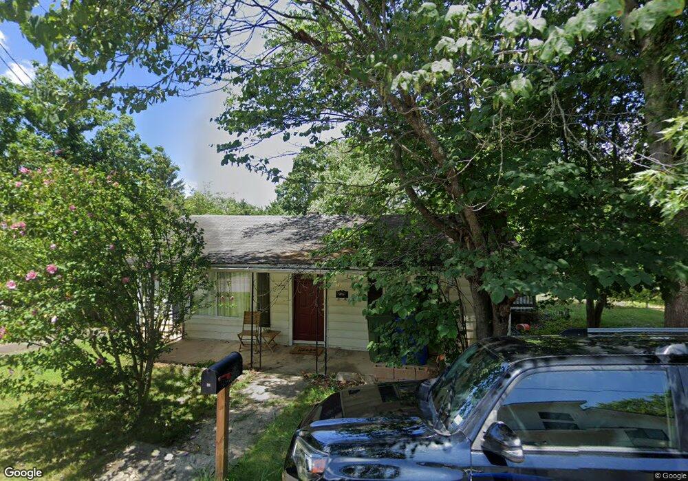
42 Howard St Asheville, NC 28806
West Asheville NeighborhoodEstimated Value: $270,000 - $408,000
2
Beds
1
Bath
808
Sq Ft
$417/Sq Ft
Est. Value
About This Home
This home is located at 42 Howard St, Asheville, NC 28806 and is currently estimated at $336,992, approximately $417 per square foot. 42 Howard St is a home located in Buncombe County with nearby schools including Hall Fletcher Elementary, Isaac Dickson Elementary, and Ira B Jones Elementary.
Ownership History
Date
Name
Owned For
Owner Type
Purchase Details
Closed on
Jul 26, 2018
Sold by
Wilson Lucious T and Wilson Alexandra D
Bought by
Taylor Christopher M and Taylor Laura B
Current Estimated Value
Purchase Details
Closed on
Jul 17, 2006
Sold by
Payne Don Edward
Bought by
Wilson Lucious T
Home Financials for this Owner
Home Financials are based on the most recent Mortgage that was taken out on this home.
Original Mortgage
$117,420
Interest Rate
6.6%
Mortgage Type
Unknown
Create a Home Valuation Report for This Property
The Home Valuation Report is an in-depth analysis detailing your home's value as well as a comparison with similar homes in the area
Home Values in the Area
Average Home Value in this Area
Purchase History
| Date | Buyer | Sale Price | Title Company |
|---|---|---|---|
| Taylor Christopher M | $160,000 | None Available | |
| Wilson Lucious T | $147,000 | None Available |
Source: Public Records
Mortgage History
| Date | Status | Borrower | Loan Amount |
|---|---|---|---|
| Previous Owner | Wilson Lucious T | $117,420 | |
| Previous Owner | Wilson Lucious T | $29,355 |
Source: Public Records
Tax History Compared to Growth
Tax History
| Year | Tax Paid | Tax Assessment Tax Assessment Total Assessment is a certain percentage of the fair market value that is determined by local assessors to be the total taxable value of land and additions on the property. | Land | Improvement |
|---|---|---|---|---|
| 2025 | $2,227 | $215,600 | $106,300 | $109,300 |
| 2024 | $2,227 | $215,600 | $106,300 | $109,300 |
| 2023 | $2,227 | $215,600 | $106,300 | $109,300 |
| 2022 | $2,150 | $215,600 | $0 | $0 |
| 2021 | $2,150 | $215,600 | $0 | $0 |
| 2020 | $1,795 | $166,500 | $0 | $0 |
| 2019 | $1,795 | $166,500 | $0 | $0 |
| 2018 | $1,795 | $166,500 | $0 | $0 |
| 2017 | $1,811 | $108,400 | $0 | $0 |
| 2016 | $1,332 | $108,400 | $0 | $0 |
| 2015 | $1,332 | $108,400 | $0 | $0 |
| 2014 | $1,316 | $108,400 | $0 | $0 |
Source: Public Records
Map
Nearby Homes
- 266 Waynesville Ave
- 315 Haywood Rd Unit 111/211
- 259 Waynesville Ave Unit 1
- 31 Westwood Place
- 253 Haywood Rd
- 9 Pennsylvania Ave
- 40 Brownwood Ave
- 109 Richmond Ave
- 43 Argyle Ln
- 104 Deaver St
- 135 Westwood Place
- 140 Waynesville Ave
- 127 Pennsylvania Ave
- 30 Waynesville Ave Unit 22
- 20 Vandalia Ave
- 26 Hanover St
- 77 Tremont St
- 81 Tremont St
- 85 Tremont St
- 140 Pennsylvania Ave