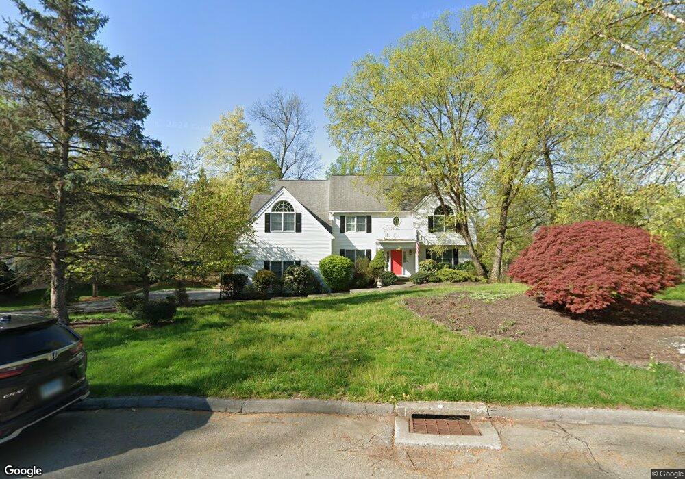
42 Pamela Rd Cortlandt Manor, NY 10567
Estimated Value: $1,006,000 - $1,193,000
4
Beds
4
Baths
4,136
Sq Ft
$264/Sq Ft
Est. Value
About This Home
This home is located at 42 Pamela Rd, Cortlandt Manor, NY 10567 and is currently estimated at $1,091,863, approximately $263 per square foot. 42 Pamela Rd is a home located in Westchester County with nearby schools including Buchanan Verplanck Elementary School, Blue Mountain Middle School, and Hendrick Hudson High School.
Ownership History
Date
Name
Owned For
Owner Type
Purchase Details
Closed on
Jun 24, 2016
Sold by
Tinari Robert P and Tinari Mary Jane
Bought by
Camarra Christopher and Slifko Camarra Sarah
Current Estimated Value
Home Financials for this Owner
Home Financials are based on the most recent Mortgage that was taken out on this home.
Original Mortgage
$430,000
Outstanding Balance
$343,011
Interest Rate
3.64%
Mortgage Type
New Conventional
Estimated Equity
$748,852
Purchase Details
Closed on
Jun 17, 1997
Sold by
Blue Ridge Realty Corp
Bought by
Tinari Robert P and Tinari Mary Jane
Create a Home Valuation Report for This Property
The Home Valuation Report is an in-depth analysis detailing your home's value as well as a comparison with similar homes in the area
Home Values in the Area
Average Home Value in this Area
Purchase History
| Date | Buyer | Sale Price | Title Company |
|---|---|---|---|
| Camarra Christopher | $730,000 | Attorney | |
| Tinari Robert P | $419,500 | -- |
Source: Public Records
Mortgage History
| Date | Status | Borrower | Loan Amount |
|---|---|---|---|
| Open | Camarra Christopher | $430,000 |
Source: Public Records
Tax History Compared to Growth
Tax History
| Year | Tax Paid | Tax Assessment Tax Assessment Total Assessment is a certain percentage of the fair market value that is determined by local assessors to be the total taxable value of land and additions on the property. | Land | Improvement |
|---|---|---|---|---|
| 2024 | $18,994 | $10,775 | $950 | $9,825 |
| 2023 | $18,322 | $10,775 | $950 | $9,825 |
| 2022 | $18,289 | $10,775 | $950 | $9,825 |
| 2021 | $17,937 | $10,775 | $950 | $9,825 |
| 2020 | $17,773 | $10,775 | $950 | $9,825 |
| 2019 | $16,804 | $10,775 | $950 | $9,825 |
| 2018 | $16,549 | $10,775 | $950 | $9,825 |
| 2017 | $5,816 | $10,775 | $950 | $9,825 |
| 2016 | $16,386 | $10,775 | $950 | $9,825 |
| 2015 | -- | $10,775 | $950 | $9,825 |
| 2014 | -- | $10,775 | $950 | $9,825 |
| 2013 | -- | $10,775 | $950 | $9,825 |
Source: Public Records
Map
Nearby Homes
- 11 Deer Haunt Dr
- 110 Laurel Hill Rd
- 114 Laurel Hill Rd
- 49 Henning Dr
- 34 Kings Ferry Rd
- 0 Laurel Hill Rd Unit KEY925925
- Lot 7 Mountain Side Trail
- 23 Meadow Rd
- 23 Chester Ct
- 14 Amalfi Dr
- 219 Rockledge Ave
- 216 Rockledge Ave
- 149 Cortlandt St
- 196 Furnace Dock Rd
- 215 Catherine St
- 137 Lindsey Ave
- 9 Flanders Ln
- 11 Flanders Ln
- 168 Seward St
- 62 Montrose Point Rd