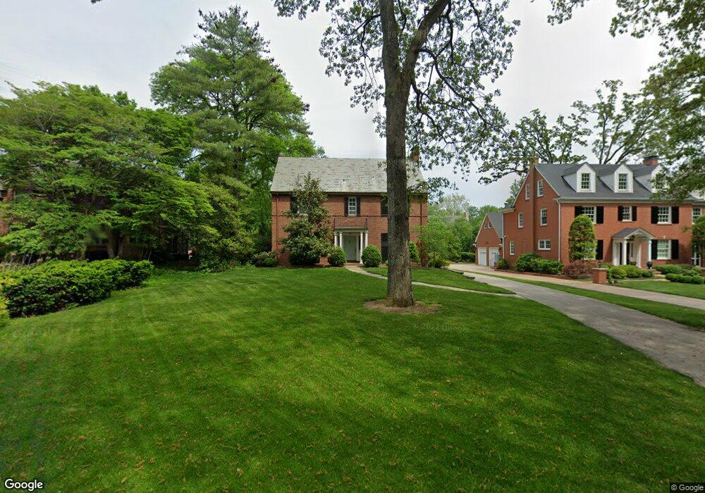
420 Dickson St Saint Louis, MO 63122
Estimated Value: $730,990 - $1,240,000
4
Beds
4
Baths
2,240
Sq Ft
$417/Sq Ft
Est. Value
About This Home
This home is located at 420 Dickson St, Saint Louis, MO 63122 and is currently estimated at $933,748, approximately $416 per square foot. 420 Dickson St is a home located in St. Louis County with nearby schools including North Glendale Elementary School, Nipher Middle School, and Kirkwood Senior High School.
Ownership History
Date
Name
Owned For
Owner Type
Purchase Details
Closed on
Jun 29, 2012
Sold by
Hizar Thomas W and Hizar Anne P
Bought by
Laux John and Laux Maria
Current Estimated Value
Home Financials for this Owner
Home Financials are based on the most recent Mortgage that was taken out on this home.
Original Mortgage
$53,250
Outstanding Balance
$31,195
Interest Rate
3.79%
Mortgage Type
Credit Line Revolving
Estimated Equity
$902,553
Purchase Details
Closed on
Sep 4, 2007
Sold by
The Albert Roos Trust
Bought by
Hizar Thomas W and Hizar Anne P
Create a Home Valuation Report for This Property
The Home Valuation Report is an in-depth analysis detailing your home's value as well as a comparison with similar homes in the area
Home Values in the Area
Average Home Value in this Area
Purchase History
| Date | Buyer | Sale Price | Title Company |
|---|---|---|---|
| Laux John | $553,250 | Investors Title Co Clayton | |
| Hizar Thomas W | $485,000 | None Available |
Source: Public Records
Mortgage History
| Date | Status | Borrower | Loan Amount |
|---|---|---|---|
| Open | Laux John | $53,250 | |
| Open | Laux John | $414,900 |
Source: Public Records
Tax History Compared to Growth
Tax History
| Year | Tax Paid | Tax Assessment Tax Assessment Total Assessment is a certain percentage of the fair market value that is determined by local assessors to be the total taxable value of land and additions on the property. | Land | Improvement |
|---|---|---|---|---|
| 2025 | $7,189 | $133,680 | $97,960 | $35,720 |
| 2024 | $7,189 | $114,800 | $78,360 | $36,440 |
| 2023 | $7,076 | $114,800 | $78,360 | $36,440 |
| 2022 | $7,240 | $101,290 | $75,960 | $25,330 |
| 2021 | $6,546 | $101,290 | $75,960 | $25,330 |
| 2020 | $6,226 | $92,640 | $63,840 | $28,800 |
| 2019 | $6,291 | $92,640 | $63,840 | $28,800 |
| 2018 | $7,214 | $93,880 | $43,150 | $50,730 |
| 2017 | $7,205 | $93,880 | $43,150 | $50,730 |
| 2016 | $7,591 | $99,710 | $38,400 | $61,310 |
| 2015 | $7,580 | $99,710 | $38,400 | $61,310 |
| 2014 | $7,759 | $99,860 | $21,010 | $78,850 |
Source: Public Records
Map
Nearby Homes
- 664 Hawbrook Ave
- 735 Oakway Place
- 807 E Essex Ave
- 102 Dickson St
- 115 Park Ave
- 832 Fuhrmann Terrace
- 664 E Argonne Dr
- 438 N Sappington Rd Unit B
- 436 N Sappington Rd Unit C
- 754 Brownell Ave
- 109 E Washington Ave Unit 2S
- 211 N Taylor Ave Unit 201
- 400 S Woodlawn Ave
- 102 E Bodley Ave Unit 204
- 826 Chelsea Ave
- 522 N Kirkwood Rd Unit 2B
- 858 Chelsea Ave
- 423 Parkland Ave
- 438 Miriam Ave
- 931 Brownell Ave
- 428 Dickson St
- 419 Parkwoods Ave
- 402 Dickson St
- 415 Parkwoods Ave
- 425 Parkwoods Ave
- 434 Dickson St
- 7 Hawbrook Ln
- 617 Hawbrook Ave
- 433 Parkwoods Ave
- 401 Parkwoods Ave
- 6 Hawbrook Ln
- 368 Dickson St
- 503 Dickson St
- 5 Hawbrook Ln
- 426 Parkwoods Ave
- 470 Dickson St
- 418 Parkwoods Ave
- 406 Parkwoods Ave
- 432 Parkwoods Ave
- 1 Hawbrook Ln