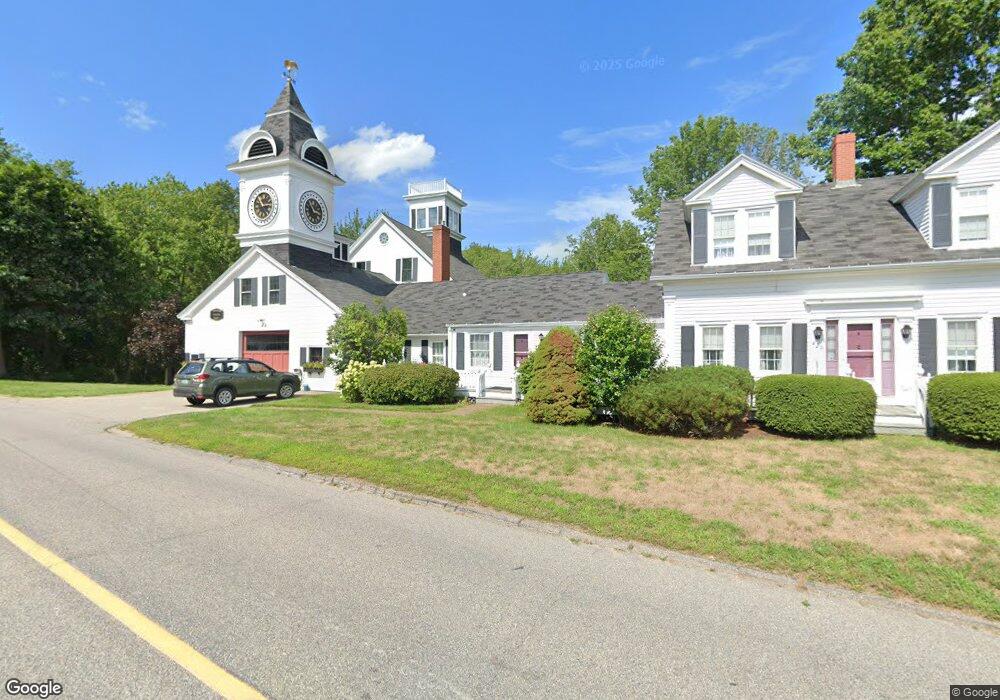
420 Goose Rocks Rd Kennebunkport, ME 04046
Estimated Value: $1,100,785 - $1,370,000
4
Beds
3
Baths
2,701
Sq Ft
$448/Sq Ft
Est. Value
About This Home
This home is located at 420 Goose Rocks Rd, Kennebunkport, ME 04046 and is currently estimated at $1,211,196, approximately $448 per square foot. 420 Goose Rocks Rd is a home with nearby schools including Kennebunk High School.
Ownership History
Date
Name
Owned For
Owner Type
Purchase Details
Closed on
Nov 1, 2024
Sold by
Emmons Clock Farm T and King
Bought by
Emmons Jennifer and Emmons Melissa
Current Estimated Value
Purchase Details
Closed on
Oct 30, 2008
Sold by
Clock Farm Rt and King John G
Bought by
King John G and Emmons Mary L
Create a Home Valuation Report for This Property
The Home Valuation Report is an in-depth analysis detailing your home's value as well as a comparison with similar homes in the area
Home Values in the Area
Average Home Value in this Area
Purchase History
| Date | Buyer | Sale Price | Title Company |
|---|---|---|---|
| Emmons Jennifer | -- | None Available | |
| Emmons Jennifer | -- | None Available | |
| King John G | -- | -- | |
| King John G | -- | -- |
Source: Public Records
Tax History Compared to Growth
Tax History
| Year | Tax Paid | Tax Assessment Tax Assessment Total Assessment is a certain percentage of the fair market value that is determined by local assessors to be the total taxable value of land and additions on the property. | Land | Improvement |
|---|---|---|---|---|
| 2024 | $6,605 | $1,016,200 | $525,300 | $490,900 |
| 2023 | $6,351 | $1,016,200 | $525,300 | $490,900 |
| 2022 | $6,097 | $1,016,200 | $525,300 | $490,900 |
| 2021 | $5,175 | $539,100 | $227,400 | $311,700 |
| 2020 | $5,094 | $539,100 | $227,400 | $311,700 |
| 2019 | $5,094 | $539,100 | $227,400 | $311,700 |
| 2018 | $4,723 | $539,100 | $227,400 | $311,700 |
| 2017 | $4,690 | $539,100 | $227,400 | $311,700 |
| 2016 | $4,464 | $539,100 | $227,400 | $311,700 |
| 2015 | $4,074 | $539,100 | $227,400 | $311,700 |
| 2014 | $4,113 | $539,100 | $227,400 | $311,700 |
Source: Public Records
Map
Nearby Homes
- 32 Beaver Pond Rd
- 5 Dyke Rd Unit E
- 40 Wildwood Ave
- 190 Mills Rd
- 442 Kings Hwy
- 1081 Kings Hwy
- 286 Goose Rocks Rd
- 20 Stone Rd
- 4 Kings Ln
- 0 Goosefair
- 4 Windward Ridge
- 245 Arundel Rd
- 8 Shore Rd
- 12 Eel Bridge Ln
- 0 Cole Benson Rd
- 22 Pier Rd Unit 2
- 22 Pier Rd Unit 1
- 0 Campbell Ln Unit 1630141
- 160 Main St
- 2 Seal Ln
- 410 Goose Rocks Rd
- 294 Mills Rd
- 11 (lot 3) Windward Ridge
- 403 Goose Rocks Rd
- 7 Ox Plow Ln
- 71 Dyke Rd
- 15 Ox Plow Ln
- 1 New Adams Rd
- Lot 3 New Adams Rd
- 11 Jennison Dr
- 0 Ox Plow Ln
- Lot 5 Jennison
- Lot 4 Jennison
- 397 Goose Rocks Rd
- Lot 1 Jennison Oaks
- Lot #1 Jennison Dr
- Lot 1 Jennison
- Lot#1 Jennison Dr
- 0 Jennison Dr Unit 1009717
- 0 Jennison Dr Unit 1046760